
The Landslide Blog is written by Dave Petley, who is widely recognized as a world leader in the study and management of landslides.

A day after the Mw=7.4 Taiwan Earthquake, it is increasingly clear that the major impacts from the event, and its aftershocks, have resulted from landslides rather than building collapses. This is a testament to the degree of earthquake preparedness in Taiwan. Indeed, the number of fatalities from building collapses may be one or two, with the rest of the loss of life being the result of landslides. Sadly, it is simply not possible to eliminate mass movements in the rugged terrain of Taiwan.
A key focus now is the road through Taroko Gorge, Provincial Highway No. 8. This is the eastern end of the Cross Island Highway that links the city of Hualien in the east to Taichung in the west. The first 18 km or so of the road runs along the bottom of the gorge, which is a spectacular National Park. This is a world class tourist attraction, but rockfalls occur on a daily basis. In a major earthquake, this area is very hazardous.
News reports indicate that the road is blocked, with at least 50 people missing. These are employees of the wonderful Silks Place hotel, located further up the road. Their location is currently unclear, but it is hoped that they are safely hiding in one of the many tunnels along the route. Rescue crews are working their way along the highway in the hope of saving them. There may be other people trapped along the road, or on the many hiking trails that extend from the highway. One person has been found dead in a car on this road already.
Of course, this is made more perilous by the continuing aftershocks, of which there have been many, which threaten to bring down more rock.
The USGS has an algorithm that forecasts the potential location of landslides from major earthquakes. This is their current estimate:-
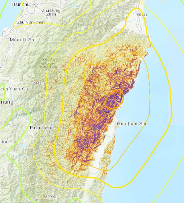
Taroko Gorge is located squarely in the area with the very highest landslide potential.
Planet Labs successfully collected a satellite image of the Taroko Gorge area yesterday, less than two hours after the Taiwan Earthquake. Remarkably, the image is largely free of cloud, which is unusual for this area.
I have imported it into Google Earth for easy viewing. The image just captures the Taroko Gorge area:-
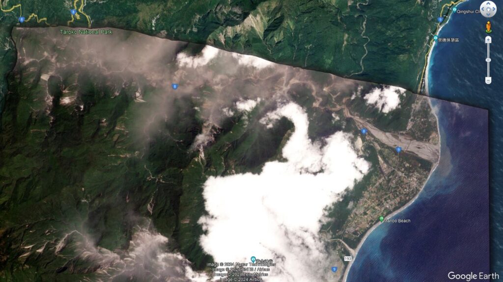
Taroko Gorge runs east – west across the top of the imported satellite image, starting at the river delta.
The Planet Labs image shows extensive landsliding in Taroko Gorge, as evidenced by the vast amount of dust that was still in the air at the time of capture. A zoomed in view highlights this more clearly:-
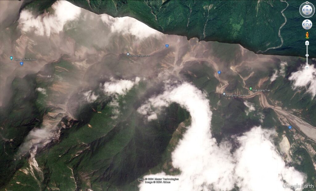
Despite the dust, it is clear that there is a very large number of rockslides in the gorge. By way of comparison, this is the Google Earth image of the same area, captured in April 2023:-
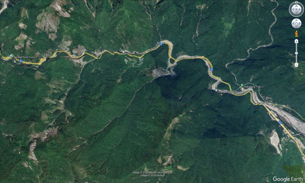
And here is a slider that should allow you to compare the two images:-


The satellite image suggests that there are other areas in the mountains of the East Coast that have also suffered very intense landsliding during the 3 April 2024 Taiwan Earthquake. The scale should become increasingly clear over the next few days, but repairing the infrastructure will be a long, slow and expensive process.
Reference and acknowledgement
Planet Team (2024). Planet Application Program Interface: In Space for Life on Earth. San Francisco, CA. https://www.planet.com/