Editors’ Highlights are summaries of recent papers by AGU’s journal editors.
Source: Journal of Advances in Modeling Earth Systems
A major challenge in working with ocean observations is the lack of observations everywhere in space and time. Most users of ocean observations want maps with no missing regions, and so the question of how to fill these regions has been a longstanding research problem in observational oceanography.
There are various methods to fill missing regions, with these methods typically making use of statistical assumptions (e.g., the Gaussian kernels used in optimal interpolation) that are not entirely based on or constrained by the underlying physics. Even though we recognize that physical processes have important spatiotemporal correlations, it is not obvious how all aspects of the correlations can be built into mapping schemes for ocean observations.
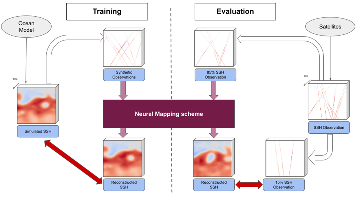
Febvre et al. [2024] offer a new approach that combines state-of-the-art numerical models along with neural mapping schemes for the purpose of reconstructing satellite altimetry data. In their method, numerical simulations with a dynamical model are used to train a machine learning method (the neural mapping scheme) that is used to map satellite altimetry. The well measured Gulf Stream region serves as a test case for their analysis. Their findings indicate that incorporating simulated ocean data into the training process enhances the neural mapping’s performance and surpasses traditional methods.
This study is an exciting example where the merger of dynamical modeling, machine learning methods, and ocean measurements can enhance oceanographic understanding, monitoring, and mapping.
Citation: Febvre, Q., Le Sommer, J., Ubelmann, C., & Fablet, R. (2024). Training neural mapping schemes for satellite altimetry with simulation data. Journal of Advances in Modeling Earth Systems, 16, e2023MS003959. https://doi.org/10.1029/2023MS003959
—Stephen Griffies, Editor-in-Chief; and Oliver Watt-Meyer, Associate Editor, JAMES