
Hurricane Melissa is bearing down on Jamaica, with many areas likely to see over 500 mm of rainfall. The impacts could be extremely significant.

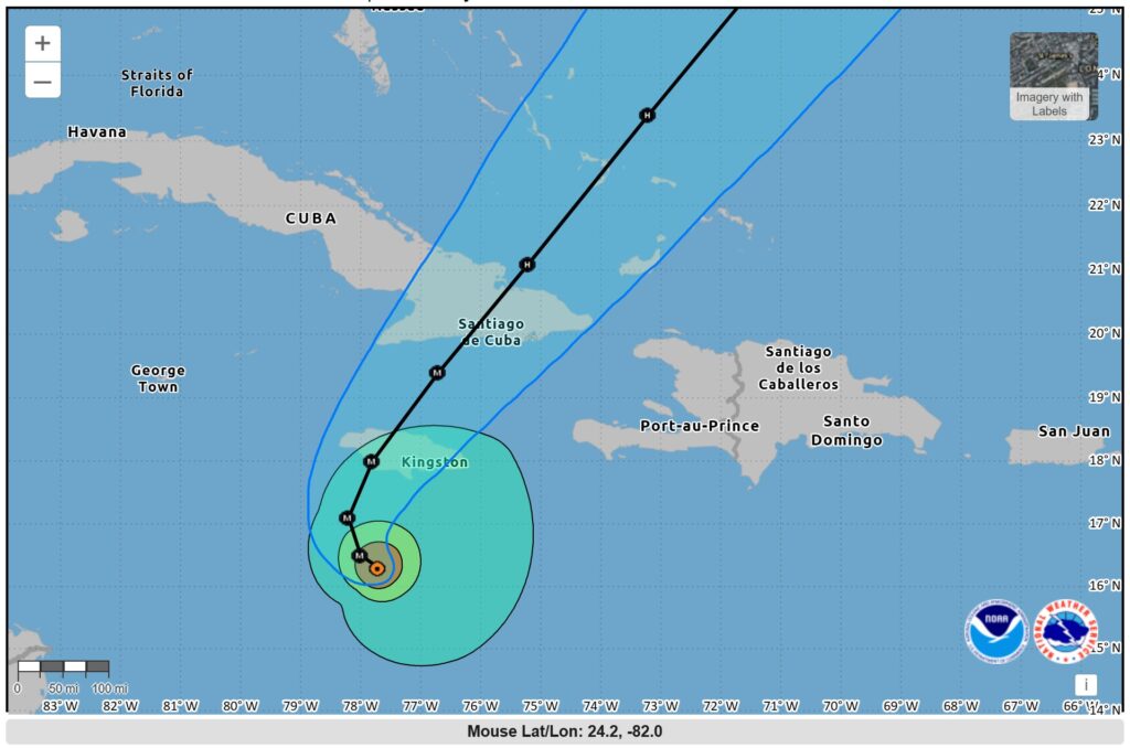
Hurricane Melissa has strengthened substantially over the weekend, and is now on course to track across Jamaica in the next couple of days. Various media agencies have identified the threats that this storm poses to a country with high vulnerability. As always, NOAA has excellent tracking charts for this storm.
The current forecast track will take the storm directly across Jamaica:-
NOAA also provides data on forecast precipitation (rainfall):-
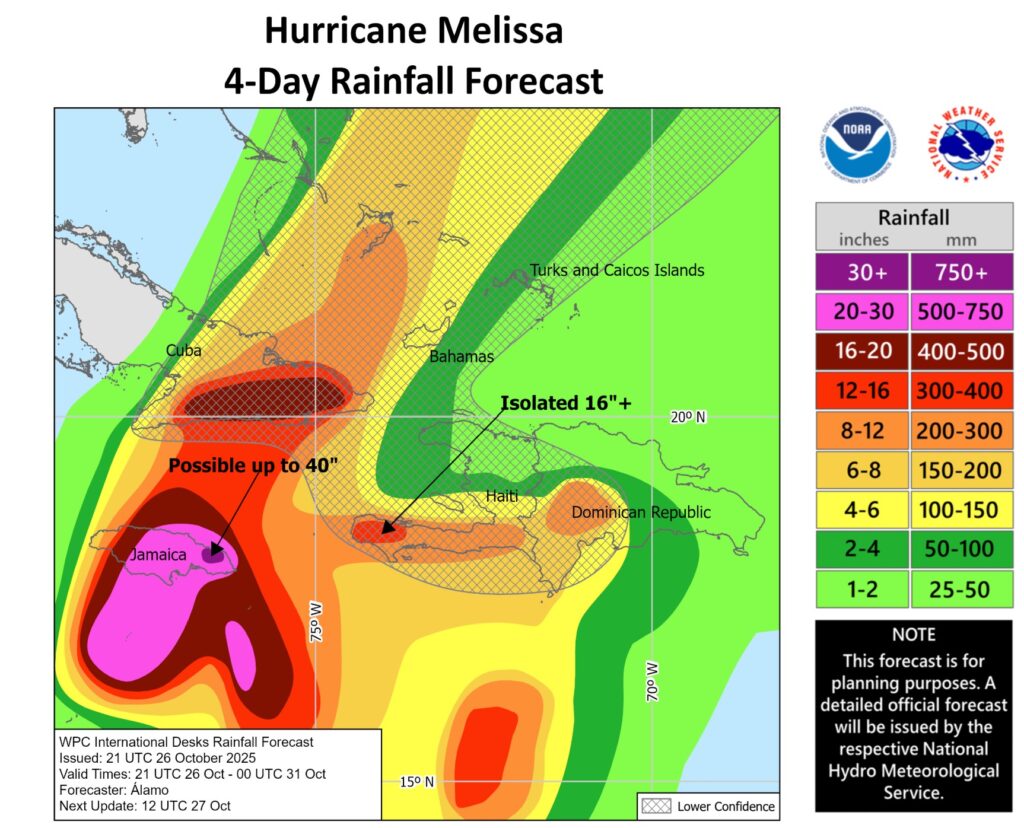
There is a great deal of uncertainty in this type of forecast – the final totals will depend upon the track, the rate at which the storm moves, the intensity of the storm (and how that changes as a result of the contact with the land mass) and orographic effects. But much of Jamaica is forecast to receive over 500 mm of rainfall, and some parts may receive more than 750 mm.
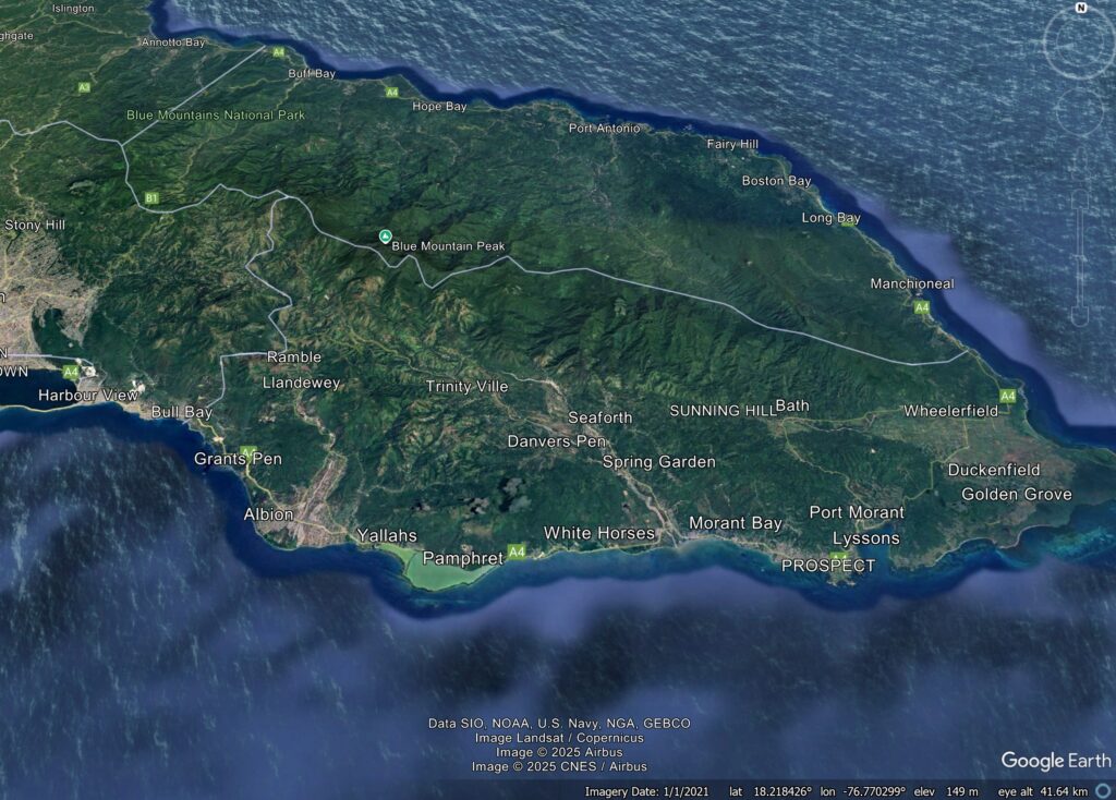
Now, the average annual rainfall in Jamaica is 2,100 mm for the island as a whole, and much more in some places, so this must be seen in context. However, as I have noted often before, in most cases the dominant medium through which tropical cyclone losses occur in water (even though windspeed often grabs the headlines). As the Google Earth image below shows, the island is characterised by steep slopes – this is a recipe for channelised debris flows:-
There is active preparation underway in Jamaica, including evacuations, and in Hurricane Beryl last year this was a success. However, we know that many people choose not to move, and this storm is on a different scale.
In the immediate aftermath, the initial focus will inevitably be on the capital, Kingston, as this is where the reporters are likely to be located. Watch out for news from the east of the island though, especially on the coast and on the southern and eastern sides of the mountains. In severe storms, communications are often lost, so in this case no news may well be probably bad news.