
Editors’ Highlights are summaries of recent papers by AGU’s journal editors.
Source: Journal of Geophysical Research: Earth Surface
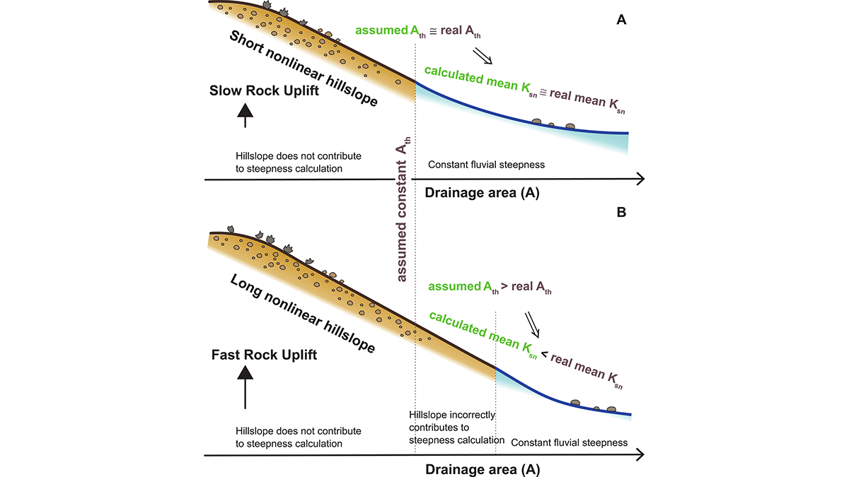
Many exciting topics in geomorphology revolve around boundaries. The boundaries between hillslopes and river channels may seem obvious in an active landscape, but are far from trivial to detect objectively from digital elevation data. A pragmatic and routine solution is to use a fixed contributing catchment area to separate hillslopes from channels. The resulting geometry of the channel network then allows estimates of local steepness as a key metric of how rivers incise in response to rock uplift, and more generally, how landscapes respond to tectonic drivers. Yet, these estimates ultimately hinge on the choice of where channels begin.
Fox et al. [2026] explore how this choice matters: they showcase a numerical model of hillslope and channel evolution that predicts that the boundary between the two domains systematically shifts with varying rates of rock uplift. According to the model, more rapid uplift tends to lengthen hillslopes such that they can extend well beyond the arbitrary minimum catchment area used to characterize channels exclusively. The effect is that hillslope geometry contaminates estimates of channel steepness, and thus any inference about how river incision responds to changes in rock uplift. What is commonly reported as “channel steepness” as a metric of river form and adjustment might indeed carry an undesired contribution of hillslopes and their processes such as soil creep or debris flow. Clearly it is time to acknowledge a more flexible perspective of where channels begin, especially if using their geometry in models of landscape evolution.
Citation: Fox, M., Goren, L., & Adams, B. A. (2026). Non-linear hillslopes produce apparent non-linear river erosion models. Journal of Geophysical Research: Earth Surface, 131, e2025JF008753. https://doi.org/10.1029/2025JF008753
—Oliver Korup, Associate Editor, JGR: Earth Surface