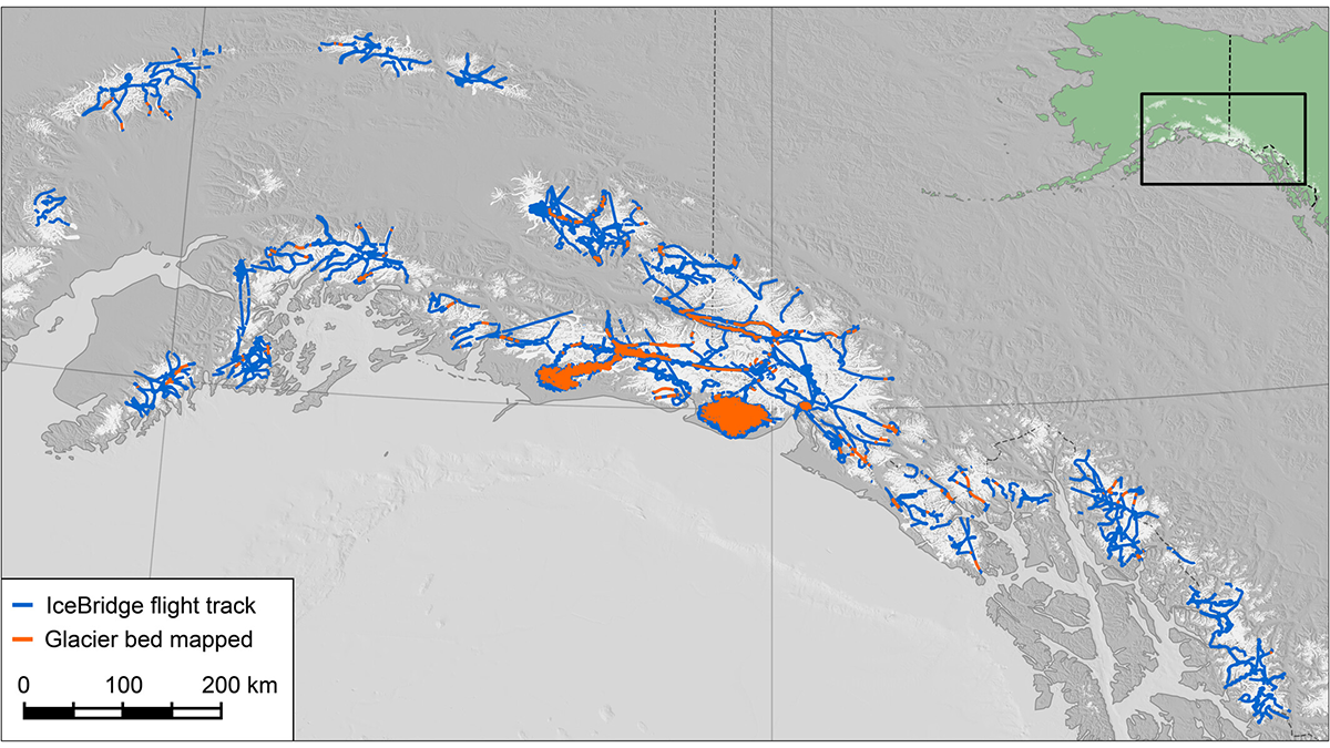
A decade of NASA airborne radar surveys produces the most extensive inventory of glacier ice thickness for Alaska and northwestern Canada to date.
Journal of Geophysical Research: Earth Surface
Posted inEditors' Highlights
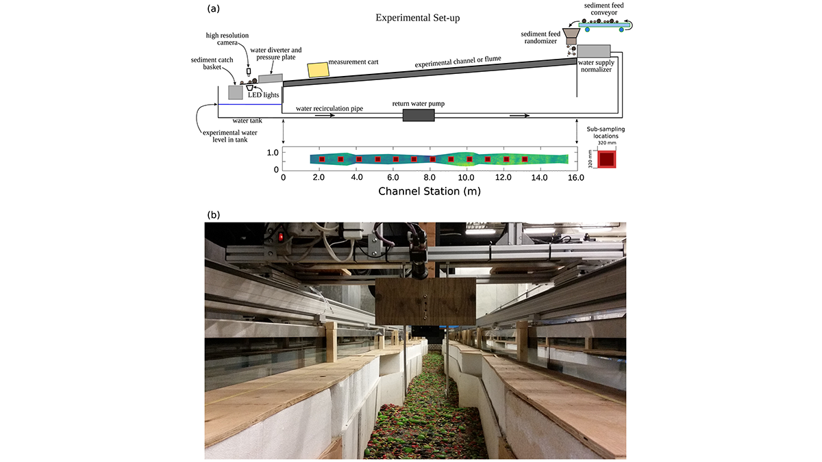
Small and Large Grains Move Differently in Water
A shift in perspective: flume experiments show that grain entrainment is far more complex than traditional models suggest.
Posted inEditors' Highlights
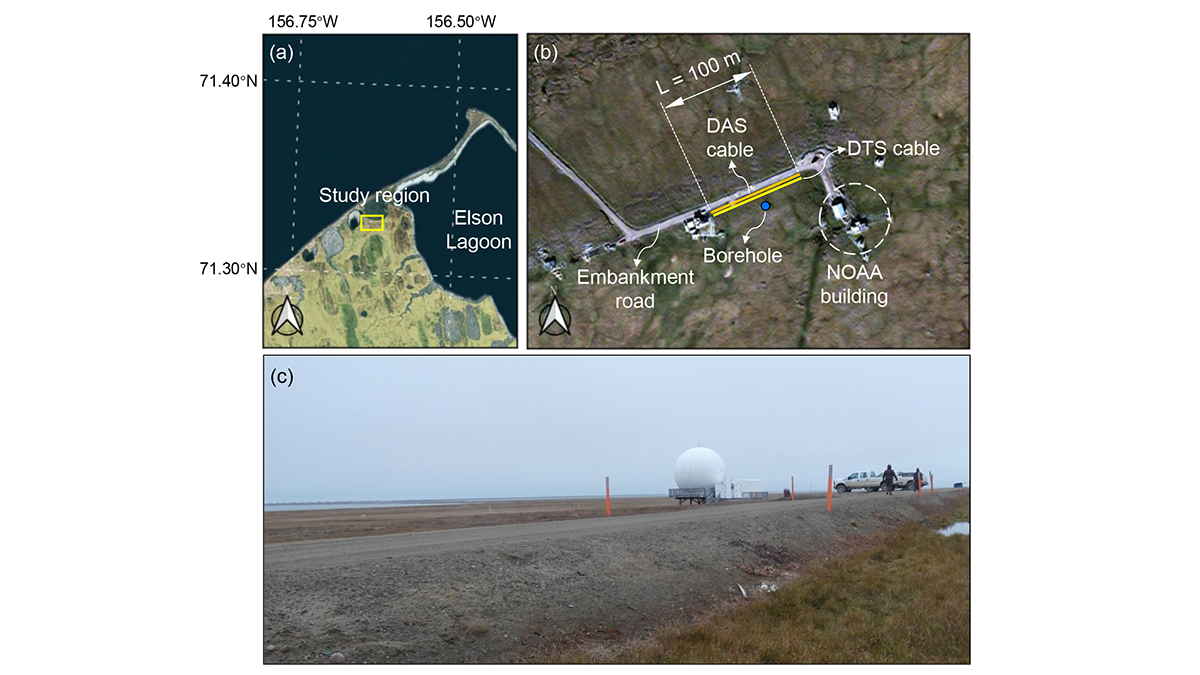
A Digital Twin for Arctic Permafrost Beneath Roads
A physics-informed digital twin uses high-resolution temperature data to track, update, and predict permafrost conditions beneath an Alaskan embankment road.
Posted inEditors' Highlights
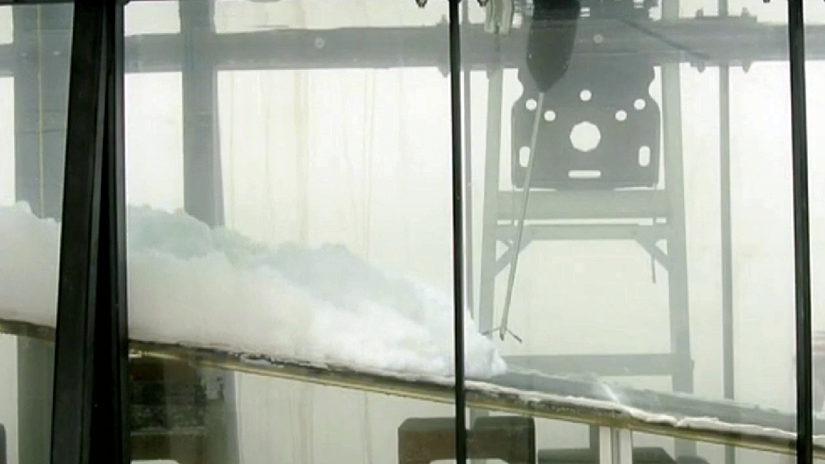
Drone Imagery Reveals Marked Variability in Antarctic Snow Roughness
Multi-temporal UAV oblique photogrammetry reveals significant fine-scale variability in Antarctic snow roughness driven by surface type, measurement scale, model choice, and meteorological conditions.
Posted inEditors' Highlights
Gravity Waves Help Drive Sediment to the Deep Ocean
Laboratory experiments reveal that gravity wave-turbidity current interactions (combined flows) can enhance sediment transport to the deep ocean.
Posted inEditors' Highlights
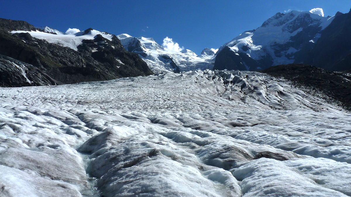
Choice of Glen’s n Leads to Differing Projections of Ice Sheet Mass Loss
Glen’s Law describes the simple physics of ice flow that underpins ice sheet models, but parameter choices substantially influence the outcome of model projections.
Posted inEditors' Highlights
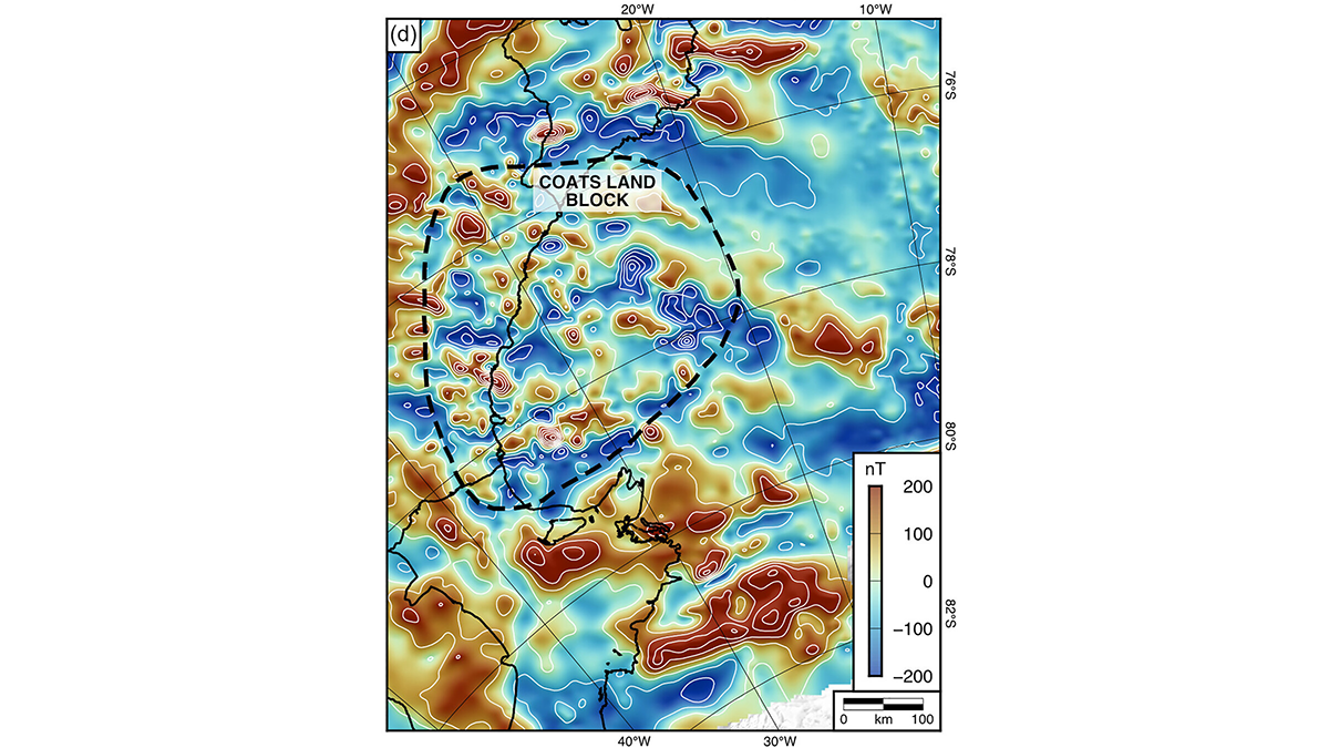
An Ancient Landscape Beneath the East Antarctic Ice Sheet
Geophysical observations of the subglacial topography of Coats Land reveal a landscape formed by tectonics and fluvial erosion that influenced the formation of the East Antarctic Ice Sheet.
Posted inEditors' Highlights
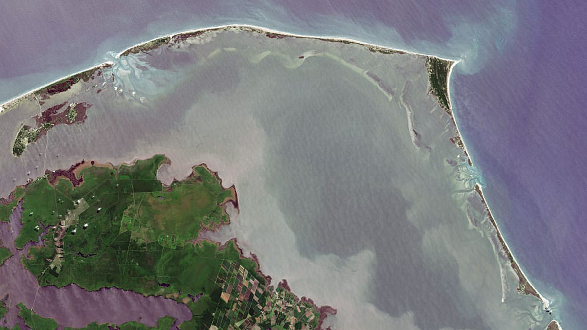
What’s Under the Water Matters
The fate of barrier islands in presence of sea level rise depends on their underwater shape.
Posted inEditors' Highlights
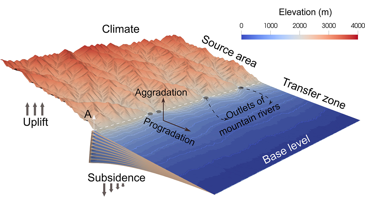
Why More Rain Doesn’t Mean More Erosion in Mountains
Erosion in mountain-basin systems driven by long-period climate variations is buffered by an erosion saturation effect, which weakens peak erosion and leads to reduced sediment flux.
Posted inResearch Spotlights
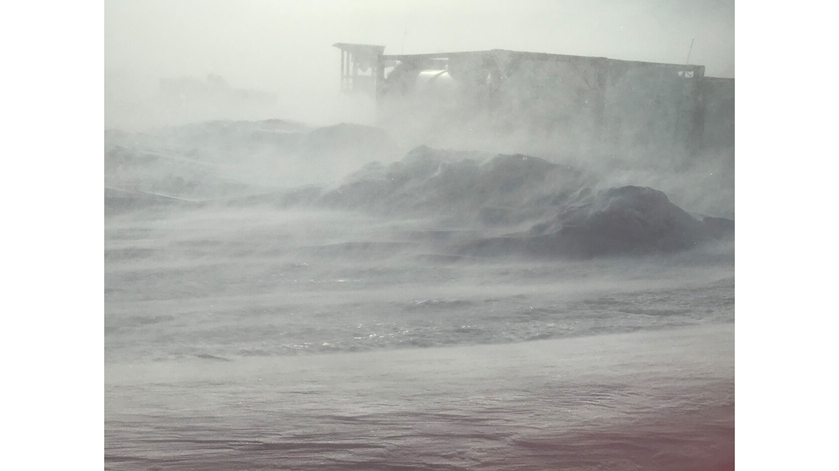
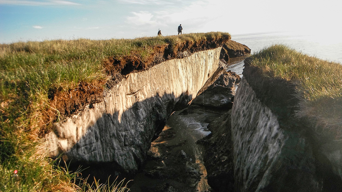
Lab Setup Mimics Arctic Erosion
The new methodology gave researchers valuable insights into why Arctic shorelines are crumbling.