
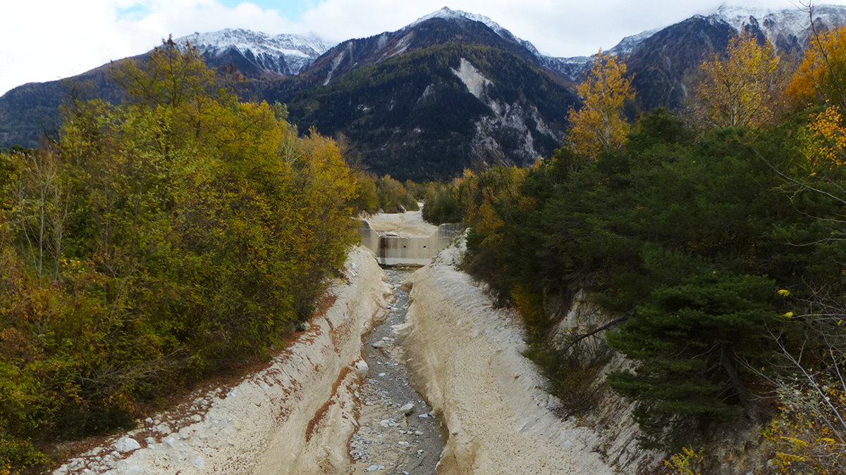
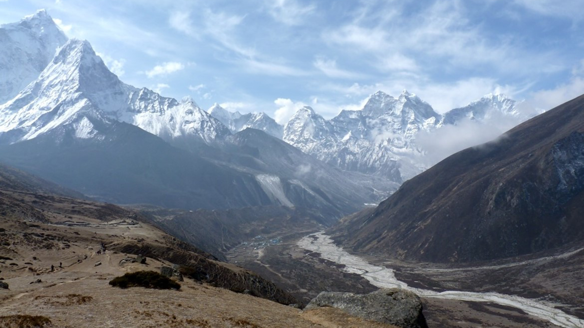
New research shows that warming beginning about 13,000 years ago contributed to a proliferation of landslides in Iceland.
Journal of Geophysical Research: Earth Surface

Posted inEditors' Highlights
Elementary, My Dear: Al & Be Give Evidence of Past Climate Change
10Be and 26Al concentrations in river sand reveal an increase in erosion rate in the Brazilian Highlands consistent with the Mid-Pleistocene Transition, a major climatic shift that occurred about 1 million years ago.
Posted inEditors' Vox
Announcing New AGU Journal Editors-in-Chief Starting in 2025
AGU is excited to welcome new Editors-in-Chief for five of our journals in 2025.
Posted inResearch Spotlights
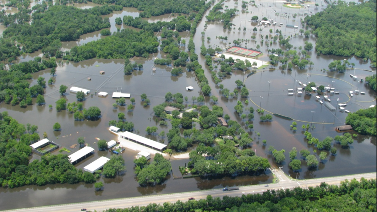
Subtle Coastal Sinking Raises Storm Surge Risks
New detection of millimeter-scale subsidence along vulnerable coastlines means flood risk predictions may be inaccurate.
Posted inResearch Spotlights
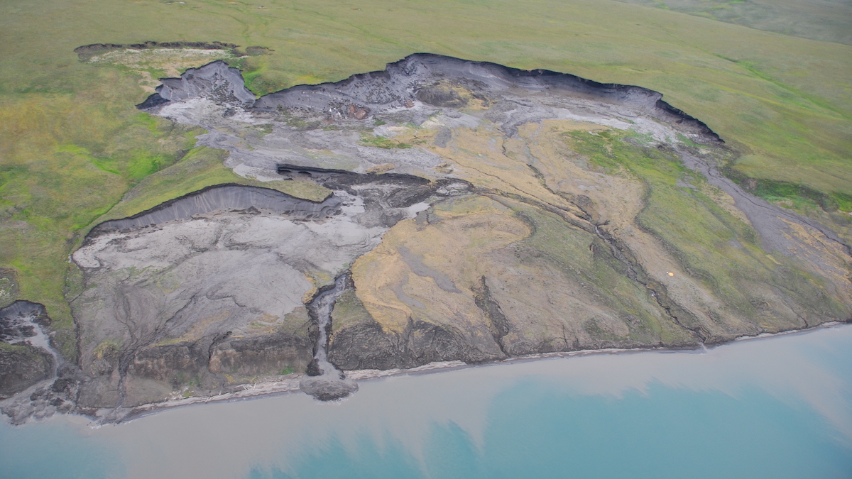
Down in the Slumps: Tracing Erosion Cycles in Arctic Permafrost
Climate change is altering permafrost thaw cycles and leading to unique Arctic erosional problems.

Posted inResearch Spotlights
California Wildfires and Weather Are Changing Erosion Patterns
Sediment runoff from the state’s increasingly severe wildfires and heavy rain events may affect ecosystems and water resources downstream.
Posted inEditors' Highlights
Counting from One to Nine to Detect Debris Flows
A groundbreaking method using Benford’s law allows the detection of debris flows from seismic signals.
Posted inEditors' Highlights
Sediment Dampens the Impact of Glaciation on Cenozoic Denudation
Rates of continental-scale sediment flux and denudation are similar between glacial and interglacial periods when the aggradation of glacier-eroded sediment inhibits fluvial erosion downstream.
Posted inEditors' Highlights
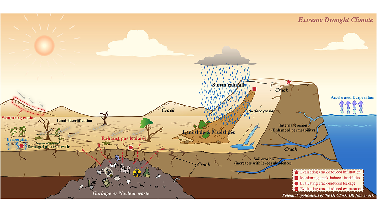
New Observations Provide Insight into Soil Desiccation Cracking
A new application of distributed fiber optic sensing provides early detection of soil desiccation cracking behavior and illustrates, for the first time, the phenomenon of soil crack breathing.

Posted inResearch Spotlights
Tsunami Sands Help Scientists Assess Cascadia Earthquake Models
With evidence from new sediment cores, researchers tested the performance of various models of the 1700 CE megathrust earthquake.