
Frozen flume experiments reveal the sensitivity of permafrost riverbank erosion to water temperature, bank roughness, and pore-ice content.
Journal of Geophysical Research: Earth Surface
Posted inEditors' Highlights
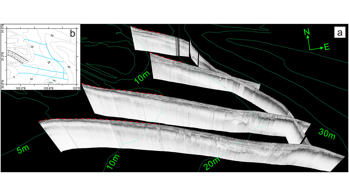
Delta Degradation Leads to Exacerbated Greenhouse Gas Emissions
Seismic ship surveys and seabed elevation maps of the Yangtze subaqueous delta reveal how the reduction of sediment supply to the coastal ocean can trigger increased greenhouse gas emissions.

Posted inEditors' Highlights
Scotland’s Last Glaciers Cause a Shift in an Old Paradigm
Cosmogenic geochronology of Scotland’s vanished glaciers indicates that the paradigm of weakened North Atlantic currents causing a rapid regional cooling is no longer valid.
Posted inEditors' Highlights
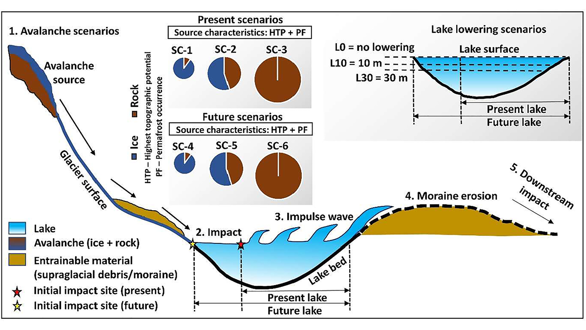
Artificial Lake-Level Lowering Alleviates Floods in the Himalayas
A new model combining future permafrost degradation and related avalanches demonstrates that artificial lake-lowering could significantly reduce the risk of glacial lake outburst floods.

Posted inEditors' Highlights
What Electrons Can Tell Us About the Speed of Sand
A new sediment tracer uses the interactions between radiation, charge, and the Sun to uncover the hidden transport histories of sand grains.

Posted inResearch Spotlights
When Projecting Coastal Resilience, Sediment Compaction Is Key
The addition of new sediment helps build up lowland environments like deltas and marshes, but it also compacts materials beneath it—a vital, but often overlooked, factor in landscape evolution studies.

Posted inEditors' Highlights
Tracking Subsidence on Deltas With Fiber-Optics
Fiberoptic strain meters capable of measuring micron-scale subsidence reveal a Holocene sediment package on the Mississippi Delta that is mostly stable.
Posted inEditors' Highlights
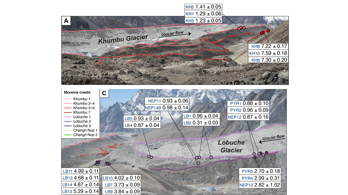
Glacier Advance and Retreat: Insights From the Top of the World
New dating of glacial features reveals predictable glacier behavior in response to climate warming and cooling in the Everest region in the past 8,000 years.
Posted inEditors' Highlights
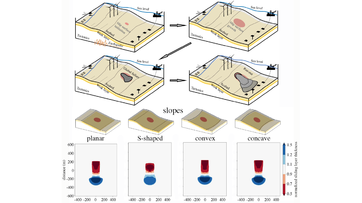
Growth That Economists Would Envy
A new study reveals how small cracks turn into gigantic submarine slides.
Posted inEditors' Vox
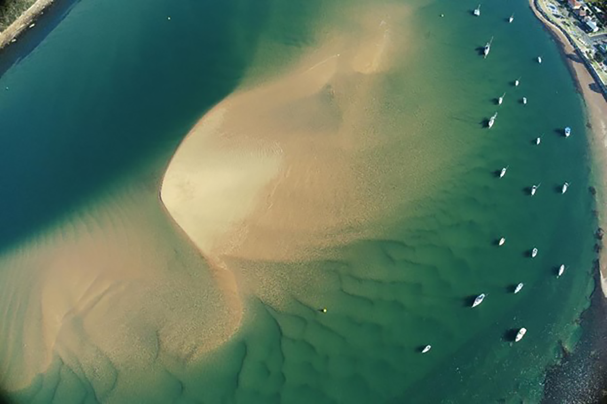
Can We Better Predict Coastal Change?
A new special collection invites studies on a new era of models and knowledge that provide predictions or insights into predictability in coastal geomorphology.