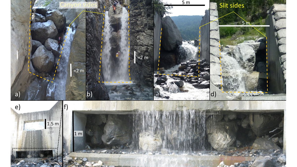
A new modeling framework to assess the likelihood of jamming at constrictions can be used to support the design of effective mitigation measures and reduce risk in debris flow prone areas.
Journal of Geophysical Research: Earth Surface

Posted inEditors' Highlights
Running Water on Topographic Data to Better Delineate Channels
Two-dimensional hydraulic simulations are a powerful tool to identify process domains such as channels, hillslopes, and floodplains in high-resolution topographic data.

Posted inEditors' Highlights
Extreme Lithium Isotope Fractionations During Intense Weathering
Extreme lithium fractionation is observed when primary minerals in andesite are transformed to secondary clay minerals and then to oxides with intensive chemical weathering in a tropical climate.
Posted inEditors' Highlights
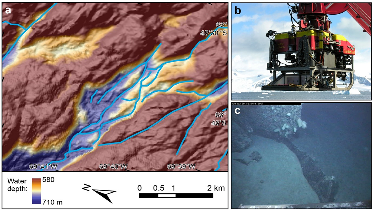
New Observations Reveal Ancient Subglacial Water Paths
Analyses of new shipboard and ROV observations of bedrock channels carved by floods and outbursts from subglacial lakes under Antarctica shed light on complex subglacial processes.
Posted inEditors' Highlights
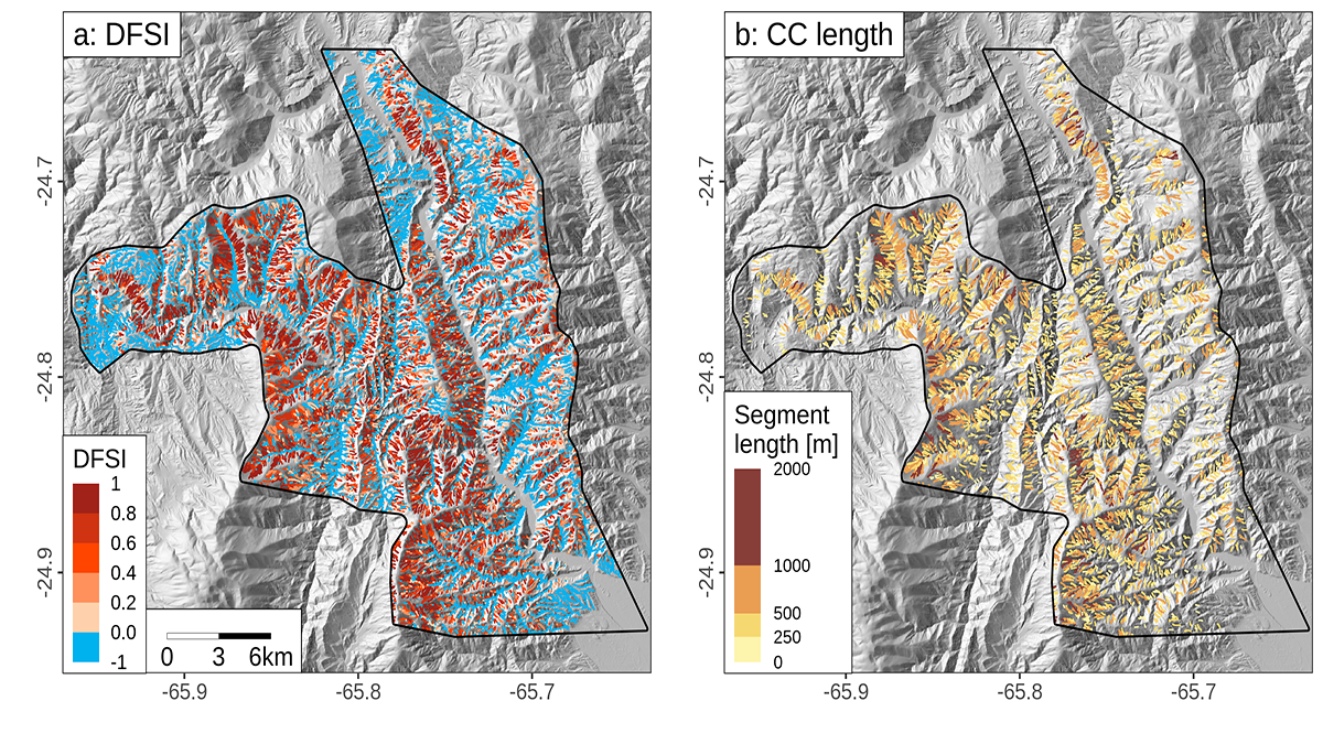
Debris Flows Keep the Landscape on the Straight and Narrow
New methods for identifying debris flow-shaped channels improve hazard quantification and highlight how high uplift rates and fractured bedrock facilitate debris flow-dominated landscape evolution.

Posted inEditors' Highlights
Moving Earthquake-Generated Sediment Through a Landscape
Ten years after the Wenchuan earthquake, most of the new sediment it produced remained on the landscape, indicating a long recovery time.
Posted inEditors' Highlights
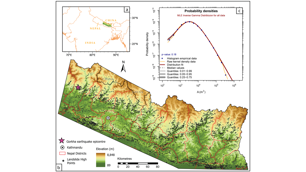
History Matters When Gauging Hillslope Susceptibility to Failure
Using susceptibility models to forecast the potential locations of landslides is a key tool in mitigating landslide hazard, but are existing approaches appropriate in dynamic mountainous settings?
Posted inResearch Spotlights
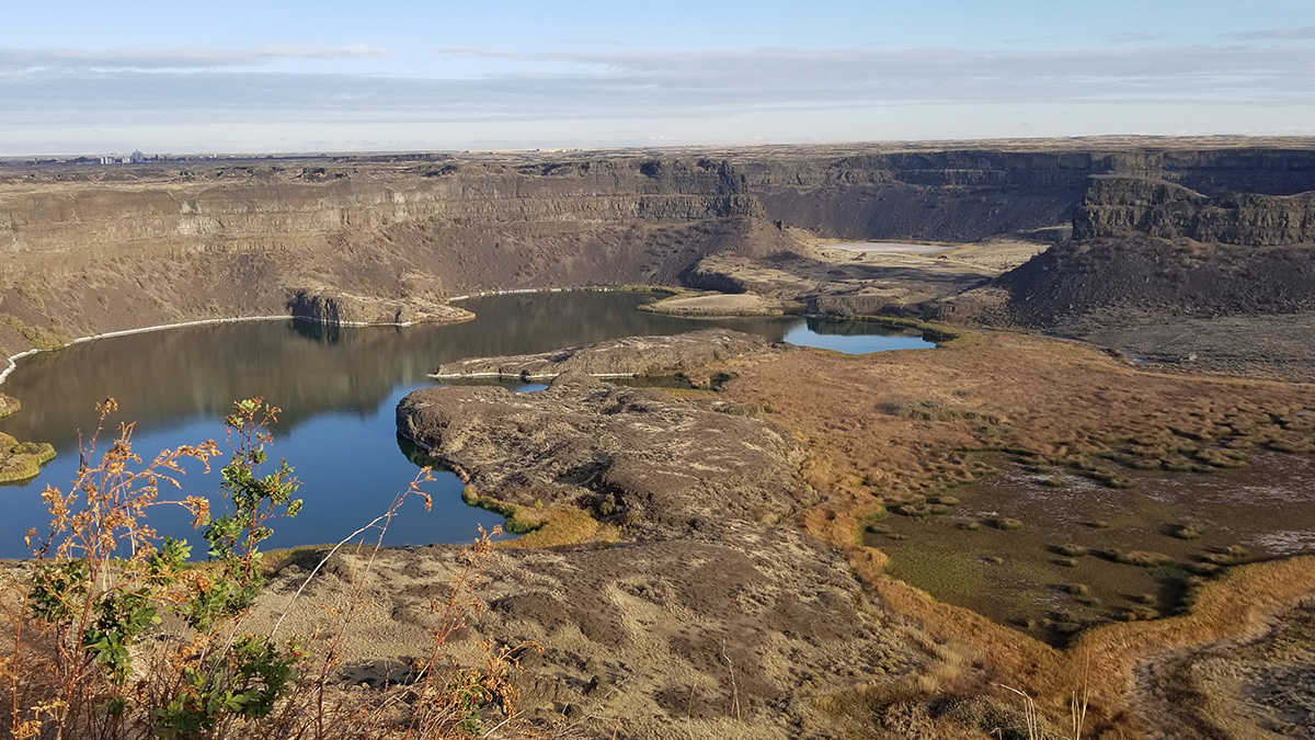
Western U.S. “Megafloods” Might Not Have Been So Mega
The flooding that carved eastern Washington State 20,000 to 12,000 years ago could have been 80% smaller than the canyons’ volume today.
Posted inResearch Spotlights
How Climate Change Shaped the Amazon’s Land and Life
Ice Age climate swings shaped the equatorial basin’s terrain—and possibly its ecology—faster than previously thought.

Posted inResearch Spotlights
High Mountain Rain Has Scientists Rethinking River Basics
Rainfall varies with elevation, and such precipitation gradients can have profound and often counterintuitive effects on topography.