
The Czech Republic’s Hranice Abyss is more than twice as deep as researchers thought.
Journal of Geophysical Research: Earth Surface
Posted inEditors' Highlights
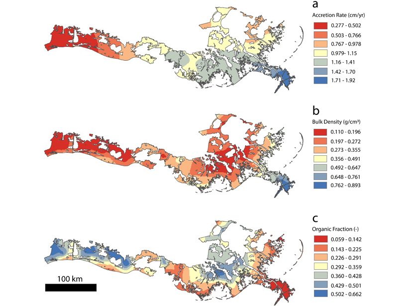
Coastal Sediment Deficit Appears Smaller Than Previously Thought
With a deficit of sediment needed to compensate for relative sea level rise, a new study demonstrates that organic material cannot be ignored in evaluating mass and volume accumulation rates.
Posted inEditors' Highlights
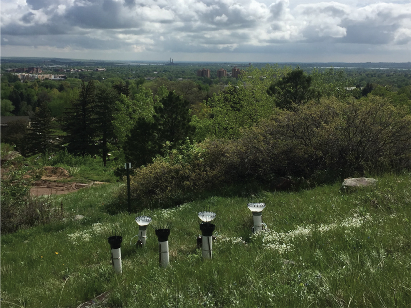
Dust in the Wind: Human Impacts to the Colorado Front Range
A recent increase in airborne dust has been attributed to both climate and land use, with human activity playing a substantial role, especially in summertime at low elevations.

Posted inEditors' Highlights
Meteoric 10Be Reveals Lithological Control on Erosion Rates
New meteoric 10Be data quantify fast erosion of slates in the Zhuoshui River catchment in Taiwan and demonstrate the influence of lithology on landscape steepness.

Posted inResearch Spotlights
Tracing the Past Through Layers of Sediment
Signals in layers of sedimentary rock hint at climates and ecosystems come and gone. Understanding this history can help us forecast the future, but challenges abound.

Posted inResearch Spotlights
Finding Natural Solutions to Man-Made Problems in River Deltas
Decades of research on river deltas identify gaps in our knowledge of delta behavior and the tools required to fill them in.
Posted inResearch Spotlights
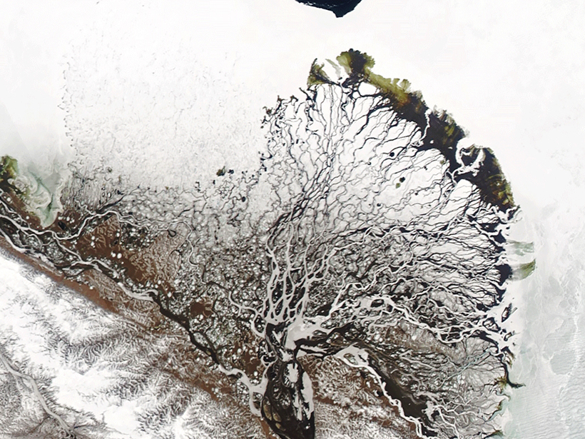
River Deltas at the Top of the World
The water that filters through river deltas has a large effect on the Arctic Ocean. A new study explores factors that shape Arctic river deltas and how delta form in turn changes water flow.

Posted inEditors' Highlights
Representing Estuaries and Braided Rivers as Channel Networks
The human eye is quite good at identifying channel networks among the rich patterns exhibited by estuaries and braided rivers, but computers have a harder time doing so. Could they do better?
Posted inResearch Spotlights
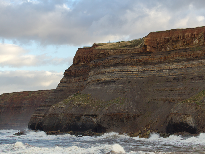
Timing Matters for Rockfall Estimates
Researchers studying an eroding coastal cliff detected 10 times more rockfall events when monitoring surveys were conducted hourly versus monthly.

Posted inEditors' Highlights
Permafrost Thaws Rapidly as Arctic River Flooding Increases
As climate warms, Arctic rivers carry higher flows and flood earlier in the spring, causing underlying permafrost to thaw rapidly.