Using small-scale physical experiments, the mobility of rock-ice avalanches is linked to variability in the earth materials that are encountered along the flow runout path.
Journal of Geophysical Research: Earth Surface

Posted inResearch Spotlights
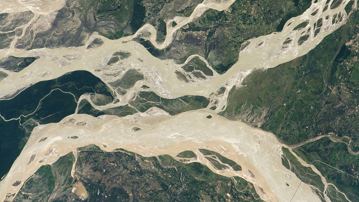
Coherent, Not Chaotic, Migration in the Brahmaputra-Jamuna River
The channel threads in braided river systems may be more predictable than previously thought.
Posted inEditors' Highlights
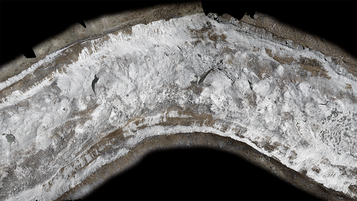
The Complex Evolution of Debris-Covered Glacier Surfaces
A first look at how the surfaces of debris-covered glaciers evolve over time from six years of drone surveys in the Nepal Himalaya.
Posted inEditors' Vox
Introducing the New EIC of JGR: Earth Surface
Learn about the person taking the helm of JGR: Earth Surface and their vision for the coming years.
Posted inEditors' Highlights
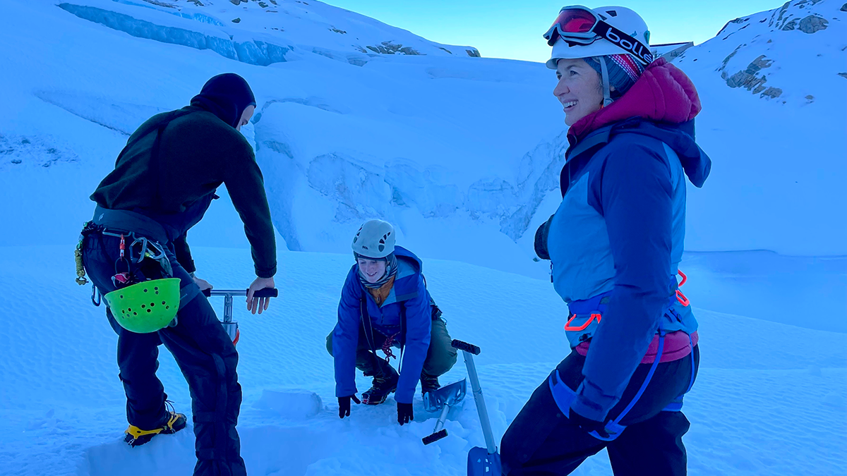
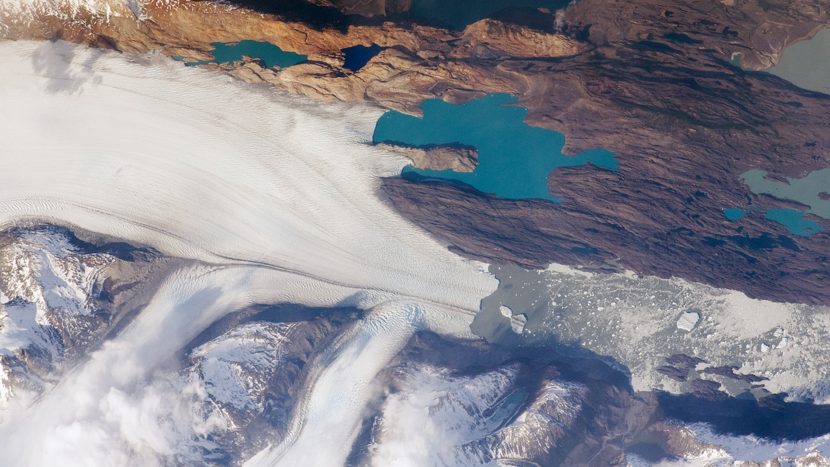
The Pulsed Pace of Glacial Erosion
New data from Lago Argentino, Patagonia reveal that glacial erosion occurs in discrete pulses, which challenges previous ideas that erosion rates have increased over time due to climate change.

Posted inEditors' Highlights
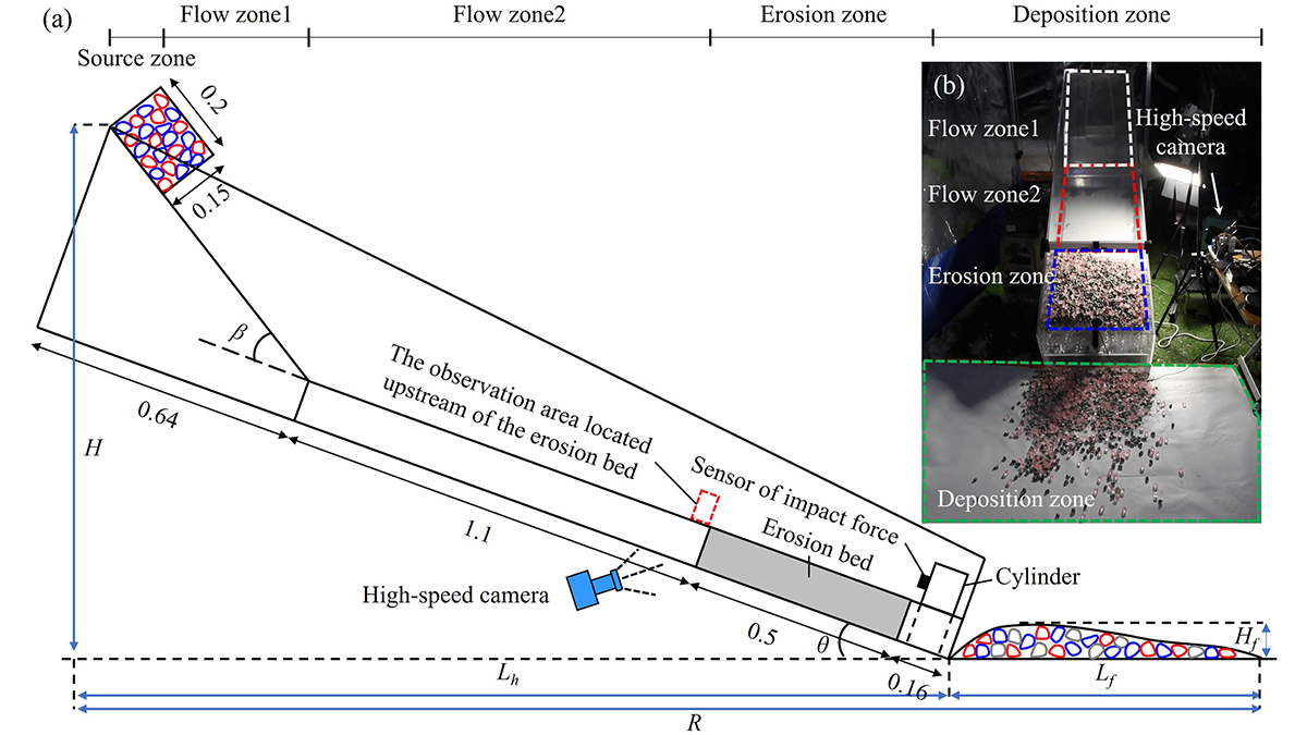
Ice boost! Why Rock Avalanches Containing Ice Travel So Far
Researchers identify a new mechanism that allows avalanches containing a mixture of rock and ice to travel very long distances.
Posted inEditors' Highlights
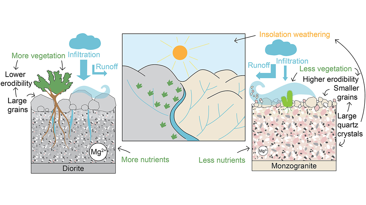
How Rock Type Shapes River Networks and Influences Landscape Evolution
A new study in Chile shows how small differences in rock type can drive large differences in erosion, vegetation, and river networks, illuminating the role of mineralogy in shaping landscapes.
Posted inEditors' Highlights
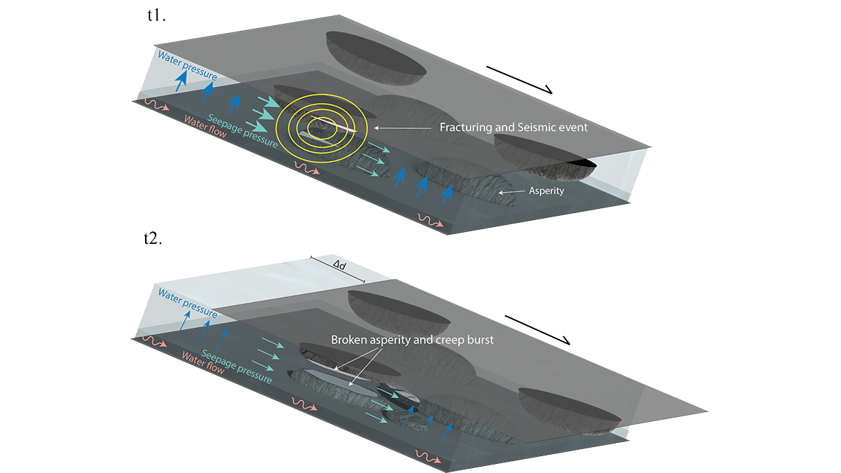
Will It Run Away? Documenting Creep Bursts in a Slow-Moving Landslide
After 11-years of monitoring a slow-moving landslide and its shear zone in Norway, scientists reveal a complex pattern of creep bursts that require a rethink of the driving mechanisms.
Posted inEditors' Highlights
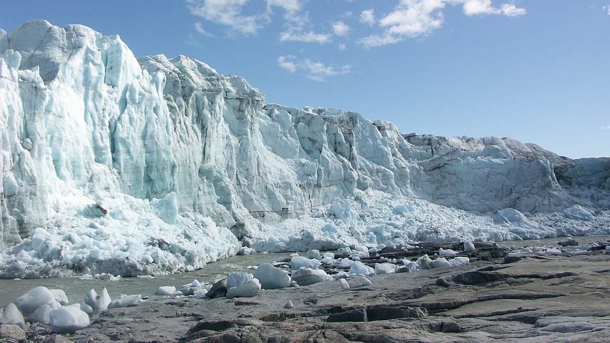
Which Greenland Outlet Glaciers have Subglacial Channels?
A new study provides insights into where the channels that drain subglacial water from underneath the Greenland Ice Sheet are most likely located.