Editors’ Highlights are summaries of recent papers by AGU’s journal editors.
Source: Journal of Geophysical Research: Earth Surface
Understanding how coarse sediments move into rivers is crucial for sedimentary hazard, for fluvial ecosystems, and to understand long-term landscape evolution. However, measuring coarse sediment transported at the bottom of rivers has remained very challenging because most of it is transported during large floods that happen rarely and can damage in-situ equipment. This lack of measuring capabilities has hampered theoretical understanding and modeling development on this topic.
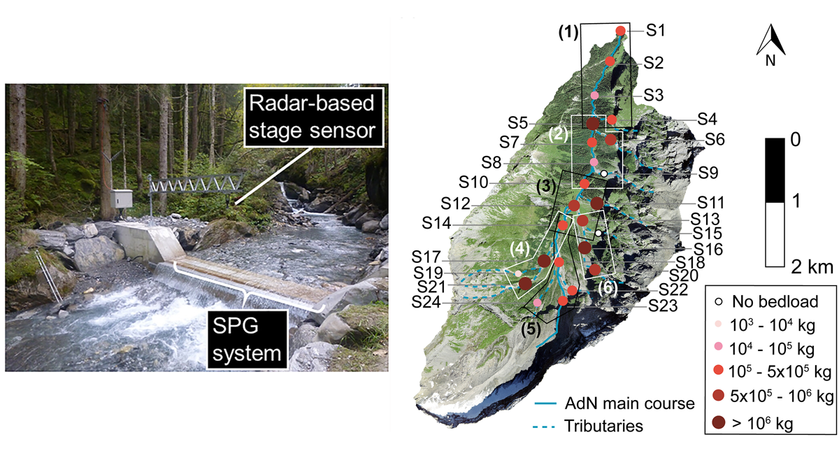
For about a decade, systems able to sense the vibration of the ground emitted by the collision of sand and gravel particles transported into rivers have been deployed to attempt to relate this signal to the volume of material transported. In a new study, Antoniazza et al. [2023] are one of the first to demonstrate the capabilities of such a network of sensors, which were calibrated against a series of instrument measuring water and sediment discharge at the outlet of a Swiss alpine catchment. With 24 sensors they estimate the volume of sediment that has moved in the main stream and its different tributaries during a flood, highlighting a substantial variability.
The system, much cheaper than the alternative instruments measuring only at the outlet, allows estimation of the sediment transported throughout the catchment and how it has varied in time during the flood, revealing several pulses of sediment transport. Deploying similar systems in many catchments, and coupling them with other systems offering continuous monitoring of environmental parameters may reveal important aspect of when and how much sediments move in mountain streams and finally allows to reduce the uncertainty of the models aiming at predicting sediment transport.
Citation: Antoniazza, G., Dietze, M., Mancini, D., Turowski, J. M., Rickenmann, D., Nicollier, T., et al. (2023). Anatomy of an Alpine bedload transport event: A watershed-scale seismic-network perspective. Journal of Geophysical Research: Earth Surface, 128, e2022JF007000. https://doi.org/10.1029/2022JF007000
—Odin Marc, Associate Editor, JGR: Solid Earth