Countries with strong early-warning systems can reduce mortality from natural hazards by 8 times, and a 24-hour alert can reduce economic losses by 30%, said Nahuel Arenas, deputy chief for Americas and the Caribbean at the United Nations Office for Disaster Risk Reduction (UNDRR).
Currently, however, half the world’s countries still lack early-warning systems, and fewer still have frameworks that link early warnings to emergency action plans. Consequently, the United Nations launched the Early Warnings for All initiative (EW4All) to ensure everyone on Earth is protected by early-warning systems by 2027.
A key component of the initiative is to take a multihazard approach to early-warning systems and involve all sectors of society in putting them into practice. “We need more systems thinking and to stop looking at hazards in an isolated way,” Arenas said.
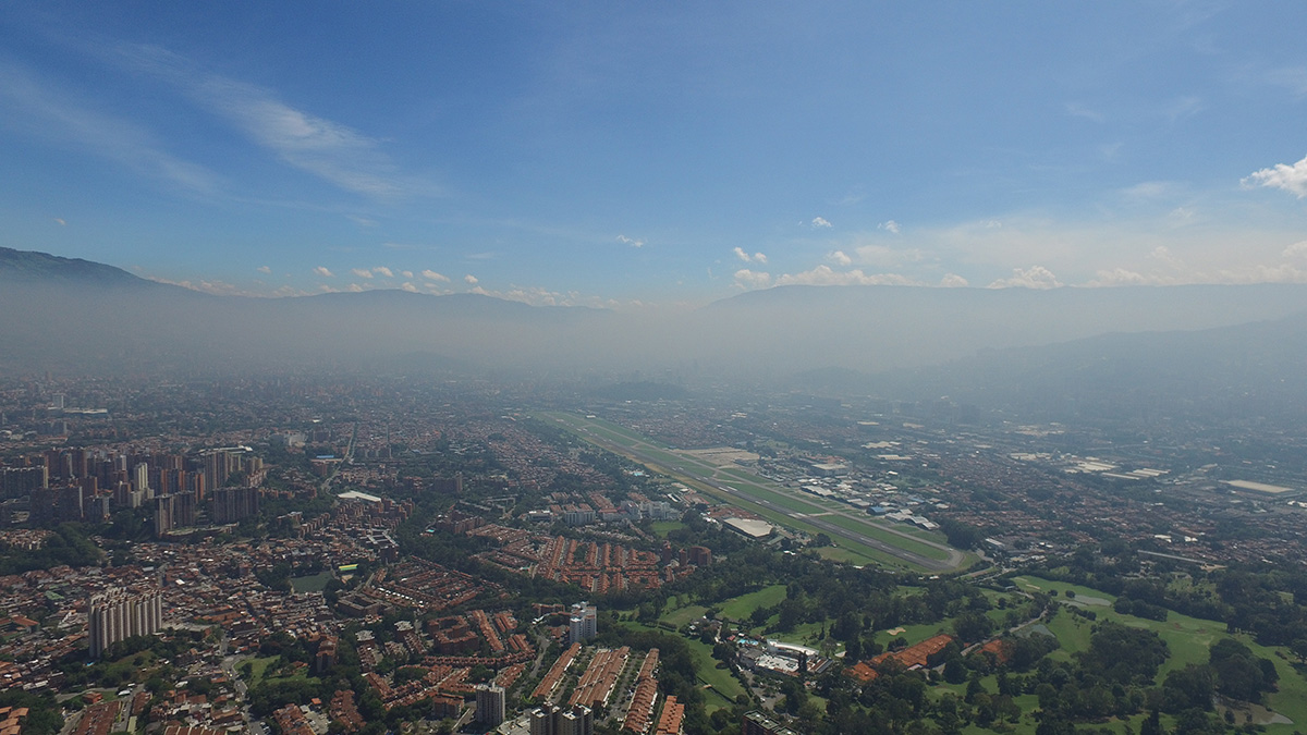
Arenas visits countries to see what works when it comes to implementing early-warning systems, and in March 2023, he visited the Aburrá Valley in Colombia.
In December 2010, La Niña rains lashed the steep hillsides of the Aburrá Valley, unleashing a landslide that buried nearly 200 people. After the event, the local environmental agency, Area Metropolitana del Valle de Aburrá, invested in ensuring that such a catastrophe wouldn’t happen again.
“We are not at the mercy of nature.”
So began the Early Warning System of Medellín and the Aburrá Valley (SIATA), which provides early warnings for floods, landslides, fires, lightning, and poor air quality to the Aburrá Valley as well as the 2.5 million residents of its largest city, Medellín. “Where we live, emergencies happen all the time, and we’ve had to be flexible and adaptable to solve whatever problem needs to be solved,” said meteorologist Lina Ceballos-Bonilla, the coordinator of SIATA’s risk management team.
SIATA is a model of how natural hazards don’t have to translate into catastrophes, Arenas said. “We are not at the mercy of nature,” he said. “We can do things right now that can substantially reduce the impacts of hazards and can prevent these hazards from resulting in disasters.”
Sounding the Alarm
“We say to people, if you have a sensor close to your house, it can save your life or your family’s lives.”
After the 2010 disaster, scientists from the newly formed SIATA analyzed past events using satellite and meteorological data to determine what mix of conditions could lead to environmental hazards across the basin.
Where the team determined flooding or landslides could affect a neighborhood, they placed gauges to monitor rainfall. They then worked closely with local communities to prepare them for future hazards, mostly by installing environmental monitors to track rainfall and running workshops to teach residents how to use them. “We say to people, if you have a sensor close to your house, it can save your life or your family’s lives,” Ceballos-Bonilla said.

Today, SIATA has nearly 1,200 sensors recording different aspects of the environment, most looked after by residents. At any one time, 100 of those sensors might even be weaving along roads or sitting outside a park—as part of SIATA’s air quality program, volunteers cycle around with mounted sensors to give dynamic feedback on the air in Medellín. The agency also sponsored a crowdsourced science project resulting in 400 air quality sensors installed in gardens, on balconies, and on facades.
Building Community Connections
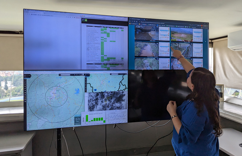
SIATA’s operational team shares daily forecasts, air quality information, and any issues to watch out for with Aburrá Valley’s risk management officers. When the scientists spot a storm that presents a potential hazard, they evaluate water levels in creeks, monitor where lightning has struck, and send additional data and rainfall warnings to trained community members, who also relay information to SIATA about on-the-ground conditions.

The EW4All initiative is based on four foundational pillars. UNDRR and the World Meteorological Organization are the coleads of the first two pillars: increase disaster risk knowledge and further the detection, observation, monitoring, analysis, and forecasting of hazards. The third and fourth pillars concern warning dissemination and communication and communities’ preparedness to respond.
Two of the pillars, Arenas noted, focus not on science, but on working with local and regional authorities (such as risk managers) and trained residents to disseminate and communicate warnings. In considering this aspect of SIATA, Arenas said that he “could see firsthand how the different institutions are coordinating with the communities and with community leaders around the early-warning systems.”
“These systems are simple and effective solutions with amazing cost benefits that can be put in place tomorrow.”
Quantifying lives saved by early-warning systems is tricky. But although the Aburrá Valley has continued to experience extreme rainfall, flooding, and landslides, the total number of fatalities due to these hazards can now be counted on one hand.
Systems like SIATA “are simple and effective solutions with amazing cost benefits that can be put in place tomorrow,” Arenas said.
—Jane Palmer (@TJPalmerWrites), Science Writer