At 3 a.m. on a Sunday night, the seafloor began to shudder. Seismic waves from an earthquake along the nearby San Andreas Fault raced through the ground. The shaking splintered apart a rocky outcrop perched along the top of Monterey Canyon, a deep, fissured, undersea terrain off the central coast of California. As the outcrop crumbled, an avalanche of dirt, kelp, and sediments laced with agricultural chemicals plummeted down the canyon wall. Within minutes, thousands of tons of churning sediments raced downstream, slithering their way through the massive canyon’s branching channels before the potentially toxic slurry deposited itself onto a submarine meadow out beyond the canyon.
If an underwater avalanche like the fictitious one above had happened any time before last month, it would have been unlikely that fishermen, resource managers, or ocean scientists would have known it took place. If somehow they did know, they wouldn’t have been able to assess how far down the canyon those laced sediments traveled and therefore where to look for consequences.
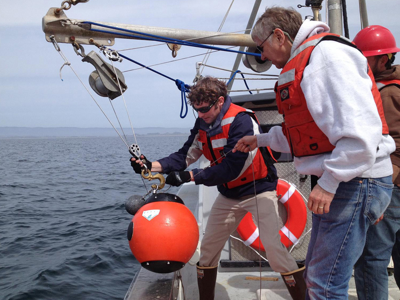
Benthic Event Detectors
However, as of this October, an international team of researchers embarked on an unprecedented experiment off Monterey, Calif., using instruments like armored beach balls that can detect and track an underwater avalanche to investigate sediment movements within deep-sea canyons.

Four of the beach ball–like benthic event detectors (BEDs) now lie on the seafloor waiting for slurries of sediment and debris to carry or roll the novel, metal-shelled instrument packages in their currents. The detectors will use sound waves to transmit data to awaiting scientists about how quickly and how far down the canyon sediment flows travel. Working from the deck of the Rachel Carson, a 135-foot-long (41-meter-long) research ship, the researchers used autonomous underwater vehicles (AUVs) to place the BEDs, as well as six moorings scattered around the Monterey Canyon, to monitor currents, sediment, and the physical characteristics of the water. The scientists also deploy other AUVs periodically to provide detailed maps of the canyon and relay information from the sensors to the shore.
This experiment is intended to enable scientists to observe sediment flows in submarine canyons. But it can also demonstrate how far contaminants from land flow into the sea and how sediments and organic matter move through the depths, affecting biodiversity of benthic organisms, said Charlie Paull, a geologist and senior scientist at the Monterey Bay Aquarium Research Institute (MBARI). It might also enable scientists to observe sediment being carried down toward a subduction zone. Such observations could deepen their understanding of a final phase of the geologic cycle in which land built by the outpourings of volcanoes erodes and gets carried back to the sea as sediments that then reenter the depths of the Earth before transforming into new rock once again somewhere else.
“It’s one of the fundamental mechanisms that redistributes sediment across the surface of the Earth,” said Paull.
Collective Effort

MBARI, the U.S. Geological Survey, and researchers from the Ocean University in China; the National Oceanographic Centre in Southampton, U.K.; and the University of Hull, U.K., all pooled together their equipment, resources, and manpower to execute the Coordinated Canyon Experiment, which started in October 2015 and will conclude in spring of 2017.
“We all have the wherewithal perhaps to do small experiments,” said Paull. “What we don’t have the wherewithal to do is to get in the canyon at the same time and have it integrated into a larger package where the sum of the components is much larger than the individual components.”
—Cody Sullivan, Writer Intern
Citation: Sullivan, C. (2015), Researchers track underwater avalanches like never before, Eos, 96, doi:10.1029/2015EO038735. Published on 3 November 2015.
Text © 2015. The authors. CC BY-NC 3.0
Except where otherwise noted, images are subject to copyright. Any reuse without express permission from the copyright owner is prohibited.