
A community-led project in California shows how collaboration can reshape farmland to improve water resources, restore native plants, and create recreational space.
California
Posted inResearch Spotlights
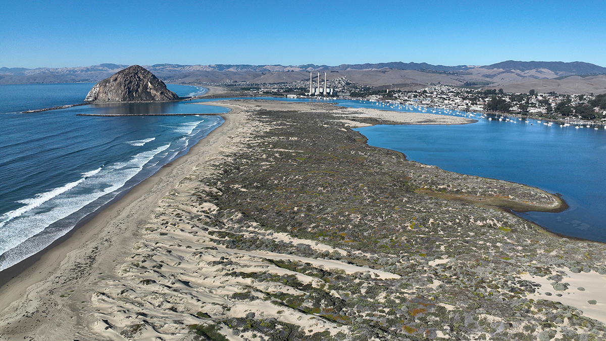
Extensive Sand Dune Loss Threatens California Coast
Aerial photos combined with lidar data show the extent of the problem.
Posted inOpinions
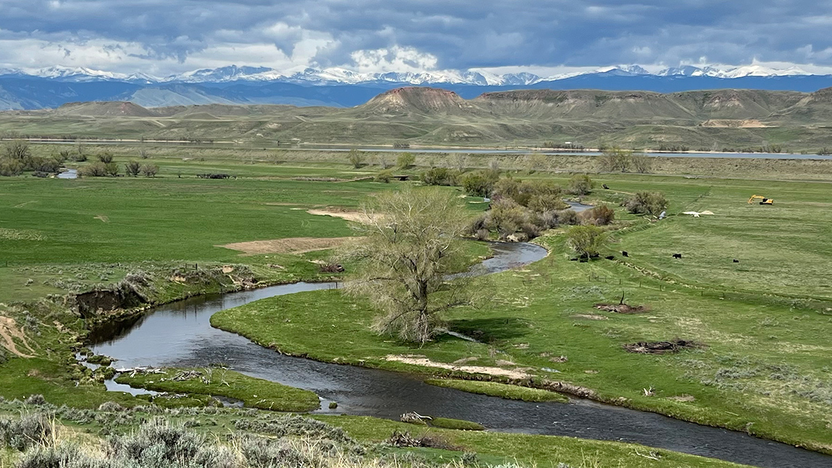
Archetypes Could Accelerate Agricultural Adaptation to Less Snowpack
Measurable characteristics can be used to develop archetypes of complex agricultural systems, helping stakeholders to assess where different adaptation strategies are more likely to succeed.
Posted inEditors' Highlights
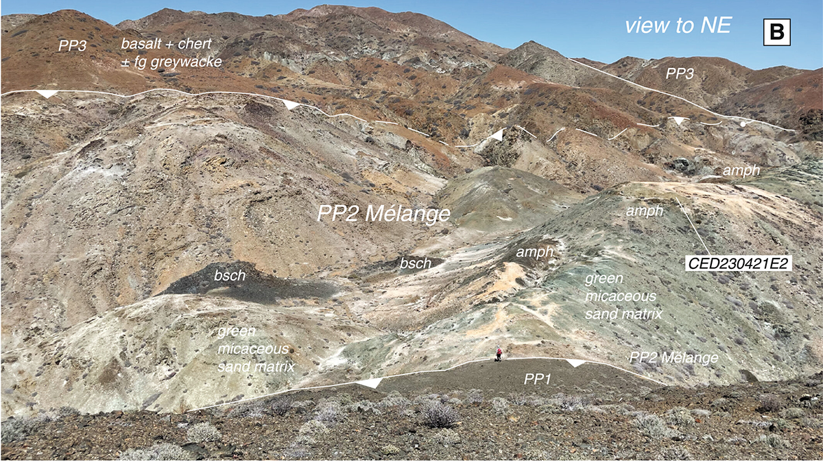
Recycled Rocks Reveal Subduction Zone Dynamics Off Baja California
High-pressure rocks on Cedros Island were exhumed, eroded, and redeposited into the subduction trench multiple times, reshaping interpretations of ancient plate boundary processes.
Posted inResearch Spotlights
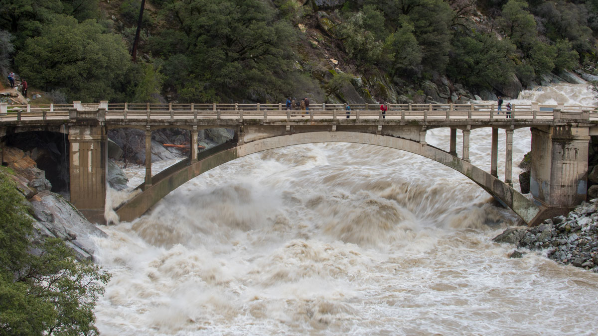
Keeping Humans in the Loop Improves Flood Forecasting
Artificial intelligence and machine learning can improve flood predictions—but human expertise still matters for accurate warnings, new research says.
Posted inResearch Spotlights
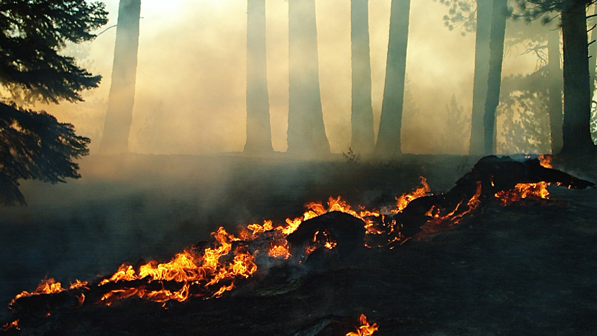
How Much Will Western Wildfires Worsen Under Warming?
A new study reevaluates the use of vapor pressure deficit, or VPD, in climate models to predict increases in area burned by wildfire across the U.S. West.
Posted inNews
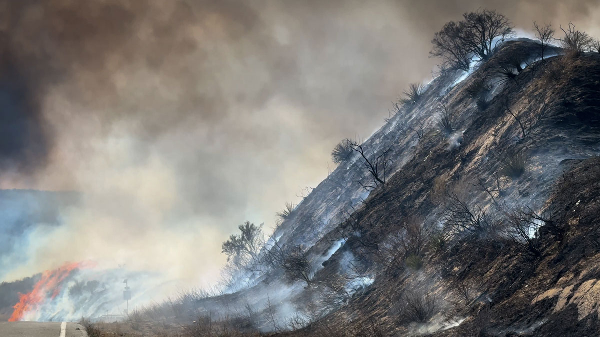
Low Snow in Eurasia Linked to Wildfires in California
Scientists found that low autumn snow levels in western Eurasia are associated with dry, warm winters in California, increasing the Golden State’s wildfire risk.
Posted inResearch Spotlights
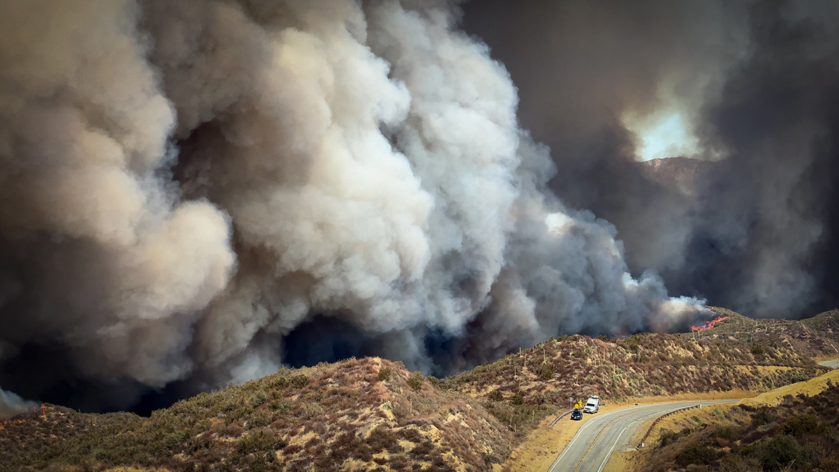
Want to Predict Wildfire Severity? Look to the State of Vegetation
A new study connects satellite data on vegetation condition, topography, and weather conditions to examine the predicted versus actual burn severity of the 2025 Los Angeles wildfires.

Posted inResearch & Developments
Temperatures Are Soaring in the Western United States. Climate Change is to Blame, Says a New Report.
A new rapid analysis by World Weather Attribution suggests that, based on a combination of observations and modeling, climate change has made the extreme temperatures forecasted for 18-22 March about 800 times more likely and 2.6°C hotter.
Posted inThe Landslide Blog
A renewed phase of movement at the Portuguese Bend Landslide Complex in Rancho Palos Verdes
Heavy winter rainfall has triggered further movement at this infamous landslide site in California, causing damage to properties and infrastructure The Portuguese Bend Landslide Complex in Rancho Palos Verdes in California frequently makes news headlines as phases of movement cause property damage. California has suffered a wet winter, which has driven a new phase of […]