The Landslide Blog is written by Dave Petley, who is widely recognized as a world leader in the study and management of landslides.
As Los Angeles recovers from the dreadful wildfires that have destroyed parts of the county, awareness is growing of the potential threat from landslides. The touchstone for these concerns was an interesting small landslide late last week in the Castellammare area, which was affected by the Palisades Fire. There is a good video of the aftermath of this event on Youtube, posted by KCAL News:-
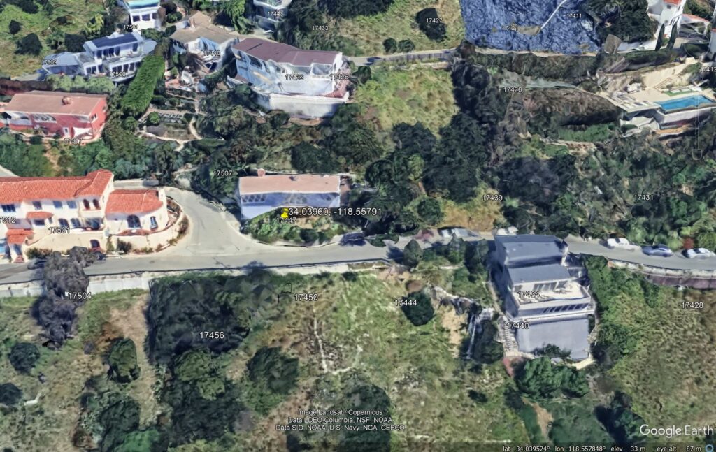
The location of the house is [34.03960, -118.55791]. There is good Google Earth imagery of this site, including the 3D model:-

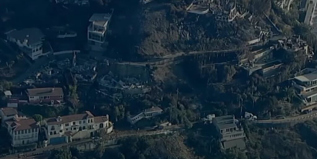
This still, from a video posted to Youtube by ABC7, is also helpful:-

The fire itself did not reach this property, but the one directly up the slope was destroyed. The house itself was located on a bench cut into the slope, possibly with a retaining wall immediately behind the property. The post-event news footage shows that the road contained a volume of wet mud, presumably resulting from water that was used to fight the fire.
The landslide may have been some combination of loading of the slope (or direct impact) from debris from the property upslope and/or failure of the wall or slope directly behind the house, probably associated with the water used to fight the fire. Whatever the cause, the house is likely to be a total loss.
Of course, this is not the type of landslide that will pose the greatest threat to Los Angeles County. This likely to be mudflows and debris flows from the burned areas. I am reminded of the 2018 Montecito mudflows following wildfires in Santa Barbara County of South California. These killed 23 people – I posted a series of satellite images of the aftermath on the old blog site.
February is the wettest month is Los Angeles, and there is also the potential for significant rainfall in March as well. This can include atmospheric river events, which brings high rainfall totals. Such an event would pose a very substantial risk – the topography is conducive to landslides. In fact, the USGS and US Army Corps of Engineers mapped landslides in the Palisades area back in 1973.


