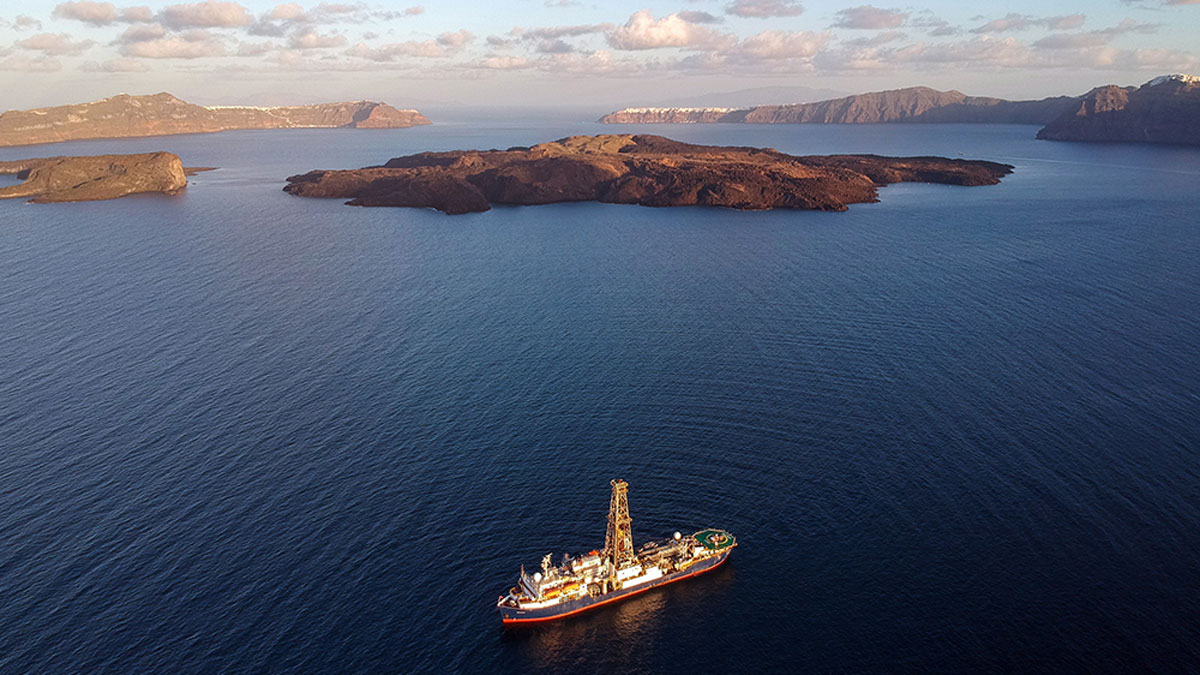
Sediment cores extracted from deep under the Aegean Sea reveal the timing of explosive eruptions of Kolumbo Volcano and a potential link to neighboring Santorini.
seafloor
Posted inNews
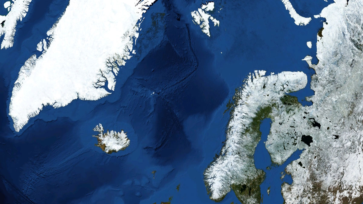
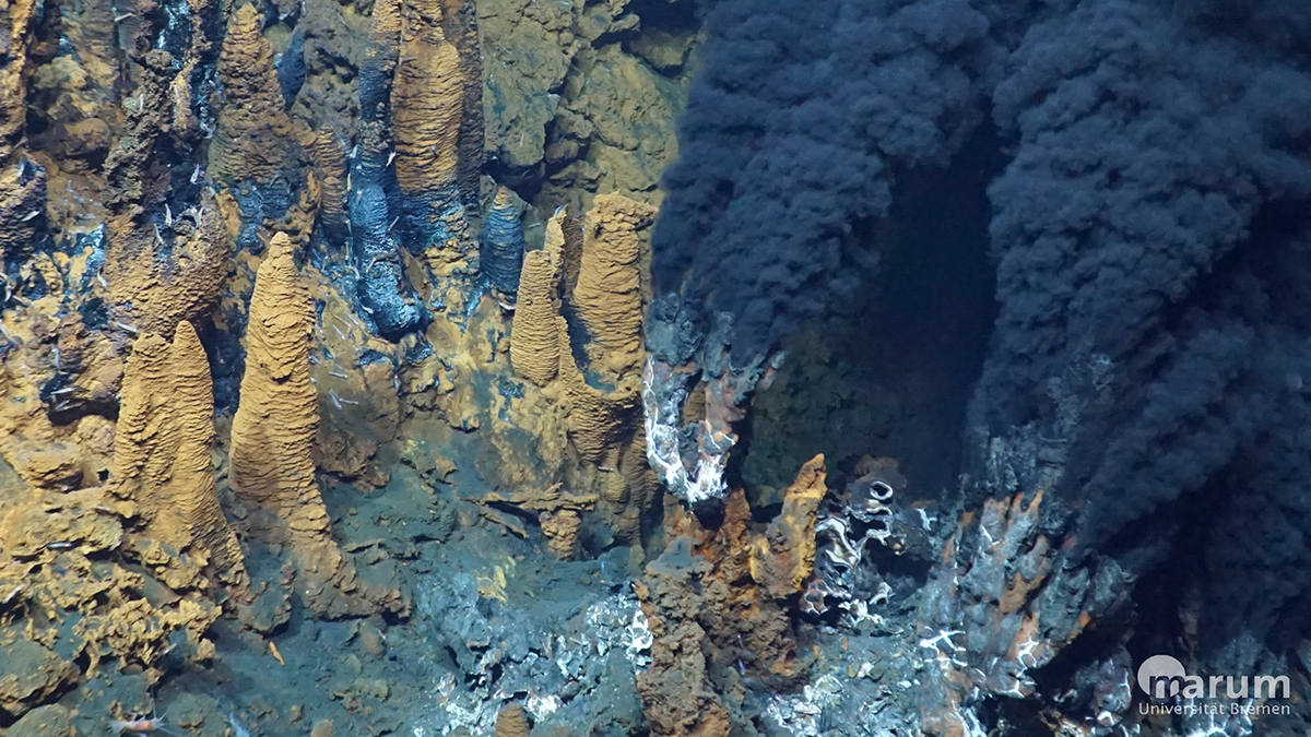
A Mid-Ocean Ridge in the Norwegian Sea Pumps Out Hydrogen
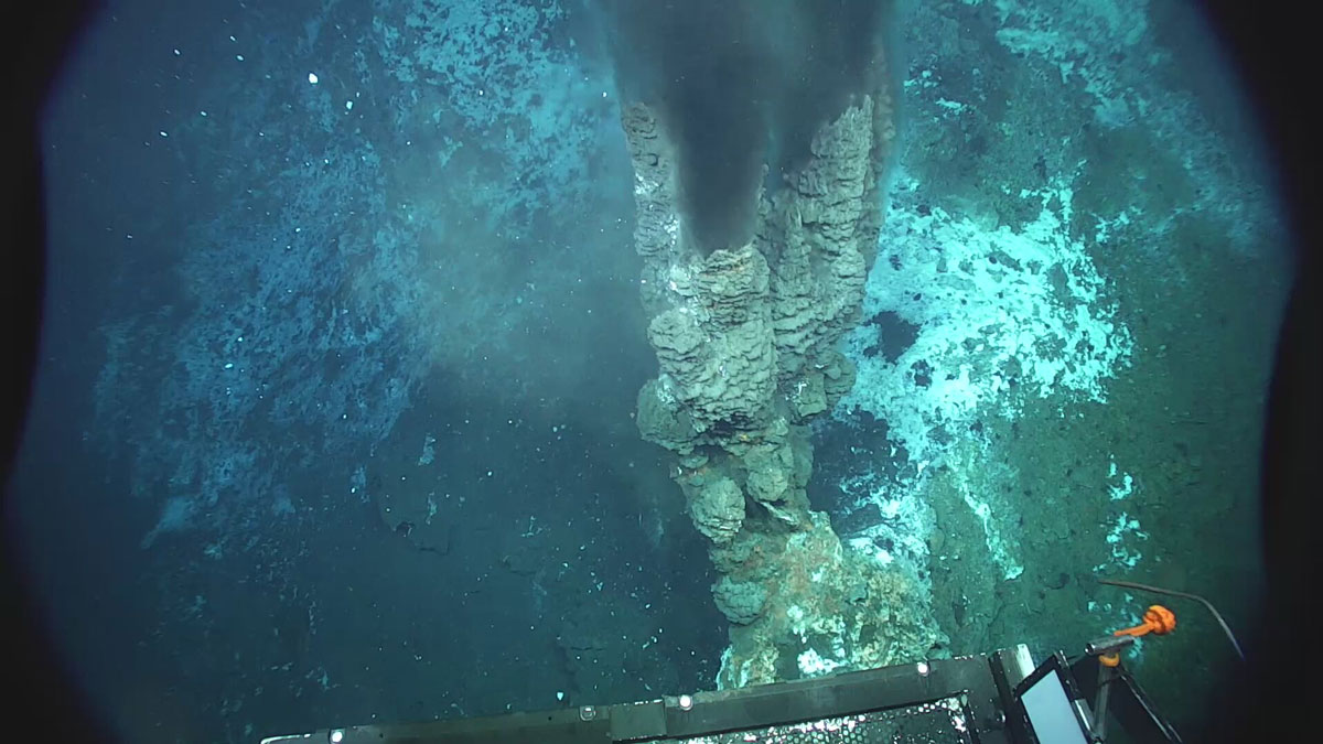
Vent fluids collected from the Knipovich Ridge contain unexpectedly high concentrations of hydrogen, potentially produced by the degradation of organic matter.
Posted inResearch Spotlights
Our Ocean’s “Natural Antacids” Act Faster Than We Thought
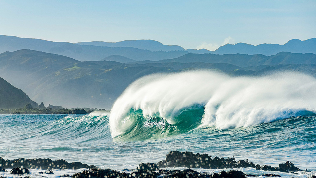
New evidence from New Zealand suggests that calcium carbonate dissolution occurs not just over millennial timescales, but over annual and decadal ones too.
Posted inResearch & Developments
Trump Administration to Speed Up Permitting for Deep Sea Mining, Even Beyond U.S. Boundaries
NOAA has finalized a rule that will expedite the permit and license application process for deep seabed mining and allow companies to mine beyond U.S. jurisdictional boundaries.
Posted inNews
New Eyes on One of the Planet’s Largest Submarine Landslides
Researchers have mapped the ancient Stad Slide off the coast of Norway to better understand what triggered it, and the hunt is on for the tsunami it might have unleashed.
Posted inEditors' Vox
Hydrothermal Circulation and Its Impact on the Earth System
From a gathering of scientists at a uniquely well-preserved section of ancient oceanic crust came a monograph investigating the latest in hydrothermal fluxes and seawater chemistry.

Posted inNews
Submerged Crater near Europe Tied to an Impact
New subsurface imaging and rock samples suggest that Silverpit Crater formed from an impact that occurred roughly 45 million years ago.
Posted inEditors' Highlights
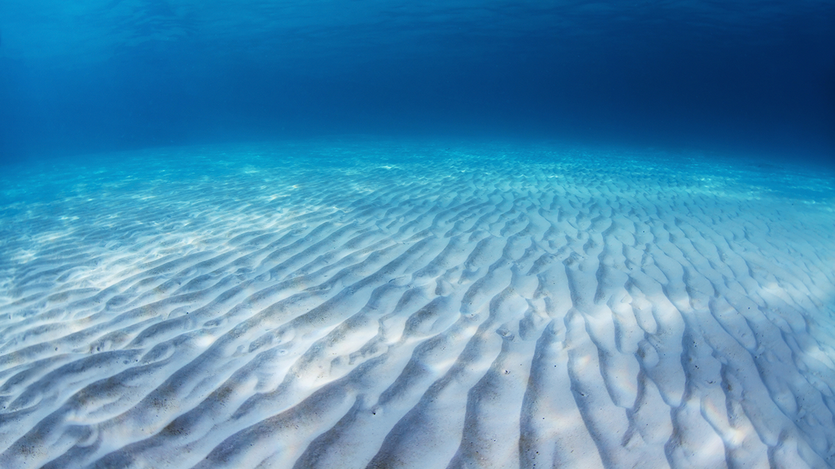
A First Look at How Sand Behaves Inside a Rippled Bed
A detailed numerical model shows how sediment particles experience wave-driven shear stress inside and above a sea bed with sand ripples.
Posted inEditors' Highlights
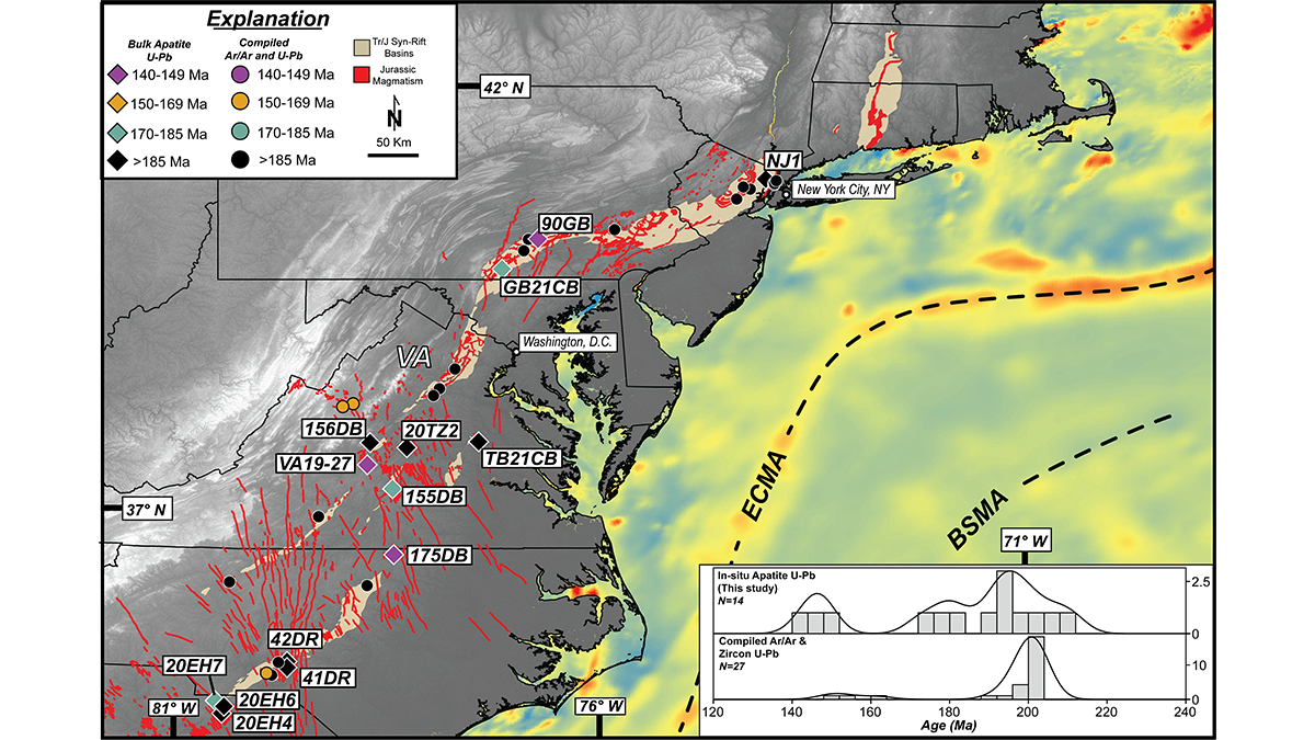
Three Magmatic Pulses Helped Rifting Transform into Seafloor Spreading
A new geochronology of Mesozoic magmatism along the eastern margin of North America shows that continental breakup involved three distinct pulses of magmatism that localized extensional deformation.
Posted inResearch Spotlights
A Transatlantic Communications Cable Does Double Duty
A new device enables existing submarine cable networks to measure deep-sea movements. It could ultimately help improve tsunami warnings and climate monitoring.