• About
  • Special Reports
  • Topics
    • Climate
    • Earth Science
    • Oceans
    • Space & Planets
    • Health & Ecosystems
    • Culture & Policy
    • Education & Careers
    • Opinions
  • Projects
    • Postcards From the Field
    • ENGAGE
    • Editors’ Highlights
    • Editors’ Vox
    • Eos en Español
    • Eos 简体中文版
    • Print Archive: 2015–2025
  • Policy Tracker
  • Blogs
    • Research & Developments
    • The Landslide Blog
  • Newsletter
  • Submit to Eos
  • AGU.org
  • Career Center
  • Join AGU
  • Give to AGU
  • About
  • Special Reports
  • Topics
    • Climate
    • Earth Science
    • Oceans
    • Space & Planets
    • Health & Ecosystems
    • Culture & Policy
    • Education & Careers
    • Opinions
  • Projects
    • Postcards From the Field
    • ENGAGE
    • Editors’ Highlights
    • Editors’ Vox
    • Eos en Español
    • Eos 简体中文版
    • Print Archive: 2015–2025
  • Policy Tracker
  • Blogs
    • Research & Developments
    • The Landslide Blog
  • Newsletter
  • Submit to Eos
Skip to content
  • AGU.org
  • Career Center
  • Join AGU
  • Give to AGU
Eos

Eos

Science News by AGU

Support Eos
Sign Up for Newsletter
  • About
  • Special Reports
  • Topics
    • Climate
    • Earth Science
    • Oceans
    • Space & Planets
    • Health & Ecosystems
    • Culture & Policy
    • Education & Careers
    • Opinions
  • Projects
    • Postcards From the Field
    • ENGAGE
    • Editors’ Highlights
    • Editors’ Vox
    • Eos en Español
    • Eos 简体中文版
    • Print Archive: 2015–2025
  • Policy Tracker
  • Blogs
    • Research & Developments
    • The Landslide Blog
  • Newsletter
  • Submit to Eos

seafloor

Crushed sponges and churned up sediment with ridges
Posted inNews

Anchoring Is Damaging the Fragile Antarctic Seabed

by Erin Martin-Jones 11 July 202511 July 2025

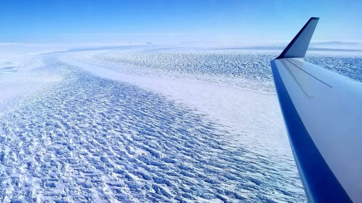
Scientists call for better protection of Antarctica’s vulnerable seafloor ecosystem as ship traffic increases around the continent.

A pool of brown mud with a large bubble near the center of the image
Posted inNews

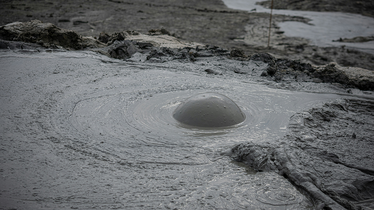
Mapping Mud Volcanoes in Shallow Seas

by Meghie Rodrigues 10 July 202510 July 2025

A team of scientists put together a global database of submarine mud volcanoes. Orders of magnitude more are still bubbling, undiscovered, in the deep ocean.

Diagram showing different sampling technologies.
Posted inEditors' Highlights

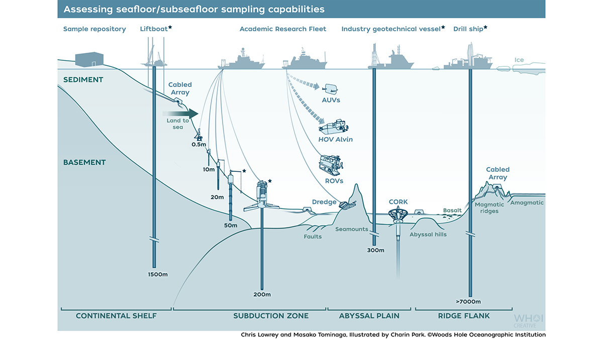
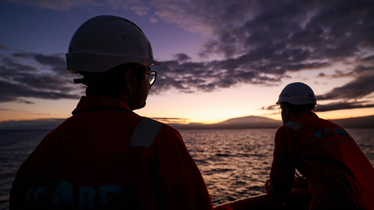
Scientists Face Limitations Accessing Seafloor Information

by Alberto Montanari 9 July 20258 July 2025

Recent reductions in U.S. oceanographic assets are limiting scientists’ ability to access vital materials in the ocean.

Fine-grained sand on the ocean floor, marked by the rippling movement of currents
Posted inResearch Spotlights

Mapping the Ocean Floor with Ancient Tides

Aaron Sidder, freelance science writer by Aaron Sidder 6 May 20256 May 2025

A new study uses a paleotidal model to trace the formation of carbon-rich mud deposits over thousands of years.

Small plastic fragments on sand and stones.
Posted inNews

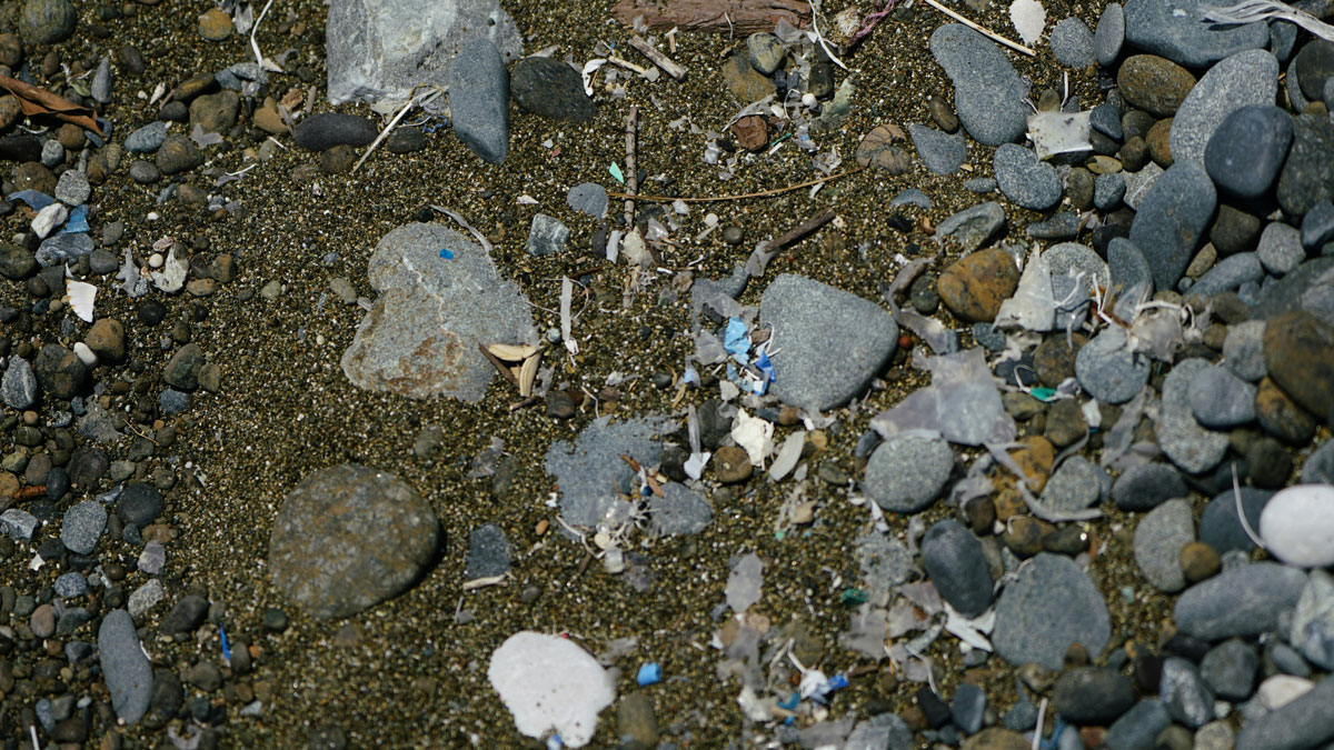
Avalanches of Microplastics Carry Pollution into the Deep Sea

by Grace van Deelen 23 April 202523 April 2025

Scientists observed a once-theorized process ferrying microplastics into the deep ocean.

Two people wearing hard hats are silhouetted by the Sun rise in the distance as they look out over the ocean from a research vessel.
Posted inScience Updates

Unlocking Climate Secrets of Hawai‘i’s Drowned Reefs

by Jody M. Webster and Christina Ravelo 11 April 202511 April 2025

Researchers set sail to study sea levels, climate, ecosystem responses, and volcanic histories over the past 500,000 years, using an innovative seabed drill to sample fossilized reefs off Hawai‘i.

View from afar of a blue and white research vessel next to an iceberg.
Posted inNews

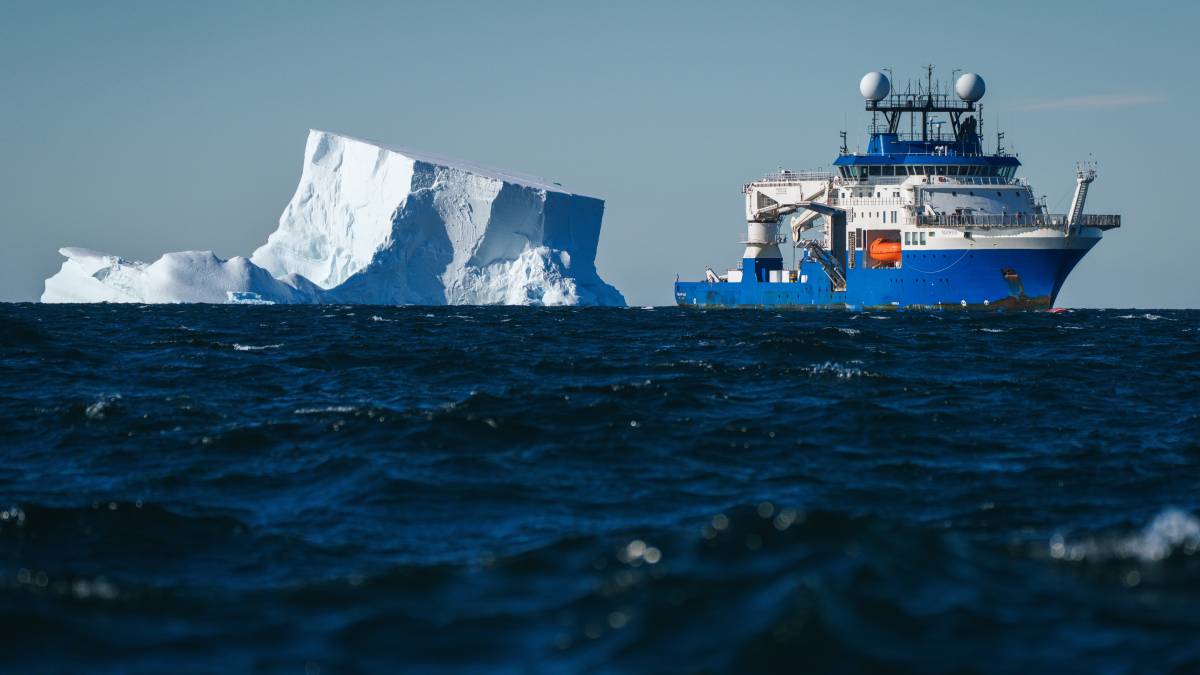
Thriving Antarctic Ecosystem Revealed by a Departing Iceberg

Kimberly M. S. Cartier, News Writing and Production Intern for Eos.org by Kimberly M. S. Cartier 31 March 202523 June 2025

A quick-calving iceberg gave scientists a rare glimpse into what hides beneath Antarctic ice.

A glacier with ripples on top of it, as seen from a plane. A blue sky is visible.
Posted inResearch Spotlights

A Seafloor Spreading Slowdown May Have Slashed Sea Levels

Sarah Stanley, Science Writer by Sarah Stanley 24 February 202524 February 2025

Between 15 million and 6 million years ago, a drop in ocean crust production may have lowered sea level by 26–32 meters.

The Alvin submersible hovers over and illuminates the seafloor near the rocky towers of a hydrothermal vent site.
Posted inScience Updates

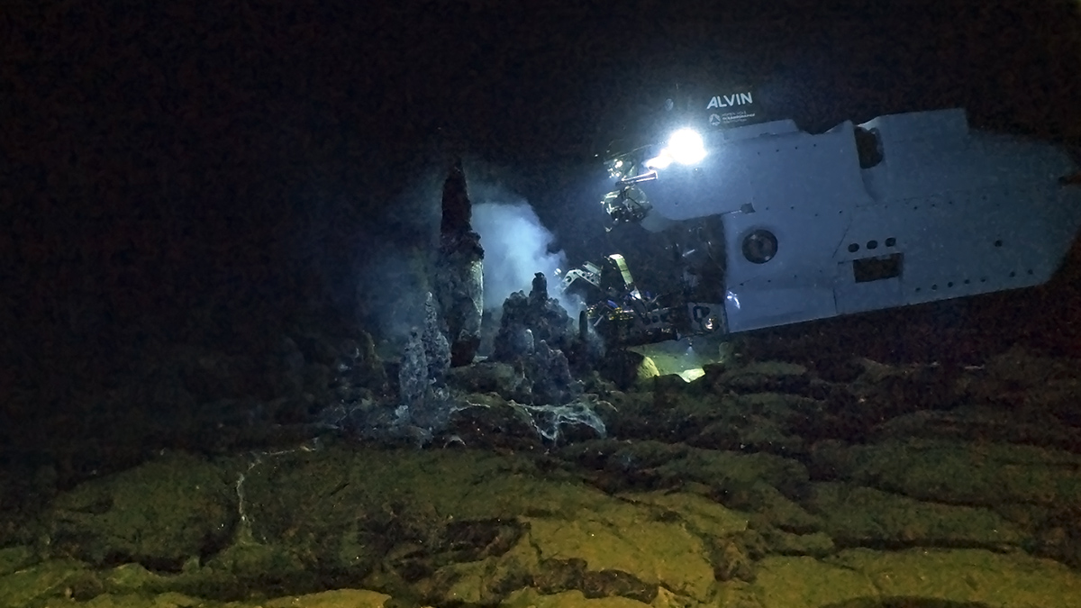
An Upgraded Alvin Puts New Ocean Depths Within Reach

by Kenna Harmony Rubin, Anna P. M. Michel and S. Adam Soule 31 January 202526 February 2026

The newly retooled submersible, which has already returned fascinating new findings from Earth’s watery depths, is opening more of the deep ocean to direct human exploration.

An image of Earth’s globe flattened out, with a detailed map of the ocean floor
Posted inNews

Satellite Measurements Make Major Seafloor Map Improvements

by Emily Dieckman 12 December 202410 January 2025

Though ship-based sounding has mapped some areas of the ocean floor in higher resolution, researchers have used SWOT data to create a detailed new map of the seafloor, including thousands of previously undetected small seamounts.

Posts pagination

Newer posts 1 2 3 4 … 19 Older posts
Over a dark blue-green square appear the words Special Report: The State of the Science 1 Year On.

Features from AGU Publications

Research Spotlights

How Much Will Western Wildfires Worsen Under Warming?

15 May 202615 May 2026
Editors' Highlights

A Digital Twin for Arctic Permafrost Beneath Roads

8 May 202612 May 2026
Editors' Vox

The Impact of Advocacy: American Geophysical Union’s Days of Action

14 May 202613 May 2026
Eos logo at left; AGU logo at right

About Eos
ENGAGE
Awards
Contact

Advertise
Submit
Career Center
Sitemap

© 2026 American Geophysical Union. All rights reserved Powered by Newspack