
These nodules, a focus of seabed mining interests, could be natural “geobatteries” and play a larger-than-expected role in the deep-sea ecosystem.
seafloor


Posted inNews
Sedimentary Basins Tell Zealandia’s Ancient Story
New interpretations and mapping of all New Zealand’s offshore sedimentary basins offer clues about the evolution of Earth’s eighth continent.

Posted inResearch Spotlights
Seals Help Scientists Make Discoveries in Antarctica’s Bellingshausen Sea
By analyzing hydrographic information gathered by seals and an undersea glider, researchers found new meltwater currents, as well as a new seafloor trough.

Posted inNews
Balancing the Deep Ocean Plastics Budget
Up to 11 million metric tons of plastic are sitting on the seafloor, mostly near coasts and shipping corridors.
Posted inNews
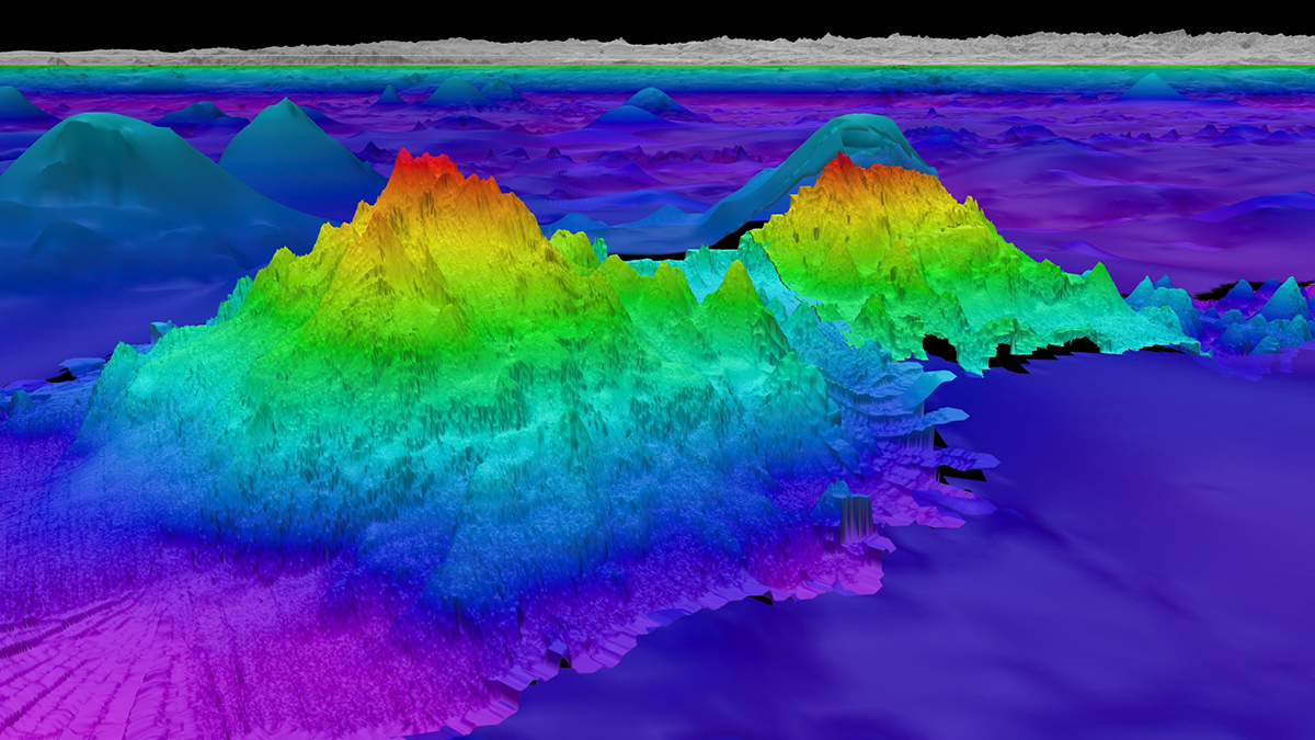
New Seafloor Map Only 25% Done, with 6 Years to Go
Beneath the waves, the vast majority of the ocean is unknown. Seabed 2030 is using cutting-edge technologies to fill in the bathymetric blanks and fully map the seafloor.

Posted inNews
Mars as a Driver of Deep-Sea Erosion
An analysis of breaks in deep-sea sediment links the geological record to a 2.4-million-year cycle that heats Earth and ventilates our oceans.

Posted inEditors' Highlights
What’s Hot in Iceland? A Close Up View of Hotspot-Ridge Interaction
New seafloor magnetic data help scientists retrace the evolution of the Reykjanes Ridge, lending insights into the effects of a mantle plume on mid-ocean ridge organization and evolution.
Posted inScience Updates
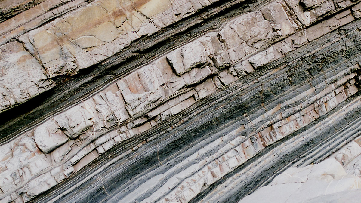
Submarine Avalanche Deposits Hold Clues to Past Earthquakes
Scientists are making progress on illuminating how undersea sedimentary deposits called turbidites form and on reconstructing the complex histories they record. But it’s not an easy task.

Posted inNews
Scientists Quantify Blue Carbon in Bahamas Seagrass
The island nation’s underwater fields store huge reserves of carbon, though not as much as scientists thought.