In an age when almost everyone can access GPS on their smartphone, a compass seems like a crude instrument, better left to Boy Scouts, Girl Scouts, and orienteers.
Hidden in your smartphone, however, is a compass that helps to keep your GPS on track. That compass can now be shared using an app called CrowdMag to help scientists monitor, map, and explore Earth’s ever-changing—and still navigationally vital—magnetic field in unprecedented detail.
Limitations to Current Navigation Methods
“All planes have magnetometers”— high-tech compasses—“because GPS can be jammed,” explained Manoj Nair, a scientist with the Cooperative Institute for Research in Environmental Sciences. Nair also works in the National Oceanic and Atmospheric Administration’s National Geophysical Data Center (NGDC) on the CrowdMag project.
According to Nair, GPS also has other limitations. To work, GPS requires that you have a clear line of sight to at least three GPS satellites so you receive their radio signals. These low-power signals do not penetrate water well or reach underground.
“The only natural force on Earth that is available everywhere that gives north–south direction is the Earth’s magnetic field,” Nair explained.
The Need for Finely Scaled Models
The limitations of GPS mean that monitoring and modeling the small, constant variations in Earth’s magnetic field over time and space are still needed to keep navigation—for planes, boats, future package-delivering drones, or anything that requires positioning down to the meter—safe and accurate.
Most of these fluctuations are natural, although urban areas house many manmade magnetic fields. These subtle shifts in magnetic strength and direction occur on a scale that cannot be resolved by traditional methods used by the NGDC, which involve planes, ships, and satellites.
The latest global magnetic model, released on 15 December by NGDC and the British Geological Survey, also lacks important details. Data from satellites give the magnetic field model a fuzzy resolution of 3000 kilometers. Ships and planes yield a sharper resolution of 56 kilometers, which is still coarse when you need precision in a magnetically noisy place like a city.
“One of the key challenges is going further than that,” said Nair. “Phones can get that down to meters.” That’s where the CrowdMag app, which Nair presented on 19 December at the 2014 AGU Fall Meeting in San Francisco, Calif., comes in.
CrowdMag: How You Can Help Make High-Resolution Maps
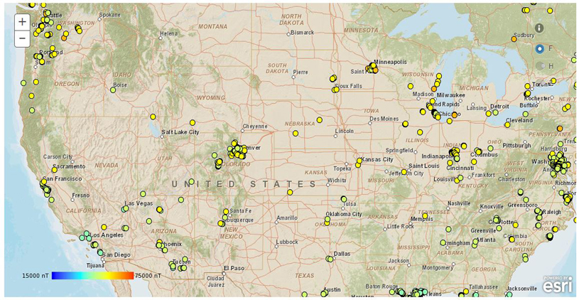
Nair and his colleagues hope to get as many as 5000 people worldwide to download CrowdMag and put their Android or IOS smartphones to work as they drive, walk, bicycle, or otherwise move about their environment. Through CrowdMag, readings from a phone’s compass are transmitted to scientists at NGDC, where they are added to models to reveal never-before-seen details of the local magnetic field.
“We have about 2000 people using it [CrowdMag] right now in all kinds of environments,” Nair said. “Cities are magnetically noisy environments. We don’t have any idea what the field is in urban environments. So more urban users is OK because that’s where the high resolution is needed.”
More information on CrowdMag, including a pathway to download the app, can be found here.
—Larry O’Hanlon, Writer
Citation: O’Hanlon, L. (2015), Smartphone app seeks to make navigation safer, Eos, 96, doi:10.1029/2015EO021603.
Text © 2015. The authors. CC BY-NC 3.0
Except where otherwise noted, images are subject to copyright. Any reuse without express permission from the copyright owner is prohibited.

