Thanks to a new research technique, lasers are providing valuable insights into the behaviors of such diverse creatures as termites and lions and the plants with which they interact. The application of this new means of exploring ecology has just begun, according to researchers.
Using traditional field methods to gain the same insights would be “very, very intensive and difficult to achieve.”
The act of scanning a terrain from an aircraft or satellite using the laser technology known as lidar yields an intricate three-dimensional panorama. The laser-generated representation accurately depicts fine details of most of the area’s trees, bushes, and other ecosystem features, such as pillar-like termite mounds. It offers scientists the ability to assess the three-dimensional structure of an ecosystem’s vegetation, which is a critical underpinning of wildlife habitats that shapes the ways animals move and behave within them, researchers say.
The debut in ecology of imaging technology already widely used in Earth sciences provides a new and practical way for researchers to hone in on tough-to-quantify ecosystem characteristics, said Andrew Davies of the Carnegie Institution for Science in Stanford, Calif. Such characteristics include nutrient distribution and predator-prey interactions , he noted in his 18 December talk at the American Geophysical Union’s 2015 Fall Meeting in San Francisco, Calif.
Using traditional field methods to gain the same insights would be “very, very intensive and difficult to achieve,” said Davies.
Termites, Lions, and Lidar

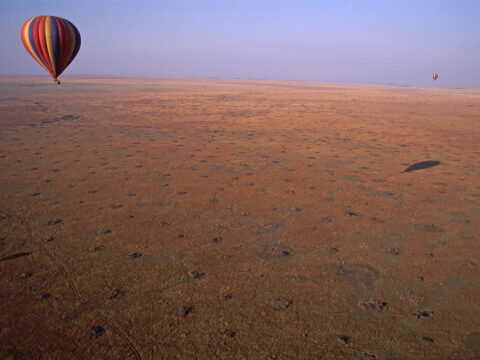
In Kruger National Park in South Africa, Davies reported, he and his colleagues used the new approach to visualize the spatial distribution of termite mounds. The data, published in early 2014, showed that termites build their mounds at a relatively even spacing—not randomly—which minimizes the distance that any animal need travel to access the nutrients and water the mounds offer.
Further melding of the lidar data with spectral imagery allowed the scientists also to identify the species of thousands of plants growing near termite mounds. With that information, the team discovered that some tree species grow preferentially on mounds rather than in surrounding savanna. The findings demonstrated that termite mounds can alter plant diversity.
“We mapped 13,000 termite mounds across the landscape, which is something you could never do in the field,” said Davies.
In a yet unpublished study of lions, Davies has used lidar to map plants and landforms that block visual “viewsheds” around lion kill sites in South Africa’s Elephant National Park. He is currently working on a paper correlating visibility level to hunting success and comparing those findings to the hunting behavior of lions in other environments.
How It Works
Lidar combines the imaging capability of lasers and radar’s ability to calculate distance to yield high-precision maps of vegetation and topography. The technology also turns up in police speed guns and self-driving cars. Some researchers have begun using it to map the interiors of caves.
Animal ecology has just started down this road, Davies said: The field’s first study involving lidar appeared in 2002, and only 120 or so papers have been published on the topic since then.
Seeing the Forest and the Trees
“We don’t really have a full appreciation of the effects of vegetation structure on animals as of yet.”
“We don’t really have a full appreciation of the effects of vegetation structure on animals as of yet,” said Davies. But in at least one ecological niche—forests—researchers have made headway on the vegetation structure itself, said Michael Falkowski, an associate professor in Colorado State University’s Department of Ecosystem Science and Sustainability in Fort Collins.
“We’ve looked at the power of lidar a lot for characterizing three-dimensional forest structure, and I think we’ve got that pretty much figured out—at least at certain spatial extents,” he said. “One of the really interesting things now is starting to explore what we can actually do with that data.”
Falkowski, who was not involved in Davies’s work, helped convene the session at which Davies spoke. He said he was impressed with Davies’s research and wanted to inform the geoscience community about new avenues of remote sensing research.
“Wildlife is such an interesting topic area because we know it’s so strongly related to forest structure,” said Falkowski. “So I think it’s one of the most exciting application areas for lidar data right now.”
—Kerry Klein, Freelance Science Writer
Citation: Klein, K. (2015), Three-dimensional scans illuminate wildlife environments, Eos, 96,doi:10.1029/2015EO042531. Published on 28 December 2015.
Text © 2015. The authors. CC BY-NC 3.0
Except where otherwise noted, images are subject to copyright. Any reuse without express permission from the copyright owner is prohibited.

