• About
  • Sections
  • Topics
    • Climate
    • Earth Science
    • Oceans
    • Space & Planets
    • Health & Ecosystems
    • Culture & Policy
    • Education & Careers
    • Opinions
  • Projects
    • ENGAGE
    • Editors’ Highlights
    • Editors’ Vox
    • Eos en Español
    • Eos 简体中文版
    • Print Archive
  • Blogs
    • Research & Developments
    • The Landslide Blog
  • Newsletter
  • Submit to Eos
  • AGU.org
  • Career Center
  • Join AGU
  • Give to AGU
  • About
  • Sections
  • Topics
    • Climate
    • Earth Science
    • Oceans
    • Space & Planets
    • Health & Ecosystems
    • Culture & Policy
    • Education & Careers
    • Opinions
  • Projects
    • ENGAGE
    • Editors’ Highlights
    • Editors’ Vox
    • Eos en Español
    • Eos 简体中文版
    • Print Archive
  • Blogs
    • Research & Developments
    • The Landslide Blog
  • Newsletter
  • Submit to Eos
Skip to content
  • AGU.org
  • Career Center
  • Join AGU
  • Give to AGU
Eos

Eos

Science News by AGU

Support Eos
Sign Up for Newsletter
  • About
  • Sections
  • Topics
    • Climate
    • Earth Science
    • Oceans
    • Space & Planets
    • Health & Ecosystems
    • Culture & Policy
    • Education & Careers
    • Opinions
  • Projects
    • ENGAGE
    • Editors’ Highlights
    • Editors’ Vox
    • Eos en Español
    • Eos 简体中文版
    • Print Archive
  • Blogs
    • Research & Developments
    • The Landslide Blog
  • Newsletter
  • Submit to Eos

D. G. De Paor

Google Earth image displays data overlays showing ages of the ocean floor, together with tectonic plate boundaries.
Posted inScience Updates

A Grand Tour of the Ocean Basins

by D. G. De Paor 1 September 20174 November 2022

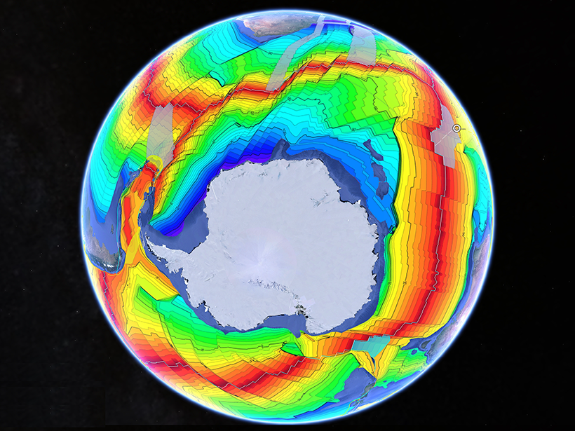
A new teaching resource facilitates plate tectonic studies using a Google Earth virtual guided tour of ocean basins around the world.

Posted inScience Updates

Puzzles Invite You to Explore Earth with Interactive Imagery

by M. M. Dordevic, D. G. De Paor, S. J. Whitmeyer, C. Bentley, G. R. Whittecar and C. Constants 21 July 20154 November 2022

The EarthQuiz challenge can take you to virtual field locations with just the click of a button. Where in the world is this, and can you guess the significance of the geological features shown?

Posted inFeatures

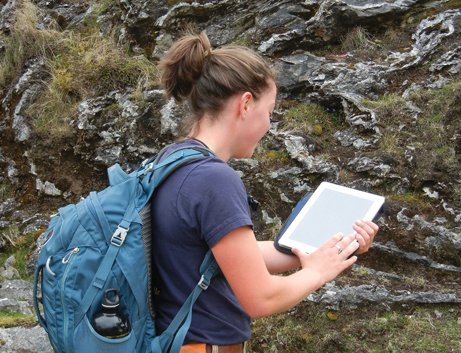
Crowdsourcing Digital Maps Using Citizen Geologists

by S. J. Whitmeyer and D. G. De Paor 4 November 20144 November 2022

Could citizen geologists help scientists make geological maps?

A view of a Washington, D.C., skyline from the Potomac River at night. The Lincoln Memorial (at left) and the Washington Monument (at right) are lit against a purple sky. Over the water of the Potomac appear the text “#AGU24 coverage from Eos.”

Features from AGU Publications

Research Spotlights

Deforestation Is Reducing Rainfall in the Amazon

19 May 202519 May 2025
Editors' Highlights

Bringing Storms into Focus

19 May 202515 May 2025
Editors' Vox

Decoding Crop Evapotranspiration

6 May 20256 May 2025
Eos logo at left; AGU logo at right

About Eos
ENGAGE
Awards
Contact

Advertise
Submit
Career Center
Sitemap

© 2025 American Geophysical Union. All rights reserved Powered by Newspack