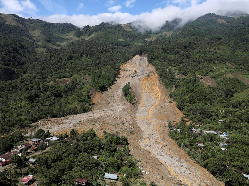
Extreme precipitation can trigger deadly landslides. Satellite-based tools provide regional perspectives on landslide hazards, help assess risks in near-real time, and guide emergency responses.
Extreme precipitation can trigger deadly landslides. Satellite-based tools provide regional perspectives on landslide hazards, help assess risks in near-real time, and guide emergency responses.