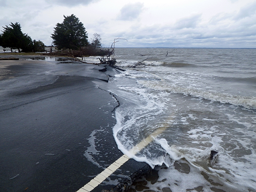
A new framework based on decision analysis can help scientists produce practical data that support informed decisions about climate adaptations.
Research Spotlights
Research spotlights are plain-language summaries of recent articles published in AGU’s suite of 24 journals.

Posted inResearch Spotlights
Numerical Models Overestimate Near-Inertial Wind Power Input
The first study to estimate the global wind power on internal gravity waves based solely on observations offers a new benchmark for comparing future calculations.

Posted inResearch Spotlights
Solar Flares Increase Radiation Risk on Commercial Aircraft
A new study quantifies how space weather may affect polar transcontinental flight.

Posted inResearch Spotlights
Mapping Ice Algal Blooms from Space
Satellite data reveal how colorful algae are melting the Greenland ice sheet.

Posted inResearch Spotlights
If Precipitation Extremes Are Increasing, Why Aren’t Floods?
Improving our understanding of the relationship between changes in precipitation and flooding due to rising temperature is a new grand challenge for the scientific community, argue the authors of a recent commentary.

Posted inResearch Spotlights
How the Moon Got Its Concentric Rings
A new study explores the origins of massive, multiringed lunar craters.

Posted inResearch Spotlights
Soil Wet Spots Drive Agricultural Nitrogen Gas Emissions
A new study offers novel insights into the mechanisms driving gas releases in agricultural regions.
Posted inResearch Spotlights
How Do Intergranular Particles Affect the Flow of Ice?
Laboratory experiments that indicate rock particles can impede sliding along grain boundaries in ice may help researchers more accurately determine the composition of planetary ice masses.

Posted inResearch Spotlights
Using Multiple Models to Improve Seasonal Forecasting
The first study to examine the ability of a suite of general circulation models to predict sudden warmings in Earth’s stratosphere highlights the potential for improving Northern Hemisphere forecasts.

Posted inResearch Spotlights
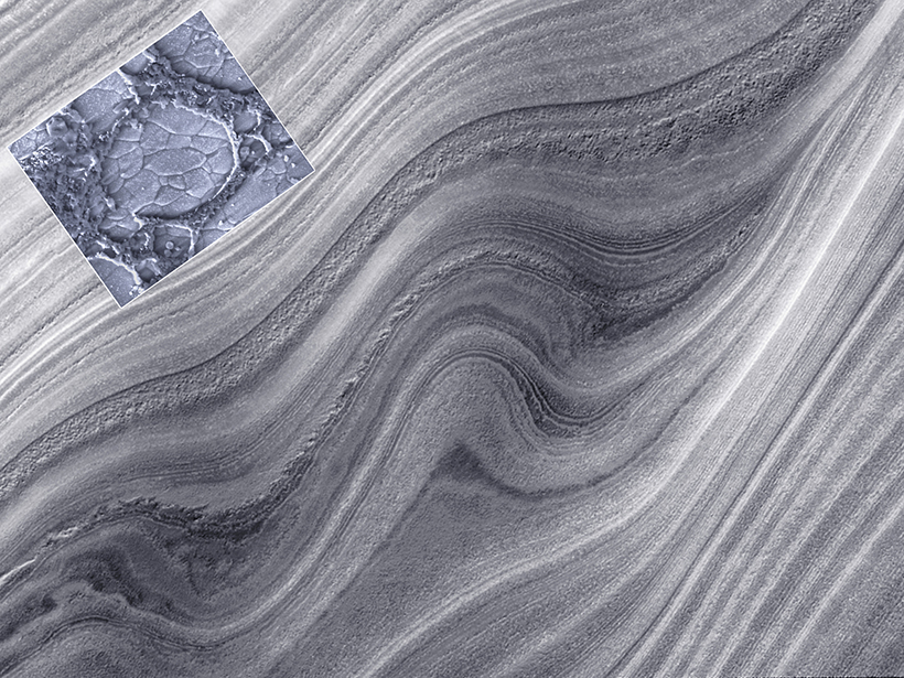
Old Idea Spurs New Research into Origins of Carbonate Mudstones
Using modern techniques, scientists tested an old hypothesis about carbonate mud production to shift the thinking about rocks that are used as seawater archives and a source of petroleum.