Source: Space Weather
Coronal mass ejections (CMEs) drive many of the most disruptive space weather impacts; these clouds of plasma can enhance the flow of energy carried by the solar wind and those CMEs that hit the Earth can drive strong geomagnetic activity leading to impacts on many vital technologies including power grids and satellites.
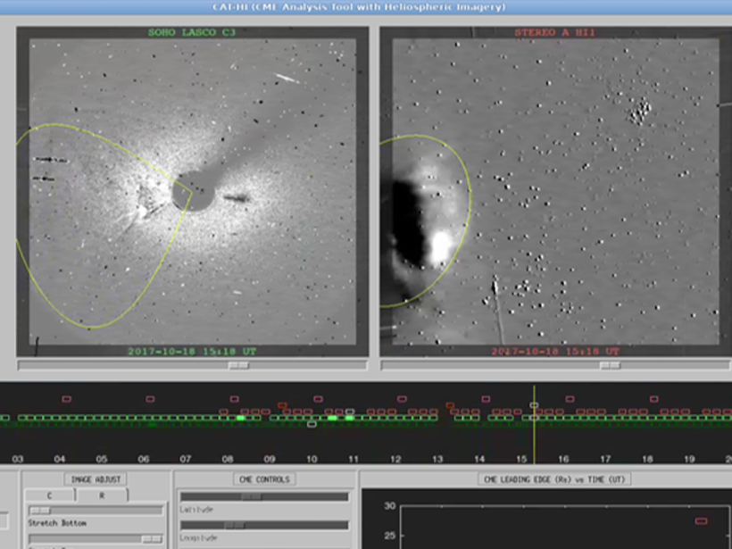
Wharton et al. [2019] provide a proof of concept on how heliospheric imaging can be used to refine forecasts of the arrival of CMEs at Earth, a key element in forecasting a wide range of space weather impacts. Current forecasts are based on conditions at the time of CME launches and can use ensemble methods to forecast a range of potential outcomes. These forecasts are typically based on coronagraph observations of CMEs close to Sun. Those observations can now be complemented by data from heliospheric imagers, very sensitive cameras that can observe CMEs at greater distances from the Sun.
The authors present an improved CME analysis tool (CAT-HI) that can include observations from heliospheric imagers. They show that these additional images may be used to prune ensemble forecasts and thereby provide updated forecasts during the CME transit to Earth.
Such updates have the potential to help operations teams preparing to deal with adverse impacts that may follow CME arrival at Earth. Hence this proof of concept adds real practical value to space weather forecasts, especially if, as planned, the next generation of space weather monitoring missions from Europe and the United States provides greater access to heliospheric imager data.
Citation: Wharton, S. J., Millward, G. H., Bingham, S., Henley, E. M., Gonzi, S., & Jackson, D. R. [2019], Incorporation of Heliospheric Imagery into the CME Analysis Tool for improvement of CME forecasting. Space Weather, 17. https://doi.org/10.1029/2019SW002166
—Michael A. Hapgood, Editor, Space Weather
Text © 2019. The authors. CC BY-NC-ND 3.0
Except where otherwise noted, images are subject to copyright. Any reuse without express permission from the copyright owner is prohibited.