Source: Water Resources Research
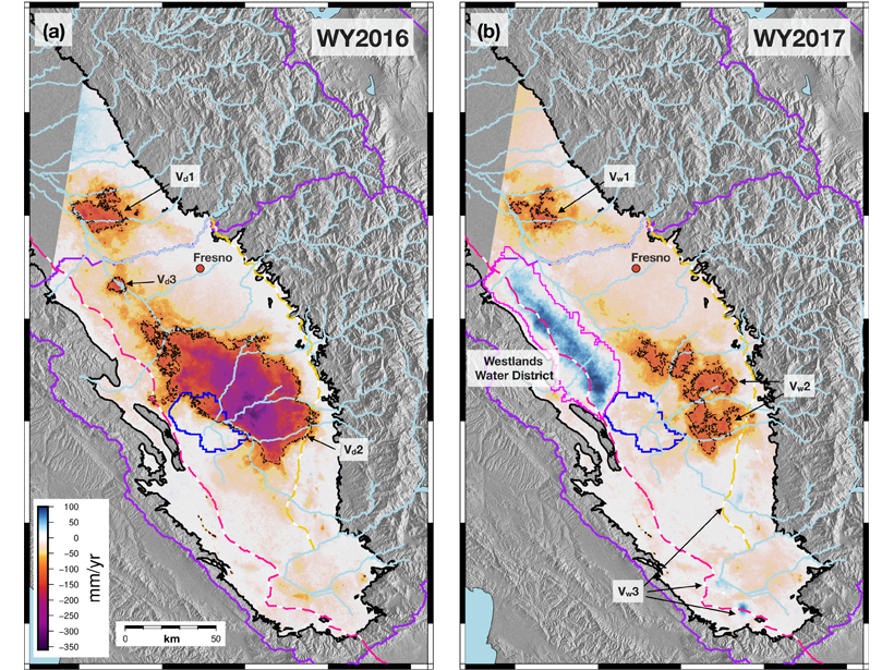
Groundwater recharge information is critical to groundwater modeling and management but is hard to observe and evaluate over large areas. Neely et al. [2021] explore the possibility to assess aquifer flow dynamics (recharge and discharge) by evaluating spatial patterns of the amplitude and phase of seasonal deformation across the San Joaquin Valley in California for consecutive dry (2016) and wet (2017) water years.
The information on deformation is derived from geodetic observations that integrate spaceborne InSAR time series and continuous Global Positioning System (cGPS). The spatial distribution and phase progression of the seasonal deformation do not follow the surface flow path that is derived from topography, which is important for water management by Groundwater Sustainability Agencies (GSA). The measurements of surface uplift likely reveal recharge and pathways for groundwater flow, having important implications for study and management of groundwater across the state of California and similar aquifers globally.
Citation: Neely, W. R., Borsa, A. A., Burney, J. A., Levy, M. C., Silverii, F., & Sneed, M. [2021]. Characterization of groundwater recharge and flow in California’s San Joaquin Valley from InSAR‐observed surface deformation. Water Resources Research, 57, e2020WR028451. https://doi.org/10.1029/2020WR028451
—Di Long, Associate Editor, Water Resources Research
Text © 2021. The authors. CC BY-NC-ND 3.0
Except where otherwise noted, images are subject to copyright. Any reuse without express permission from the copyright owner is prohibited.