Source: Journal of Geophysical Research: Planets
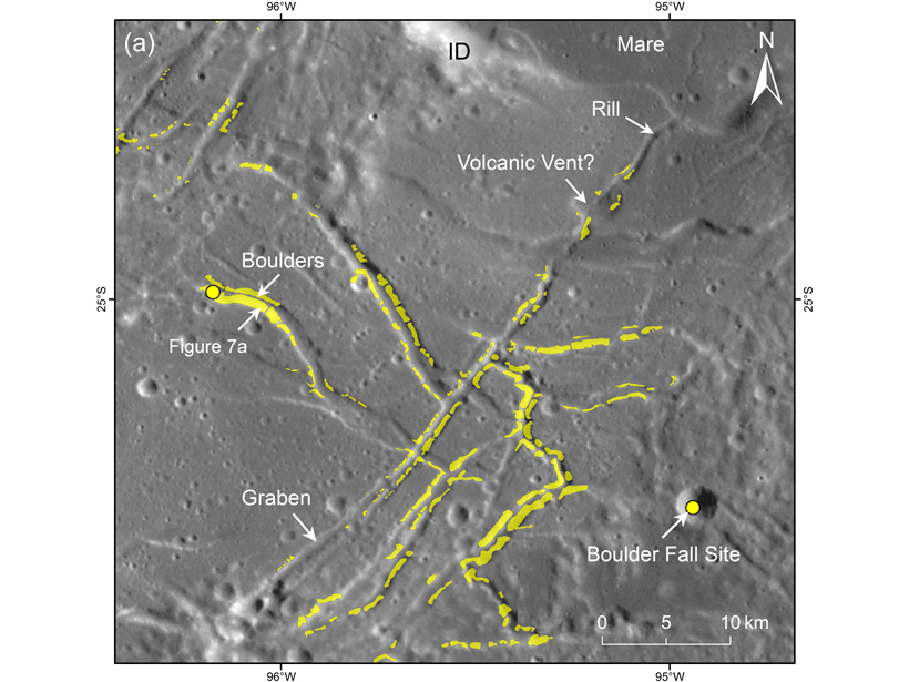
Earthquakes can send precariously balanced boulders tumbling downhill, as happened for example in the Trona Pinnacles of California during the 2019 Ridgecrest earthquakes. Thus, identifying fallen boulders and other rocks can be used to evaluate the intensity seismic ground motion. On the Moon, boulder avalanches and other rock falls can leave a track in the fine regolith that coats our satellite. Mohanty et al. [2020] mapped the boulder tracks and fields in the Orientale Basin on the Moon. Many are superposed small craters, implying they are less than half a million years old. A few may even have been mobilized even during an earthquake that happened in 1972. The quantity and distribution of boulder tracks puts new constraints on seismic hazard on the Moon and can be used to plan for safe exploration of our natural satellite.
Citation: Mohanty, R., Kumar, P. S., Raghukanth, S. T. G., & Lakshmi, K. J. P. [2020]. The long‐lived and recent seismicity at the lunar Orientale basin: Evidence from morphology and formation ages of boulder avalanches, tectonics, and seismic ground motion. Journal of Geophysical Research: Planets, 125, e2020JE006553. https://doi.org/10.1029/2020JE006553
—Laurent G. J. Montési, Editor in Chief, JGR: Planets
Text © 2021. The authors. CC BY-NC-ND 3.0
Except where otherwise noted, images are subject to copyright. Any reuse without express permission from the copyright owner is prohibited.