Editors’ Highlights are summaries of recent papers by AGU’s journal editors.
Source: Earth and Space Science
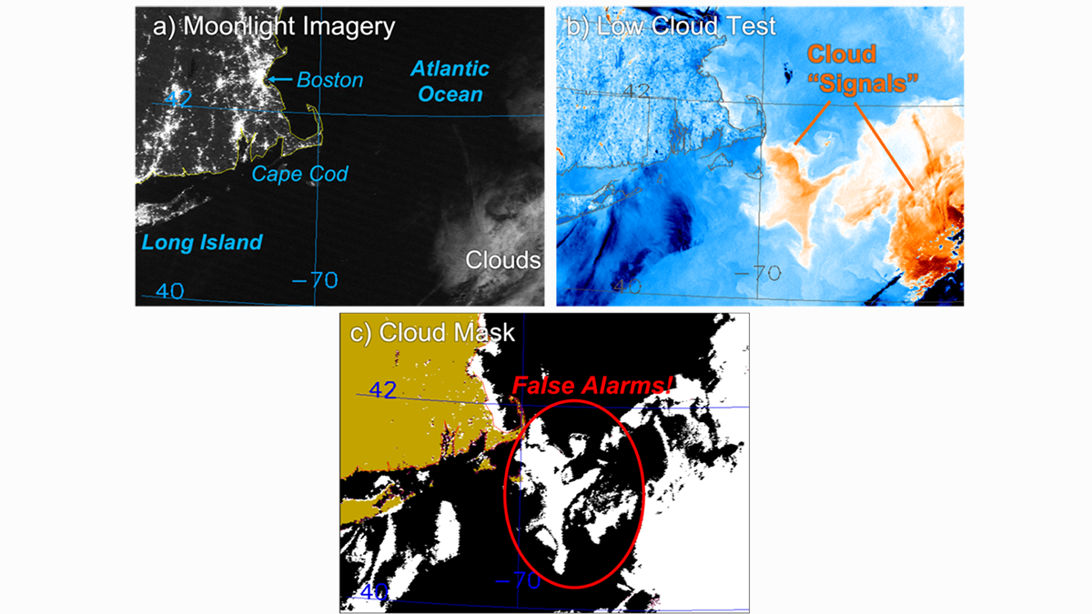
Marine boundary layer (MBL) fog and low clouds, ubiquitous to the data-sparse global ocean, play important roles in both maritime operations on local scales and in Earth’s energy balance overall. Environmental satellites offer the best means to collecting information about the frequency, distribution and properties of these clouds, including their evolution across day and night. Recent comparisons of operational cloud detection to novel moonlight-based nighttime observations from the Day/Night Band (DNB) sensor have revealed certain scenarios where the operational techniques analyze too many MBL clouds (i.e., false alarms).
Miller et al. [2022] explore the underlying physical basis for such issues, showing how a special configuration of atmosphere and surface conditions can produce a clear-sky infrared (IR) spectral signal that causes these operational algorithms to infer the presence of low clouds. The false alarm mechanism is confirmed via radiative transfer simulations in both idealized and realistic environment scenarios.
These findings imply that local to regional-scale biases may exist in current nocturnal MBL cloud detection, translating to possible biases in other important environmental parameters such as sea surface temperature (SST) which rely upon accurate cloud masks. Increasing the frequency of nighttime visible observations and refining IR-based algorithms in areas prone to cloudy false alarms could mitigate these issues, helping operational forecasters to better identify clouds at night and improving our description of key satellite-derived data records used in our studies of climate and climate change.
Citation: Miller, S. D., Noh, Y.-J., Grasso, L. D., Seaman, C. J., Ignatov, A., Heidinger, A. K., et al. (2022). A physical basis for the overstatement of low clouds at night by conventional satellite infrared-based imaging radiometer bi-spectral techniques. Earth and Space Science, 9, e2021EA002137. https://doi.org/10.1029/2021EA002137
—Jonathan H. Jiang, Editor, Earth and Space Science