Source: Geophysical Research Letters
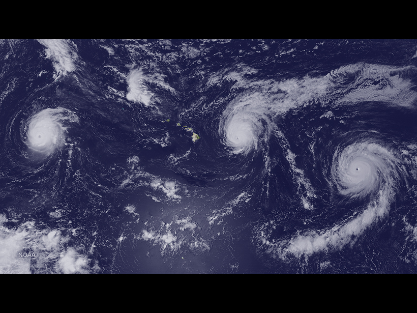
The year 2015 was record-breaking for hurricanes in the eastern North Pacific Ocean. Major storms included Hurricanes Ignacio, Olaf, and Patricia, the lattermost being the strongest storm on record for the Western Hemisphere. A new study by Collins et al. investigates what made the 2015 eastern North Pacific hurricane season so extraordinary.
The scientists focused on hurricane activity in the western portion of the eastern North Pacific basin. In 2015, twenty storms in the Western Development Region (WDR) were strong enough to be named, making the year second only to 1992, which featured a record 21 named storms.
To analyze what made last year’s WDR hurricane season so remarkable, the researchers compared 2015 conditions with those of the previous 3 decades using publicly available atmospheric and oceanic data. They found that 2015’s very strong El Niño coincided with a “positive” phase in the Pacific Meridional Mode (PMM), a tropical climate pattern that involves interactions between the atmosphere and the ocean.
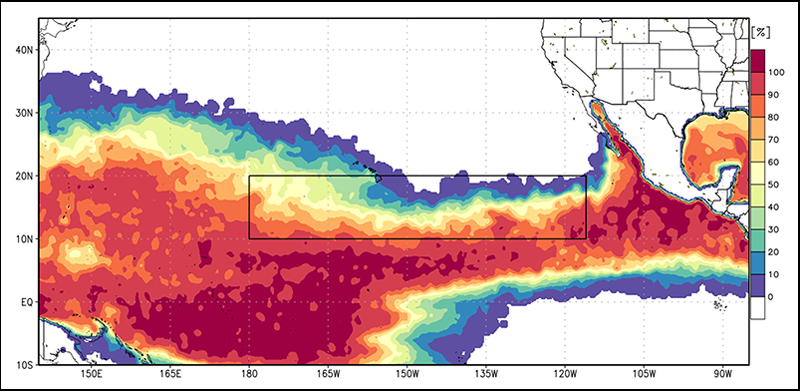
The combined effects of El Niño and the PMM resulted in record-breaking sea surface temperatures in the WDR that set the stage for an exceptionally active hurricane season. Other hurricane-promoting conditions included record-high humidity, record-high levels of atmospheric water vapor, and record-low vertical wind shear, which is the change in wind speed or direction with height.
The scientists hope that by linking large-scale atmospheric and oceanic patterns with storm activity, their study could help scientists predict extreme hurricane seasons in the future. (Geophysical Research Letters, doi:10.1002/2016GL070597, 2016)
—Sarah Stanley, Freelance Writer
Citation:
Stanley, S. (2016), Why 2015 was a big hurricane year for the eastern North Pacific, Eos, 97, https://doi.org/10.1029/2016EO060435. Published on 06 October 2016.
Text © 2016. The authors. CC BY-NC-ND 3.0
Except where otherwise noted, images are subject to copyright. Any reuse without express permission from the copyright owner is prohibited.