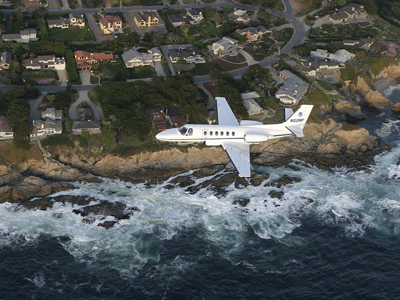
Advances in instrumentation and navigation technology have brought airborne gravimetry, the measurement of Earth’s gravitational field strength using instruments aboard aircraft, to an unprecedented 1–2 milligal level of accuracy today. This means that scientists can now use aircraft to map tiny gravity changes that are 1 million times smaller than 1 g0 (standard gravity), allowing them to make detailed maps of buried resources and enabling high-precision geodetic applications.
Scientists can now use aircraft to map tiny gravity changes and make detailed maps of buried resources.
Airborne gravimetry, which bridges the gap between ground-based sensors and satellite instruments, helps to improve the gravity field determination for geodetic and geophysical applications, and it is critical to the Gravity for the Redefinition of the American Vertical Datum (GRAV-D) project. To address the progress in this field and inform parties who are interested in airborne gravimetry, the National Geodetic Survey hosted a 5-day summer school.
Sessions during this summer school covered a broad range of topics, from fundamental theory to data collection, from data processing to applications, and from instrument developments to the future of airborne gravimetry. A total of 65 participants from 12 counties attended: United States (43), Germany (5), Canada (4), Denmark (3), Turkey (2), Saudi Arabia (2), Great Britain (1), Ireland (1), Israel (1), New Zealand (1), Russia (1), and Spain (1). Participants were affiliated with the U.S. federal government, foreign governments, universities, private industry, and an independent research institute.
Each of the summer school’s 5 days centered on a different topic.
Day 1 covered the fundamental theories of airborne gravimetry, the history of the discipline, and current airborne gravimetry programs around the world.
Day 2 focused on the practical execution of airborne gravimetry surveys. Speakers discussed topics on airborne gravity project design, logistics, data collection, aircraft positioning, and data processing.
Day 3 was devoted to one of the important applications of airborne gravimetry, geoid determination. Presentations addressed combining satellite gravity models with airborne and terrestrial gravity data, as well as accuracy improvements gained by incorporating airborne gravity data into geoid models.
The first known flights of an airborne gravimeter on an unmanned aircraft occurred in April 2016.
Day 4 focused on emerging developments affecting airborne gravimetry. Speakers discussed advances in absolute gravimeters, new devices that use cold-atom interferometry, a quantum physics technique that would allow gravity measurements a thousand times more precise than the best laboratory-based instruments available today and a million times more precise than the best airborne gravimeters. A highlight of this day was a presentation about the first known flights of an airborne gravimeter on an optionally piloted aircraft (flown in unmanned mode), done in collaboration with the National Oceanic and Atmospheric Administration, Micro-g LaCoste, and Aurora Flight Sciences in April 2016.
Day 5 was devoted to time-varying gravity and monitoring the geoid from space and the ground. Presenters discussed which gravity signals would need to be tracked over time to maintain a geoid model with 1-centimeter accuracy, with particular emphasis on North American gravitational changes.
The event brought experts from around the world together to share their knowledge with students of all ages and experience levels, with interests in both geodesy and geophysics alike. All teaching materials and recorded lectures are available at the summer school website, and a book based on the teaching materials is forthcoming.
—Yan Ming Wang (email: [email protected]) and Theresa Damiani, National Geodetic Survey, National Oceanic and Atmospheric Administration, Silver Spring, Md.
Citation:
Wang, Y. M.,Damiani, T. (2017), Measuring Earth’s gravity field from the air, Eos, 98, https://doi.org/10.1029/2017EO064983. Published on 10 January 2017.
Text not subject to copyright.
Except where otherwise noted, images are subject to copyright. Any reuse without express permission from the copyright owner is prohibited.
Text not subject to copyright.
Except where otherwise noted, images are subject to copyright. Any reuse without express permission from the copyright owner is prohibited.