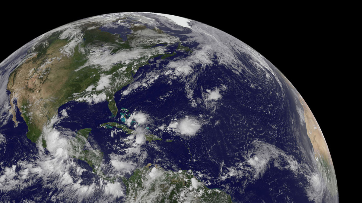
• About
  • Special Reports
  • Topics
    • Climate
    • Earth Science
    • Oceans
    • Space & Planets
    • Health & Ecosystems
    • Culture & Policy
    • Education & Careers
    • Opinions
  • Projects
    • Postcards From the Field
    • ENGAGE
    • Editors’ Highlights
    • Editors’ Vox
    • Eos en Español
    • Eos 简体中文版
    • Print Archive: 2015–2025
  • Policy Tracker
  • Blogs
    • Research & Developments
    • The Landslide Blog
  • Newsletter
  • Submit to Eos
  • AGU.org
  • Career Center
  • Join AGU
  • Give to AGU
  • About
  • Special Reports
  • Topics
    • Climate
    • Earth Science
    • Oceans
    • Space & Planets
    • Health & Ecosystems
    • Culture & Policy
    • Education & Careers
    • Opinions
  • Projects
    • Postcards From the Field
    • ENGAGE
    • Editors’ Highlights
    • Editors’ Vox
    • Eos en Español
    • Eos 简体中文版
    • Print Archive: 2015–2025
  • Policy Tracker
  • Blogs
    • Research & Developments
    • The Landslide Blog
  • Newsletter
  • Submit to Eos
Skip to content
  • AGU.org
  • Career Center
  • Join AGU
  • Give to AGU
Eos

Eos

Science News by AGU

Support Eos
Sign Up for Newsletter
  • About
  • Special Reports
  • Topics
    • Climate
    • Earth Science
    • Oceans
    • Space & Planets
    • Health & Ecosystems
    • Culture & Policy
    • Education & Careers
    • Opinions
  • Projects
    • Postcards From the Field
    • ENGAGE
    • Editors’ Highlights
    • Editors’ Vox
    • Eos en Español
    • Eos 简体中文版
    • Print Archive: 2015–2025
  • Policy Tracker
  • Blogs
    • Research & Developments
    • The Landslide Blog
  • Newsletter
  • Submit to Eos

Africa

Ciudadanos mayores en una zona rural toman parte de un mapeo. El mapa está al centro de la foto, y cinco ciudadanos miran cómo uno de ellos dibuja el mapa.
Posted inNews

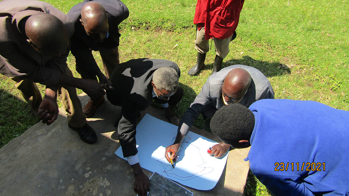
Proyecto de ciencia comunitaria ayuda a rastrear los riesgos geológicos en Uganda

by James Dacey 14 September 202222 March 2023

Un proyecto comunitario en las tierras altas de Kigezi está ayudando a identificar puntos calientes de deslizamientos de tierra e inundaciones y cómo los peligros están evolucionando.

Aerial view of a large wetland area, with part of an airplane wing in the foreground
Posted inResearch Spotlights

Tropical Wetlands Emit More Methane Than Previously Thought

Rachel Fritts, Science Writer by Rachel Fritts 13 September 20225 October 2022

Climate models could be vastly underestimating methane emissions from the world’s tropical wetlands, according to observational surveys of wetlands in Zambia.

Sensors attached to an orange buoy on the deck of a research vessel
Posted inNews

River Floods Can Trigger Powerful Underwater Landslides

by Carolyn Wilke 26 August 202214 March 2024

A record-length turbidity current triggered by river flooding has revealed a new link between the surface and the deep sea.

Senior citizens in a rural setting take part in a mapping workshop in Uganda’s Kigezi Highlands.
Posted inNews

Community Science Project Helps Track Geohazard Risks in Uganda

by James Dacey 22 July 202227 March 2023

A community project in the Kigezi Highlands is helping to identify landslide and flooding hot spots and how the hazards are evolving.

A truck emits a cloud of pollution while driving in Cameroon.
Posted inResearch Spotlights

Side Benefits of Climate Action May Save Millions of Lives in Africa

by Saima May Sidik 21 June 20221 June 2023

Premature deaths due to air pollution would decline across the continent.

A strong wind blows on the coastal city of Maputo, Mozambique.
Posted inNews

Severe Storms Expose Ill-Equipped Weather Stations in Southeast Africa

by Munyaradzi Makoni 16 June 202220 September 2022

The lack of infrastructure is preventing scientists from robustly reporting meteorological information as well as communicating warnings about hazard-prone areas.

Niveau du lac du Nyiragongo au cours du temps.
Posted inEditors' Highlights

Mesurer les oscillations d’un lac de lave depuis l’espace

by Michael Poland 19 May 202221 February 2023

Les images satellite permettent de mesurer les oscillations du lac de lave du Nyiragongo (RD Congo). Ces mesures renseignent sur la dynamique du volcan et aident à anticiper ses éruptions futures.

Lava lake activity over time at the Nyiragongo volcano.
Posted inEditors' Highlights

Tracking Lava Lake Levels at an African Volcano from Space

by Michael Poland 19 May 20222 August 2022

Satellite data from Nyiragongo Volcano, Democratic Republic of Congo, track changes in summit-crater lava levels that provide a window into eruption dynamics and aid in forecasting future activity.

Skyline of the downtown business district of Addis Ababa, Ethiopia
Posted inNews

New Hazard Exposure Model for Africa

by Munyaradzi Makoni 31 March 202231 March 2022

The rapid pace of urbanization could encroach on hazard-prone regions without adequate land management and building design regulations, a new modeling project shows.

The Amazon Tall Tower Observatory is a joint Brazilian-German research station with a 325-meter tower making environmental observations in the Amazon.
Posted inFeatures

Africa’s Earth, Wind, and Fire Keep the Amazon Green

by J. Besl 23 March 202225 March 2022

Jet streams sprinkle North African dust over the Amazon, providing the rain forest with much needed nutrients. Changing wind patterns and increasing smoke may shift the system.

Posts pagination

Newer posts 1 … 5 6 7 8 9 … 16 Older posts
Over a dark blue-green square appear the words Special Report: The State of the Science 1 Year On.

Features from AGU Publications

Research Spotlights

Making a Map to Make a Difference

11 February 202611 February 2026
Editors' Highlights

Models Reveal Imprint of Tectonics and Climate on Alluvial Terraces

17 February 202617 February 2026
Editors' Vox

A Double-Edged Sword: The Global Oxychlorine Cycle on Mars

10 February 202610 February 2026
Eos logo at left; AGU logo at right

About Eos
ENGAGE
Awards
Contact

Advertise
Submit
Career Center
Sitemap

© 2026 American Geophysical Union. All rights reserved Powered by Newspack