
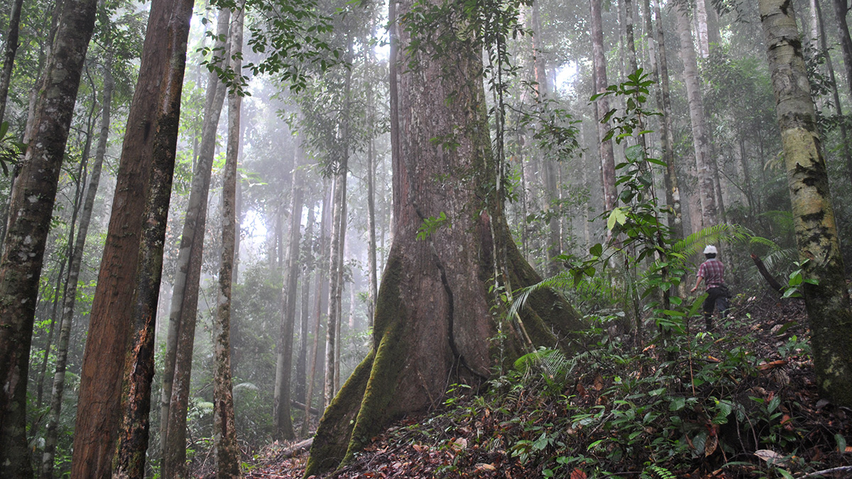
Des chercheurs ont créé un nouvel outil d’analyse pour améliorer la traçabilité du bois qui pourrait permettre d’appliquer la législation de l’Union européenne visant à lutter contre la déforestation.
Africa
Posted inEditors' Highlights
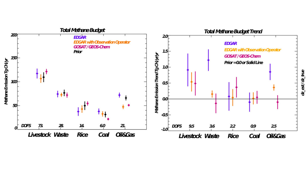
Using Bayesian Estimation to Improve Methane Inventories
A Bayesian, optimal estimation evaluation of state-of-the-art methane inventory with satellite-based emissions from 2009 to 2018 finds substantial differences for livestock, rice, and coal emissions.

Posted inFeatures
Collins Gameli Hodoli: Air Quality Is Data Driven
The environmental scientist is making pollution levels public to draw nonscientists into the fight for clean air.
Posted inNews
Fingerprinting Wood to Curb Illegal Deforestation
Researchers developed a new forensic tool for tracing the origins of timber that could enable enforcement of antideforestation legislation in the European Union.

Posted inNews
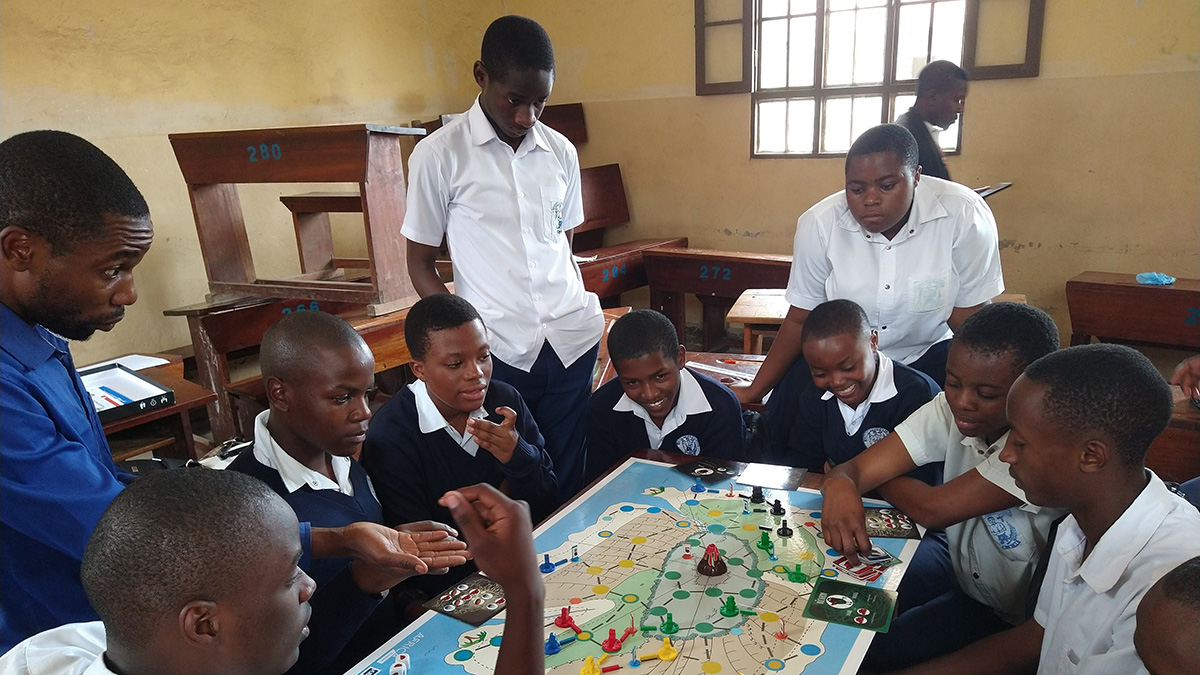
Concientizando sobre los riesgos a las faldas de uno de los volcanes más peligrosos del mundo
A la sombra de una erupción letal en el 2021, estudiantes en Goma, República Democrática del Congo, están aprendiendo sobre futuros riesgos.
Posted inNews
Raising Hazard Awareness at the Foot of One of the World’s Most Dangerous Volcanoes
In the shadow of a deadly eruption in 2021, students in Goma, Democratic Republic of Congo, are learning about future hazards.
Posted inEditors' Highlights, RTL
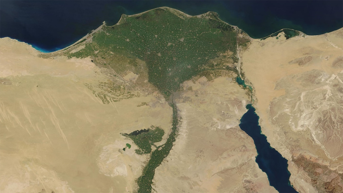
مراقبة تراكم الملوثات من المعادن الثقيلة في دلتا النيل
تُظهر نتائج تحاليل العينات أن إعادة استخدام مياه الصرف بدون معالجة والتوسع في إنشاء السدود يسبب زيادة تركيز المعادن الثقيلة الملوثة في دلتا النيل مما يهدد بشدة سلامة النظام البيئي والصحي والإنتاج الزراعي في مصر.

Posted inEditors' Highlights
Tracking Heavy Metal Accumulation in the Nile Delta
Sediment measurements show that flow alterations and discharges are driving increasing concentrations of multiple heavy metals in the Nile Delta, threatening ecosystems, agriculture, and human health.

Posted inEditors' Highlights
Suivie de l’accumulation des métaux lourds dans le Delta du Nil
Les analyses de sédiments montrent que la réutilisation de l’eau non traitée et la construction de barrages entraînent l’augmentation des concentrations de métaux lourds dans le Delta du Nil, menaçant gravement les écosystèmes, l’agriculture et la santé humaine.

Posted inNews
Mapping Rwanda’s Trees from Above
Researchers used both aerial and satellite imagery, as well as machine learning, to map the carbon stock of every overstory tree in Rwanda—the first such inventory in the world.