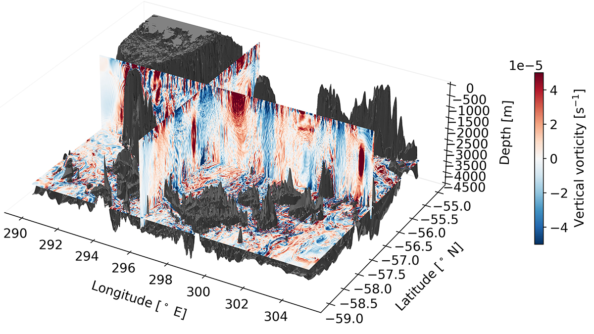
A high-resolution regional model of the Southern Ocean reveals how topographically induced mixing in the abyss is important in creating the water masses that can upwell back up to the surface.
AGU Advances
Posted inEditors' Highlights
How Nutrients Get Back Up to the Surface Ocean
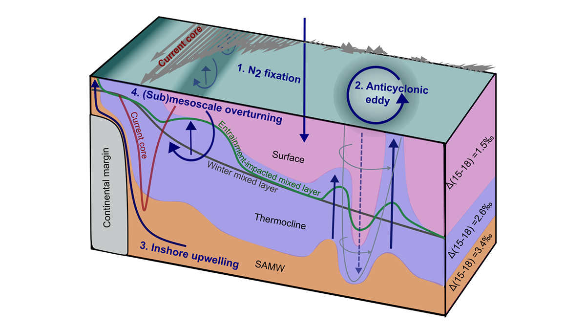
A new dual isotope tracer technique is used to assess the role of a number of poorly understood nutrient supply mechanisms fueling biological productivity in the ocean.

Posted inResearch Spotlights
Scientists Investigate How Heat Rises Through Europa’s Ocean
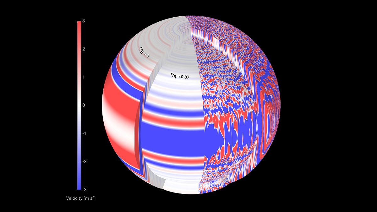
A new study examines how heat may be transferred from the mantle, through the ocean, and into the icy crust of one of Jupiter’s moons—perhaps among the most promising places in our solar system to search for life.
Posted inEditors' Highlights
A Wider and Deeper View of Jupiter’s Jets
The mid-latitude jets on Jupiter are driven by turbulence that arises, in part, from deep cells, consistent with Juno microwave and gravity observations.

Posted inEditors' Highlights
Do Some Cratons Have Soggy Bottoms?
Long-persistent stable cratons bear much of the deep-time geologic record, and a new study combines seismic and petrological data to reveal how interactions with mantle fluids can shape their evolution.

Posted inResearch Spotlights
To Meet Climate Goals, Protect the Tongass and Chugach Forests
The two largest U.S. national forests, both in Alaska, have low wildfire risk and provide crucial forest carbon stocks and biodiversity benefits.

Posted inEditors' Highlights
A Crystal Ball for the Carbon Cycle, But a Cloudy One
Carbon cycle models quantify relationships between emission scenarios and resulting atmospheric concentrations, but are the projections credible? New analyses find grounds for both hope and concern.
Posted inEditors' Highlights
Reporting Model Results Even When They Cannot (Yet) be Tested
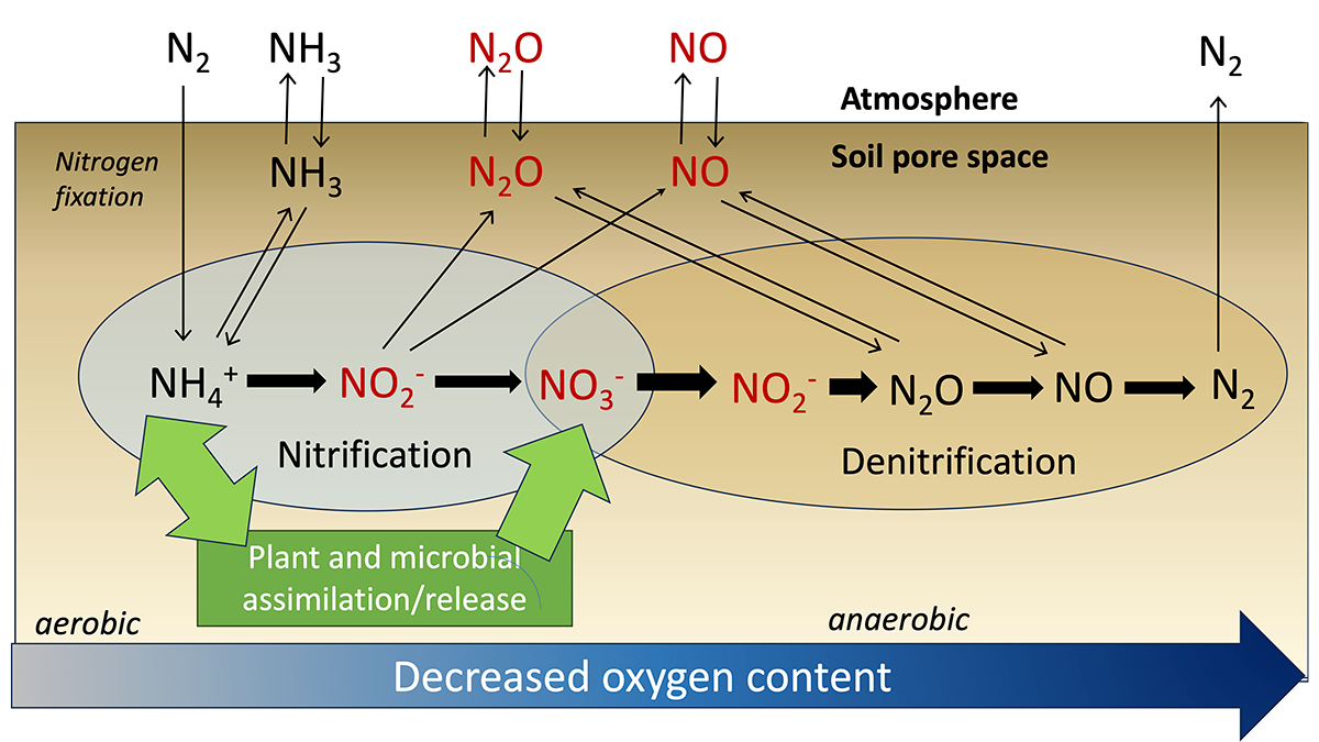
Models simulating the nitrogen cycle track its multiple chemical forms but tend to report a subset that can be compared with available field measurements.
Posted inEditors' Highlights
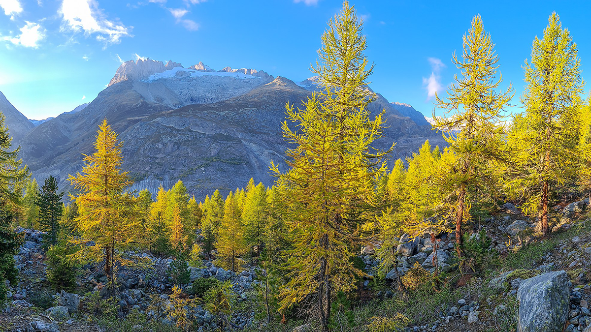
Grow-Fast-Die-Young Strategy Increases Swiss Forest Biomass
Climate change and CO2 fertilization can increase both growth and mortality of trees. The net effect on forest biomass depends on that trade-off, which long-term studies in Switzerland reveal.
Posted inEditors' Highlights
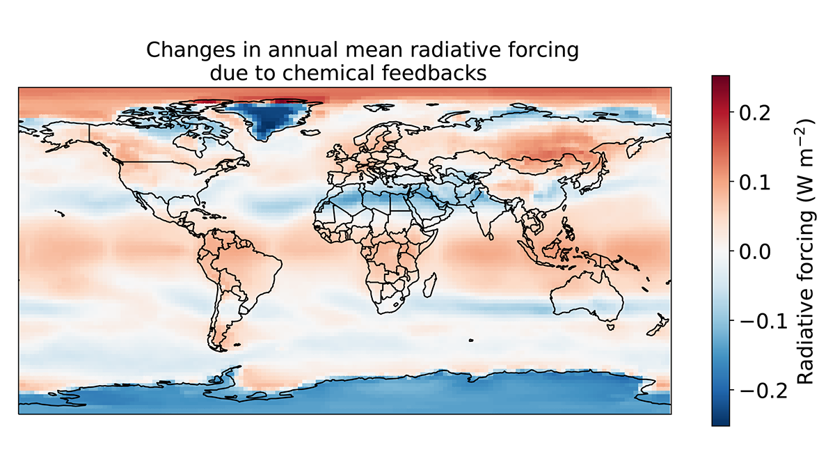
Unexpected Consequences of Solar Geoengineering
Solar engineering is not a substitute for mitigation, and concerns about its risks and unintended impacts are supported by the recent discovery of overlooked atmospheric chemical feedback.