
Damage to the Inca buildings of Cusco reveals a forgotten earthquake history that could help scientists understand modern seismic hazards.
archaeology

Posted inNews
Vehículos robóticos exploran campos de batalla de la Segunda Guerra Mundial en el océano
El Proyecto Recover usa vehículos autónomos submarinos para identificar, acceder, y captar imágenes de sitios difíciles de alcanzar con restos de la Segunda Guerra Mundial, cerca de las Islas Marianas del Norte.
Posted inEditors' Highlights
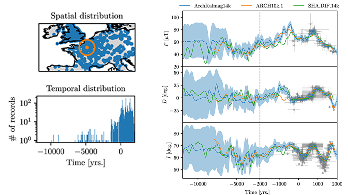
Time-Step Filtering in Holocene Global Magnetic Field Models
Through a local fixed time-step filter, global Holocene magnetic field models remain mathematically tractable refining our insight into field variability and improving archeological dating.
Posted inENGAGE, News
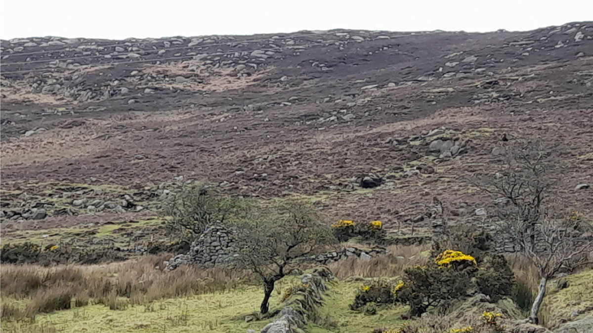
Peat Uncovers a Uniquely Resilient Irish Community
Researchers reveal an abandoned settlement in Northern Ireland that showed unusual resilience during calamities including epidemics, famine, and climate change.
Posted inResearch Spotlights
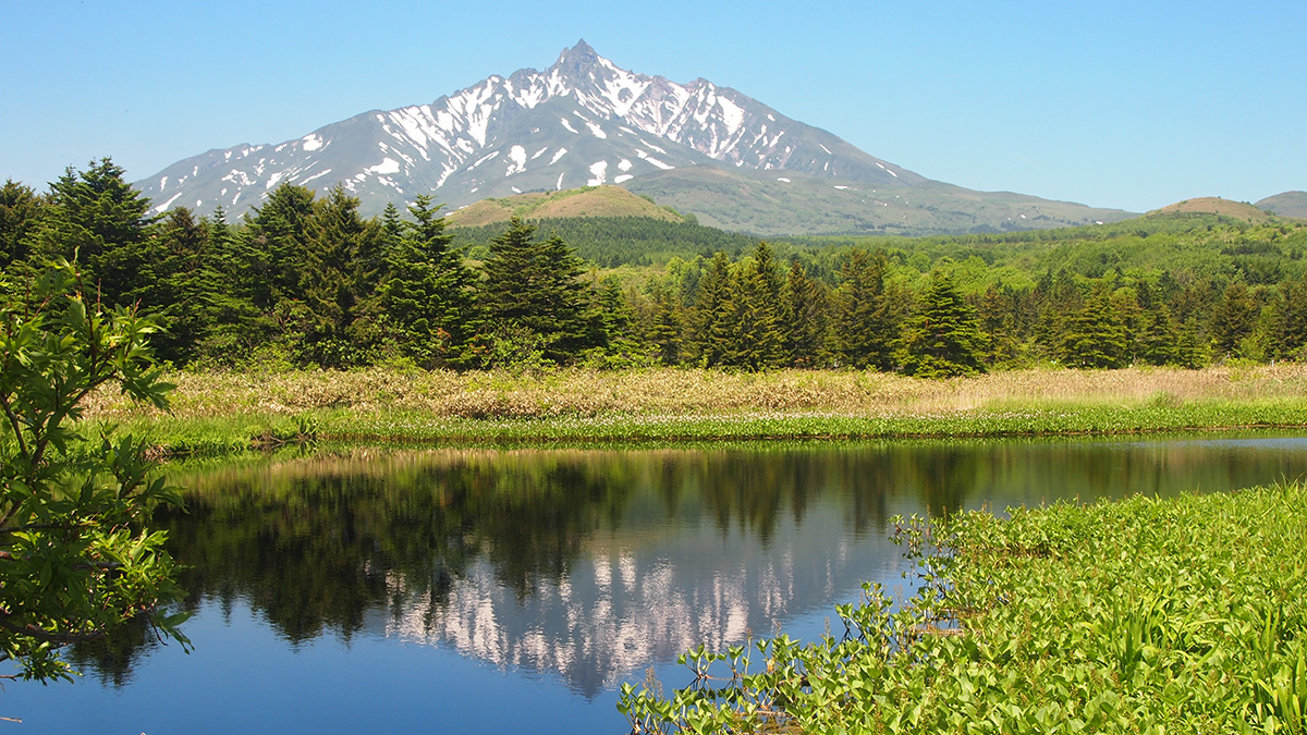
Climate and Currents Shaped Japan’s Hunter-Gatherer Cultures
New climate records from a peat bog show how two neighboring cultures responded differently to shifts in climate and ocean currents.
Posted inFeatures
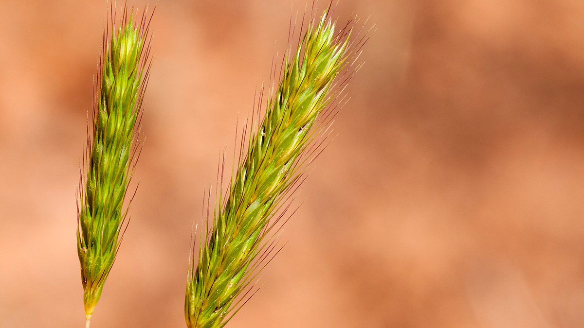
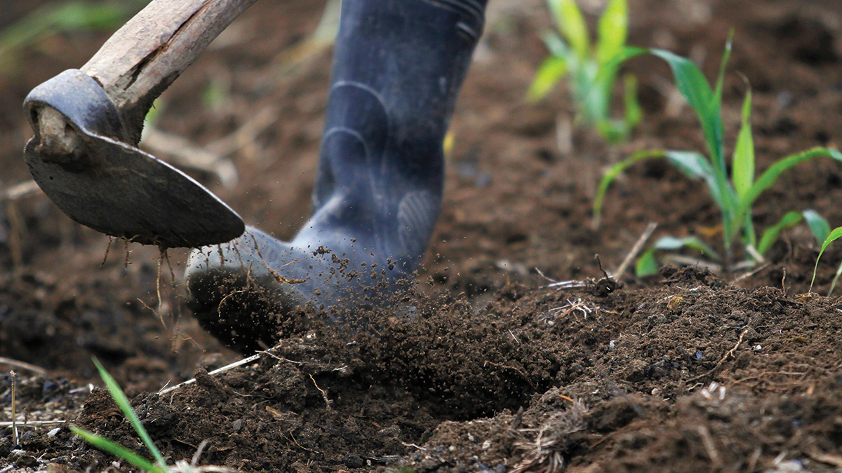
Could “Lost Crops” Help Us Adapt to Climate Change?
Archaeology might not solve all the agricultural challenges that climate change will bring, but it could provide important lessons and a record of new ideas.

Posted inNews
Robotic Vehicles Explore World War II Era Ocean Battlefields
Project Recover used autonomous underwater vehicles to identify, access, and image hard-to-reach World War II wreckage sites near the Northern Mariana Islands.
Posted inFeatures
The Nutrient-Rich Legacy in the Amazon’s Dark Earths
Fertile terra preta soils were created through centuries of carefully managed land use. Scientists are taking cues from these soils to better sequester carbon and improve soil for agriculture.
Posted inENGAGE, News
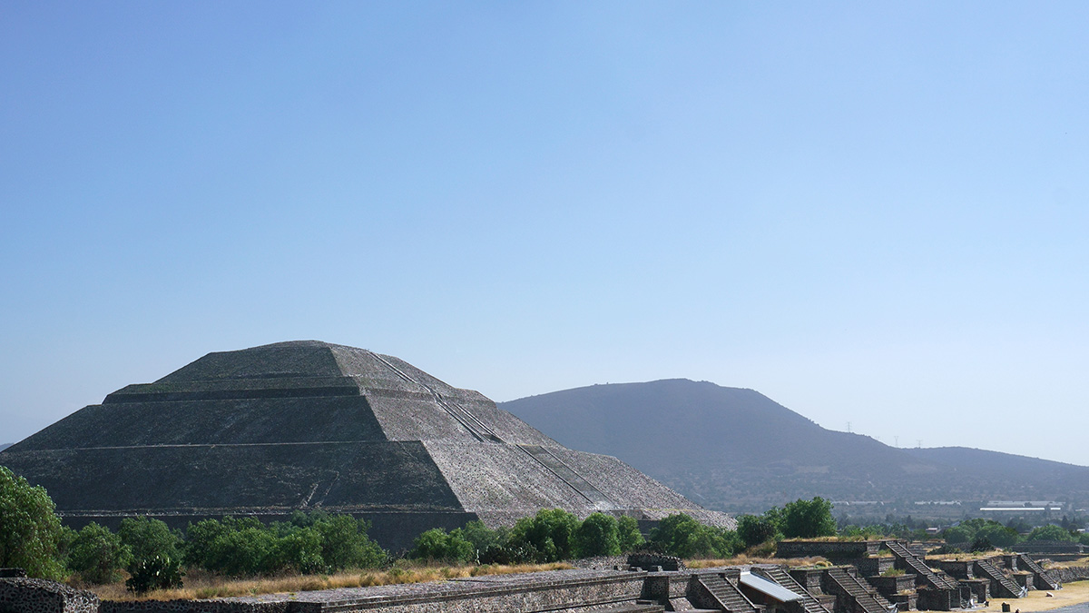
Mapeando el pasado, presente y futuro de Teotihuacan
Un nuevo proyecto con tecnología lidar revela cómo la minería y la expansión urbana han puesto en riesgo a uno de los sitios del patrimonio cultural más icónicos de México.
Posted inNews
Geochemical Data from Polynesian Artifacts Pack Pofatu Database
A new resource may help match artifacts with their original stone sources—“a really a niche part of archaeology that requires geological expertise.”