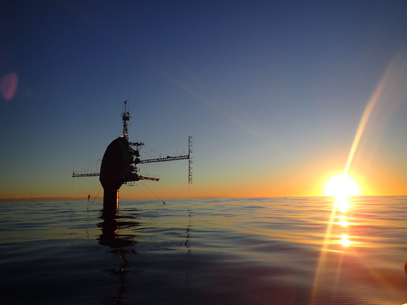
Since the 1960s, the Floating Instrument Platform has bobbed at the sea surface, supporting numerous discoveries. One scientist recalls his time aboard FLIP during what was likely its final mission.
cool tools

Posted inENGAGE, Science Updates
Cormorants Are Helping Characterize Coastal Ocean Environments
The Cormorant Oceanography Project is using sensors deployed on diving marine birds to collect broadly distributed oceanographic data in coastal regions around the world.
Posted inScience Updates
A New Focus on the Neglected Carbonate Critical Zone
Studies of Earth’s critical zone have largely focused on areas underlain by silicate bedrock, leaving gaps in our understanding of widespread and vital carbonate-dominated landscapes.
Posted inNews
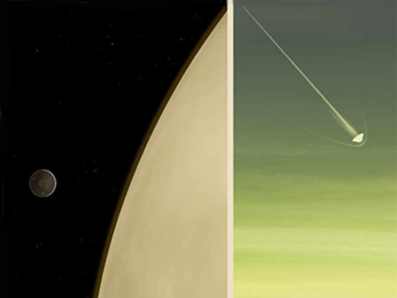
Mission to Venus Could Help Solve an Atmospheric Mystery
NASA’s recently announced DAVINCI+ mission to Venus will probe the planet’s atmosphere, hoping to shed light on the unknown dark patches that surround the planet.

Posted inENGAGE, News
Heat Pumps Can Lower Home Emissions, but Not Everywhere
A new study shows that in the right places, heat pumps can help homeowners lower greenhouse gas emissions, save on heating and cooling costs, and promote public health.
Posted inScience Updates
Making the Most of Volcanic Eruption Responses
Last year, a new collaborative initiative conducted a hypothetical volcano response exercise. A month later, they put the knowledge gained to use during an actual eruption.

Posted inENGAGE, News
How Can Wristbands Monitor Pollution, PAHs, and Prenatal Care?
Silicone wristbands can help monitor pregnant women’s exposure to polycyclic aromatic hydrocarbons. Tracking these toxic chemicals, produced by combustion, could improve public health outcomes.

Posted inNews
Tracking Sustainability Goals with Creative Data Sources
Nontraditional sources of data could assist in charting the U.N. Sustainable Development Goals, helping design appropriate policies and investments to improve the state of the environment.
Posted inENGAGE, News
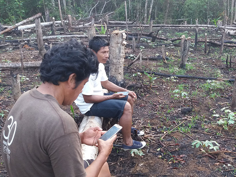
Indigenous Peoples Harness Space Technology to Stop Deforestation
Satellite observations have long been used to detect deforestation, and a new study shows that giving Indigenous groups greater access to these data can improve response times and reduce tree cover loss.

Posted inScience Updates
Undertaking Adventure to Make Sense of Subglacial Plumes
Novel observations and inventive analyses of glacial discharge in Greenland have revealed new insights into the irregular and chaotic nature of ice-ocean interactions at glacial calving fronts.