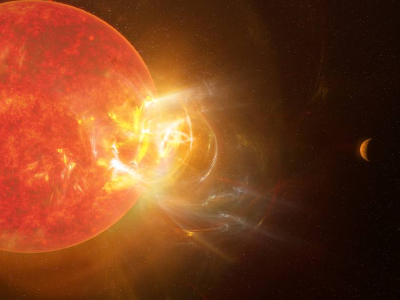
Proxima Centauri recently let loose a blast of radiation, and ground- and space-based telescopes detected the record-setting event at wavelengths ranging from radio to the ultraviolet.
cool tools
Posted inEditors' Highlights
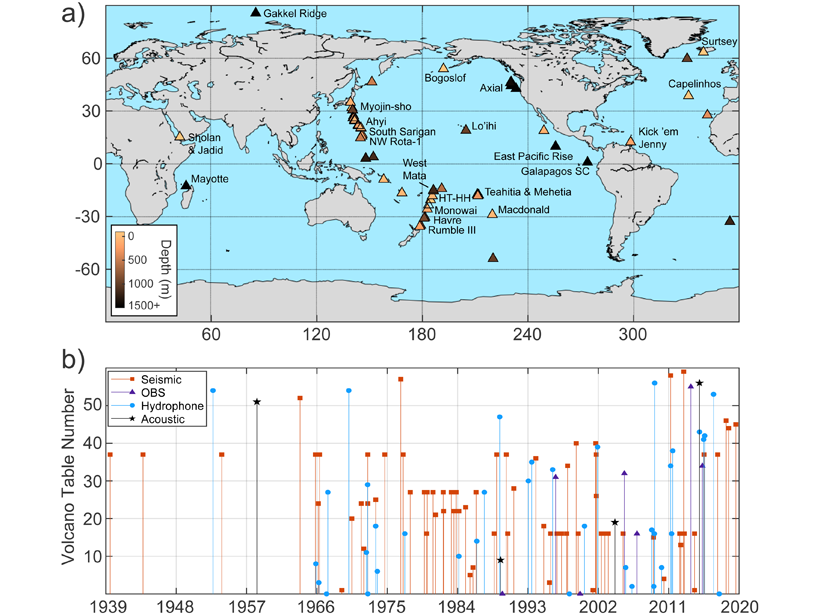
A Comprehensive Review of Submarine Volcano Seismoacoustics
Although most of Earth’s lava erupts beneath the oceans, submarine volcanoes are comparatively understudied, but a new review of submarine volcano seismoacoustics provides a framework for future work.

Posted inNews
Laser Flashes Shed Light on a Changing Arctic
An ongoing project in northern Alaska is using pulses of laser light to monitor anthropogenic activity, ice quakes, and marine wildlife.

Posted inNews
High School Junior Builds Cheap Earthquake Warning Device
The project exploring seismic noise during the coronavirus pandemic was fueled by Google searches and bathroom soldering sessions.

Posted inNews
Cheap Sensors Provide Missing Air Quality Data in African Cities
Calibrated low-cost sensors in Kinshasa and Brazzaville provide new information on pollution and help scientists model a way to improve access to air quality data.
Posted inNews
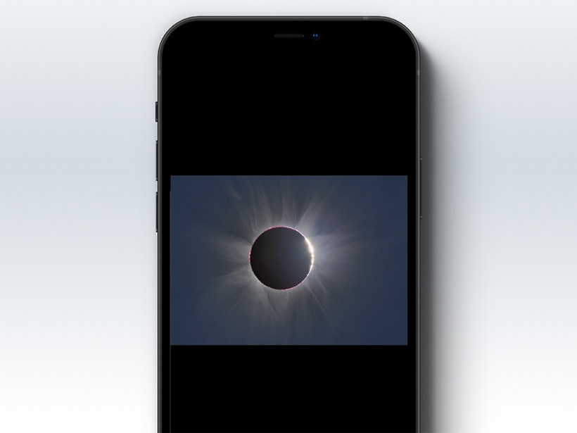
Making an Eclipse an Inclusive Multisensory Experience
New tools are helping make solar eclipse experiences and research accessible to people who are blind or low vision, communities often excluded from historically visually based sciences like astronomy.

Posted inNews
Taking Stock of Cosmic Rays in the Solar System
Scientists seek to understand the elusive properties of stellar and galactic cosmic rays before searching for life on exoplanets.
Posted inNews
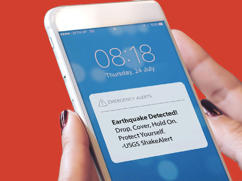
Earthquake Alerts Go Live in the Pacific Northwest
Oregon and Washington residents will receive an alert on their cell phones if they are in danger from an incoming quake.
Posted inNews
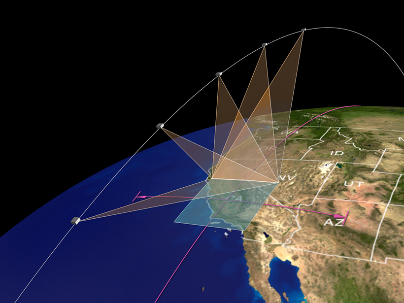
Using Satellite Data to Map Air Pollution and Improve Health
NASA scientists will be teaming up with epidemiologists in the agency’s first health-focused mission. With satellite data, they’ll find out how air pollution affects health in cities around the world.
Posted inNews
Esta búsqueda por vida alienígena comienza con la destrucción de bacterias en la Tierra
Algún día, un catálogo de fragmentos moleculares podría ayudar a científicos a identificar vida extraterrestre en las lunas heladas de nuestro sistema solar.