
A new U.S. Geological Survey report outlines how emerging technologies and cross-disciplinary collaborations are expected to empower new tools for managing hazards and resources.
cool tools

Posted inScience Updates
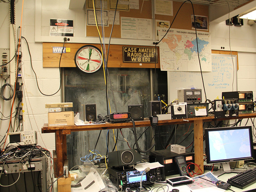
Amateur Radio Operators Help Fill Earthquake Donut Holes
Ham radio networks gear up to provide real-time, on-the-ground information about earthquake shaking and damage when other communication pathways are knocked out of commission.

Posted inNews
Weighing Inputs of Waves and Precipitation to Coastal Erosion
Conducting weekly lidar surveys of coastal cliffs for 3 years enabled a California team of coastal erosion researchers to quantify and separate marine effects from subaerial effects.
Posted inFeatures
Ham Radio Forms a Planet-Sized Space Weather Sensor Network
For researchers who monitor the effects of solar activity on Earth’s atmosphere, telecommunications, and electrical utilities, amateur radio signals a golden age of crowdsourced science.

Posted inNews
This Search for Alien Life Starts with Destroying Bacteria on Earth
Someday, a catalog of molecular fragments might help scientists identify extraterrestrial life on our solar system’s icy moons.

Posted inScience Updates
A New Era of Debris Flow Experiments in the Oregon Woods
What do a backhoe, expanding foam, half-ton concrete blocks, and a 100-meter-long hillslope slide have in common? All were part of reviving the U.S. Geological Survey’s experimental debris flow flume.

Posted inNews
The Catcher in the Ice
There are three ways to extract gases from an ice core. The cleanest one, sublimation, is getting easier.

Posted inScience Updates
Modeling Earth’s Ever-Shifting Magnetism
The World Magnetic Model, updated every 5 years through an international collaboration, supports numerous technologies that help us find our way.
Posted inNews
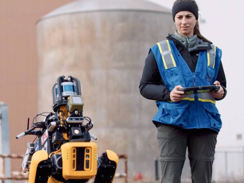
Very Good Space Boys: Robotic Dogs May Dig Into Martian Caves
Four-legged, autonomous robots known as “Mars Dogs” will explore previously inaccessible caves to look for signs of life and potential locations for future human colonies.

Posted inNews
Keeping a Close Eye on the Ocean—from Afar
Remote sensing technology proves effective in monitoring key regions of the world’s oceans, where upwelling and other essential ecosystem services occur.