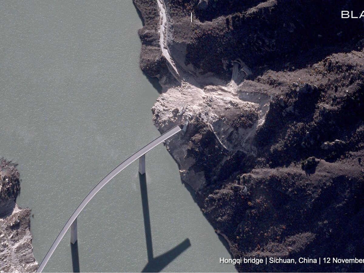
The Landslide Blog is written by Dave Petley, who is widely recognized as a world leader in the study and management of landslides. Satellite company Blacksky has released a high resolution satellite image, captured on 12 November 2025, showing the aftermath of the 11 November 2025 landslide at Hongqi Bridge in China. The image was […]
dams & reservoirs
Posted inThe Landslide Blog
The aftermath of the Matai’an landslide in Taiwan
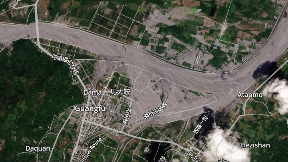
It is likely that the final death toll from the collapse of the Matai’an landslide dam will be 25 people. The dust is literally settling in the aftermath of the breach of the Matai’an landslide dam in Taiwan. The current estimates for the loss are life are 18 fatalities with seven more missing, and a […]

Posted inThe Landslide Blog
The tragic 23 September 2025 Matai’an landslide dam breach in Taiwan
At least 15 people are known to have been killed by the debris flow and flood from the landslide dam breach that was triggered by typhoon Ragasa. The extremely intense rainfall brought by super typhoon Ragasa triggered the overtopping of the landslide dam at Matai’an in Taiwan on 23 September 2025. This was not a […]

Posted inNews
A New App Tracks Burrowing Animals That Weaken Levees
Researchers are calling on amateur scientists to help protect flood barriers in their communities.
Posted inResearch Spotlights
New Insight into Inland Water Carbon Dioxide Emissions
A process-based modeling technique reveals surprising information about carbon emissions from rivers, lakes, and reservoirs across the contiguous United States.
Posted inThe Landslide Blog
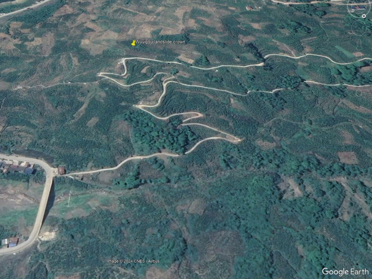
A first analysis of the 17 July 2024 Wuyigou Landslide in China
The Landslide Blog is written by Dave Petley, who is widely recognized as a world leader in the study and management of landslides. On 17 July 2024, the Wuyigou landslide occurred on the banks of the Three Gorges reservoir in China. I posted about this landslide at the time, in part because it was caught […]

Posted inNews
On the Wisconsin-Iowa Border, the Mississippi River Is Eroding Sacred Indigenous Mounds
A multimillion-dollar bank stabilization project could protect historic sites dating back thousands of years.
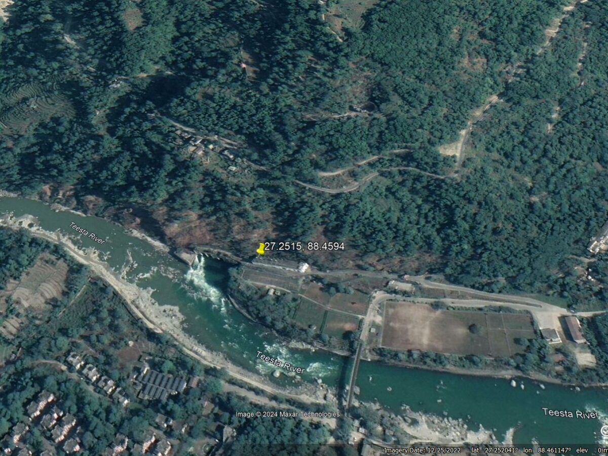
Posted inThe Landslide Blog
The 20 August 2024 landslide at the Teesta Stage V power house at Baluatar, Sikkim
The Landslide Blog is written by Dave Petley, who is widely recognized as a world leader in the study and management of landslides. On 20 August 2024, a landslide occurred on the banks of the Teesta River near to Baluatar in Sikkim, northern India. This large failure was widely captured on mobile phone videos that […]

Posted inThe Landslide Blog
The 17 July 2024 landslide in Zigui County, China
The Landslide Blog is written by Dave Petley, who is widely recognized as a world leader in the study and management of landslides. A remarkable landslide video was shared widely yesterday on social media, showing a landslide that occurred on 17 July 2024 in Zigui County, China. There is quite a good version of this […]

Posted inNews
Sand’s Role in Rerouting Meandering Rivers Is Bigger Than We Thought
Researchers delve into the dirt causing rivers to migrate.