• About
  • Special Reports
  • Topics
    • Climate
    • Earth Science
    • Oceans
    • Space & Planets
    • Health & Ecosystems
    • Culture & Policy
    • Education & Careers
    • Opinions
  • Projects
    • Postcards From the Field
    • ENGAGE
    • Editors’ Highlights
    • Editors’ Vox
    • Eos en Español
    • Eos 简体中文版
    • Print Archive: 2015–2025
  • Policy Tracker
  • Blogs
    • Research & Developments
    • The Landslide Blog
  • Newsletter
  • Submit to Eos
  • AGU.org
  • Career Center
  • Join AGU
  • Give to AGU
  • About
  • Special Reports
  • Topics
    • Climate
    • Earth Science
    • Oceans
    • Space & Planets
    • Health & Ecosystems
    • Culture & Policy
    • Education & Careers
    • Opinions
  • Projects
    • Postcards From the Field
    • ENGAGE
    • Editors’ Highlights
    • Editors’ Vox
    • Eos en Español
    • Eos 简体中文版
    • Print Archive: 2015–2025
  • Policy Tracker
  • Blogs
    • Research & Developments
    • The Landslide Blog
  • Newsletter
  • Submit to Eos
Skip to content
  • AGU.org
  • Career Center
  • Join AGU
  • Give to AGU
Eos

Eos

Science News by AGU

Support Eos
Sign Up for Newsletter
  • About
  • Special Reports
  • Topics
    • Climate
    • Earth Science
    • Oceans
    • Space & Planets
    • Health & Ecosystems
    • Culture & Policy
    • Education & Careers
    • Opinions
  • Projects
    • Postcards From the Field
    • ENGAGE
    • Editors’ Highlights
    • Editors’ Vox
    • Eos en Español
    • Eos 简体中文版
    • Print Archive: 2015–2025
  • Policy Tracker
  • Blogs
    • Research & Developments
    • The Landslide Blog
  • Newsletter
  • Submit to Eos

deltas

Diagram showing how the authors used GPS, anchors, and fiber-optic strain meters to measure coastal subsidence.
Posted inEditors' Highlights

Tracking Subsidence on Deltas With Fiber-Optics

by John Shaw 20 September 202219 September 2023

Fiberoptic strain meters capable of measuring micron-scale subsidence reveal a Holocene sediment package on the Mississippi Delta that is mostly stable.

Satellite image of the Mississippi delta.
Posted inNews

Estimating Land Loss in River Deltas

by Mohammed El-Said 31 August 202219 September 2023

Some deltas are susceptible to land loss during sea level rise, whereas others gain land because of changes in the courses of rivers.

Alligator on a log in the waters of the Mississippi River Delta
Posted inNews

Building a Better River Delta

by Danielle Beurteaux 8 September 202119 September 2023

People have been engineering river deltas for millennia, but new research identifies the optimal placement for diversions that benefit both local communities and the environment—and it might be close to a city.
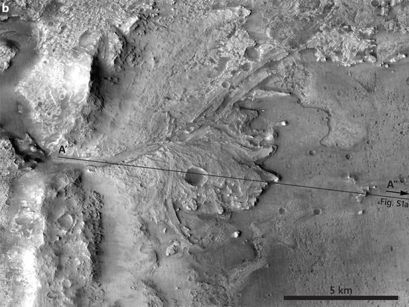
Image of the Jezero delta on Mars
Posted inEditors' Highlights

How Fast Did an Ancient Martian Delta Form?

by F. Nimmo 23 April 202019 September 2023

Terrestrial meander migration rates are used to estimate a formation timescale of decades for Jezero delta on Mars.

Aerial view of a flat floodplain delta, agricultural land, and a town beyond
Posted inResearch Spotlights

Finding Natural Solutions to Man-Made Problems in River Deltas

Kate Wheeling, freelance science writer by Kate Wheeling 3 April 202019 September 2023

Decades of research on river deltas identify gaps in our knowledge of delta behavior and the tools required to fill them in.
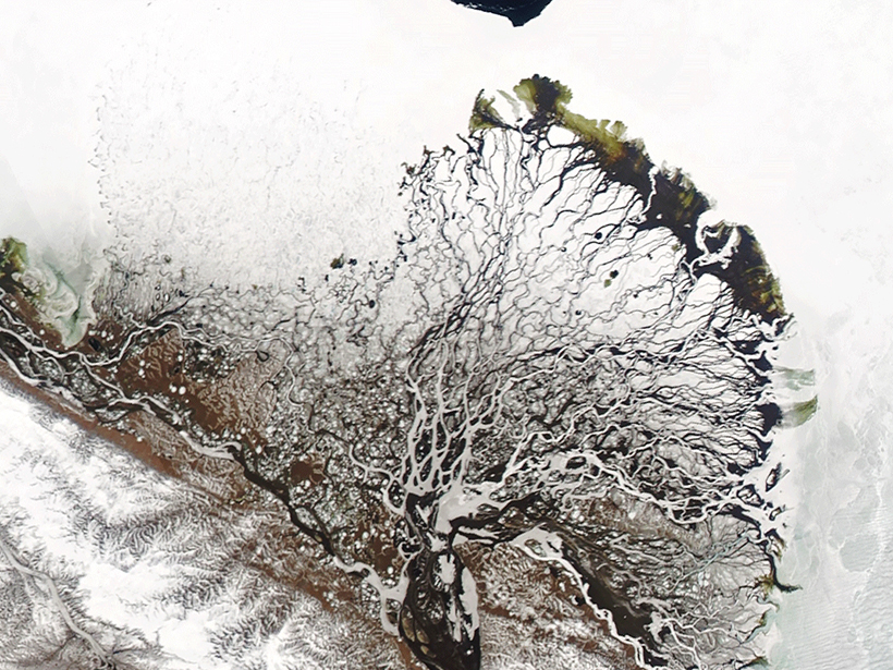
Satellite view of the Lena River delta in June 2019
Posted inResearch Spotlights

River Deltas at the Top of the World

Elizabeth Thompson by Elizabeth Thompson 20 March 202019 September 2023

The water that filters through river deltas has a large effect on the Arctic Ocean. A new study explores factors that shape Arctic river deltas and how delta form in turn changes water flow.
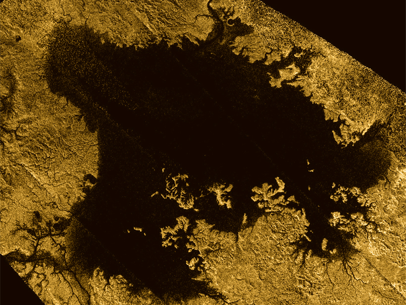
Ligeia Mare
Posted inNews

Scientists Search for Deltas on Saturn’s Largest Moon

JoAnna Wendel, freelance science writer and illustrator by JoAnna Wendel 31 January 202019 September 2023

Saturn’s moon Titan has rivers that empty into seas…but where are the deltas?
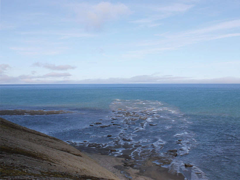
A delta channel from a large ancient delta extends into the Barents Sea
Posted inNews

Largest Delta Plain in Earth’s History Discovered in Arctic

Kimberly M. S. Cartier, News Writing and Production Intern for Eos.org by Kimberly M. S. Cartier 1 April 201919 September 2023

If this Triassic period delta existed today, its footprint would equal about 1% of all land on Earth.

Holocene sediments in Syhlet Basin
Posted inEditors' Highlights

Formation of Sedimentary Deposits: Bypass Versus Mass Extraction

by Amy E. East 4 March 201919 September 2023

Grain size and sediment delivery pathways from the Ganges delta have been used to model downstream facies changes.

A satellite image of urban sprawl in Shanghai
Posted inResearch Spotlights

The Urban Dry Island Effect

by E. Underwood 28 February 201919 September 2023

A study of the Yangtze River Delta shows how urbanization dries out the atmosphere.

Posts pagination

Newer posts 1 2 3 Older posts
Over a dark blue-green square appear the words Special Report: The State of the Science 1 Year On.

Features from AGU Publications

Research Spotlights

Students Enable Widespread Water Monitoring in India

20 July 202620 July 2026
Editors' Highlights

Redesigning Farmland Through Community Collaboration in California

22 July 202621 July 2026
Editors' Vox

Why Healthy Soils Matter More Than Ever

22 July 202622 July 2026
Eos logo at left; AGU logo at right

About Eos
ENGAGE
Awards
Contact

Advertise
Submit
Career Center
Sitemap

© 2026 American Geophysical Union. All rights reserved Powered by Newspack