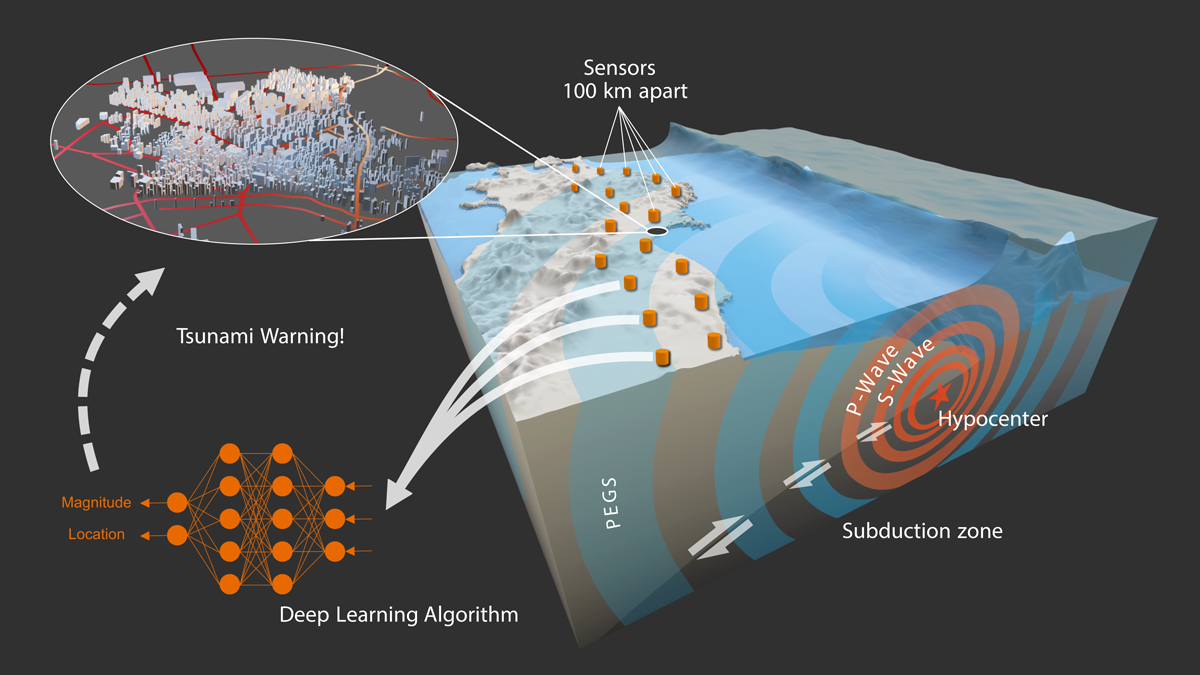
New research uses gravity and a machine learning model to instantaneously estimate the magnitude and location of large earthquakes.
earthquakes

Posted inNews
Rock Music in Utah
Three-dimensional models could help forecast rock tower frequencies—and seismic impacts—around the globe.

Posted inResearch Spotlights
Earthquake Modelers Unite to Compare and Improve Code
International community–driven efforts lend confidence to fault-slip simulations while highlighting key discrepancies.
Posted inEditors' Highlights
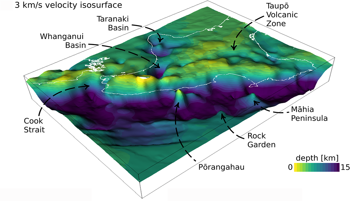
Adjoint Tomography Illuminates Hikurangi Margin Complexity
Waveform inversion of regional earthquakes reveals velocity anomalies interpreted as subducting seamounts that control an enigmatic segmentation in plate coupling along the Hikurangi margin.

Posted inNews
Community Science Builds a Seismic Network in Haiti
Small, inexpensive seismometers are capable of sharing high-quality data in real time—and were put to the test during an August 2021 earthquake.

Posted inNews
Do Earthquakes and Tectonic Plates Have a Two-Way Relationship?
A catastrophic earthquake in Turkey in 1999 changed the motion of the Anatolian plate, according to a study that could change the fundamentals of quake models.

Posted inEditors' Highlights
Moving Earthquake-Generated Sediment Through a Landscape
Ten years after the Wenchuan earthquake, most of the new sediment it produced remained on the landscape, indicating a long recovery time.
Posted inNews
Buscando terremotos en la ionosfera
Los terremotos pueden liberar ráfagas de energía eléctrica que se pueden sentir en la ionosfera, a kilómetros por encima de la Tierra. Sin embargo, la teoría sigue siendo controvertida.

Posted inFeatures
Exploring Subduction Zone Geohazards on Land and at Sea
A new initiative is bringing together scientists to address fundamental questions about subduction zone geohazards, using the latest advances in observation technology and computational resources.