
研究人员利用GRACE卫星数据发现了发生在地球深部的地震事件之前的重力异常信号。
earthquakes
Posted inENGAGE, News
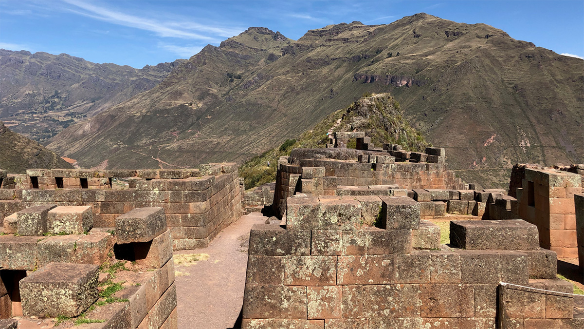
Grabado en piedra: edificios incas guardan el registro de terremotos antiguos
Daños a los edificios incas en Cusco revelan una historia de terremotos olvidada que podría ayudar a científicos a entender riesgos sísmicos modernos.
Posted inResearch Spotlights
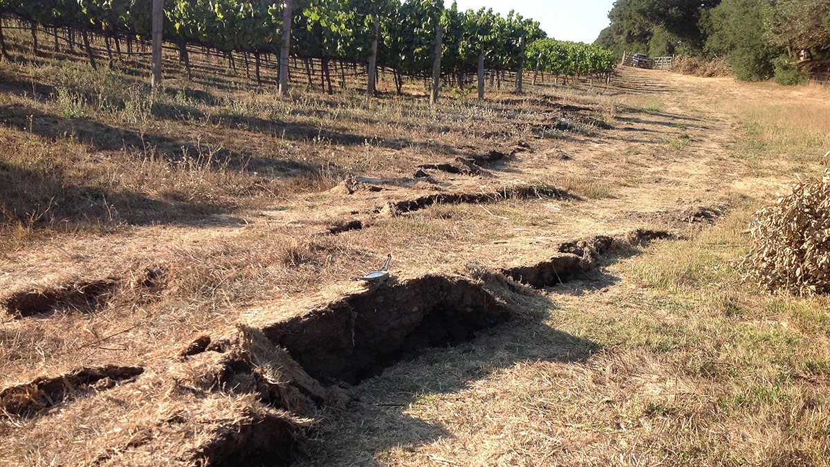
Slight Shifts in Magnetic Field Preceded California Earthquakes
Magnetometers detected faint signals that with further study, may improve our understanding of what happens before earthquakes and offer promise for early detection.
Posted inNews
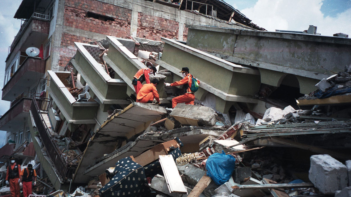
¿Tienen los terremotos y las placas tectónicas una relación bidireccional?
Un terremoto catastrófico en Turquía que sucedió en 1999 cambió el movimiento de la placa de Anatolia, según un estudio que podría modificar los fundamentos de modelamiento de los terremotos.

Posted inFeatures
Seismic Sources in the Aleutian Cradle of Tsunamis
Research over the past decade in Alaska’s Aleutian Islands has offered surprising insights into the pulses of great earthquakes that generate dangerous, often long-distance tsunamis.

Posted inENGAGE, News
Written in Stone: Inca Buildings Remember Ancient Earthquakes
Damage to the Inca buildings of Cusco reveals a forgotten earthquake history that could help scientists understand modern seismic hazards.
Posted inEditors' Vox
Global Seismic Networks: Recording the Heartbeat of the Earth
Global broadband seismographic networks have provided the science community with 30 years of data which is being used to understand the Earth.

Posted inEditors' Highlights
Probing the Sedimentology of a Continental Megathrust
Detailed analysis of sediments covering the Main Frontal Thrust in Nepal show how climate-driven baselevel changes affect sedimentation and should be considered when inferring thrust activity.

Posted inResearch Spotlights
Months of Gravity Changes Preceded the Tōhoku Earthquake
Using GRACE satellite data, researchers discovered anomalous gravimetric signals that occurred before a seismic event that started deep within Earth.
Posted inResearch Spotlights
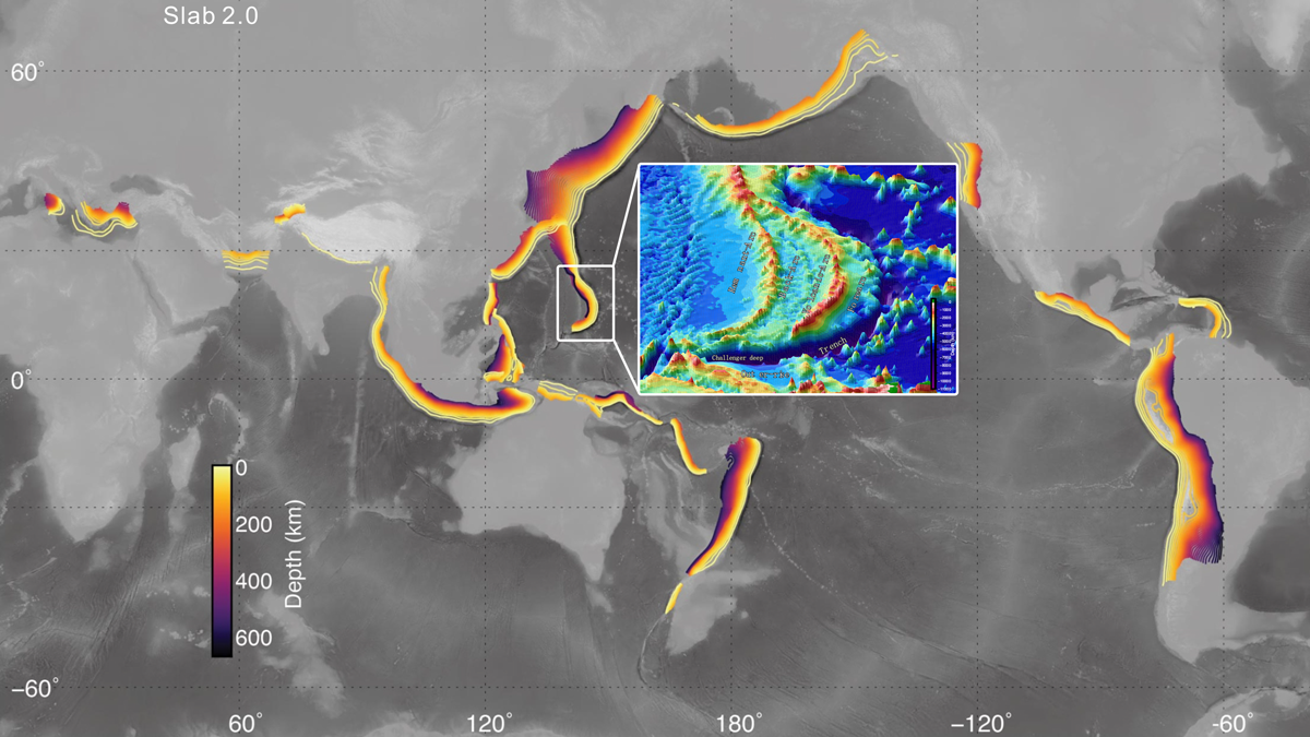
Deep Earthquakes Suggest Well-Hydrated Mariana Subduction Zone
Earthquakes as deep as 50 kilometers below the seafloor were detected by 12 ocean bottom seismometers placed around the Challenger Deep.