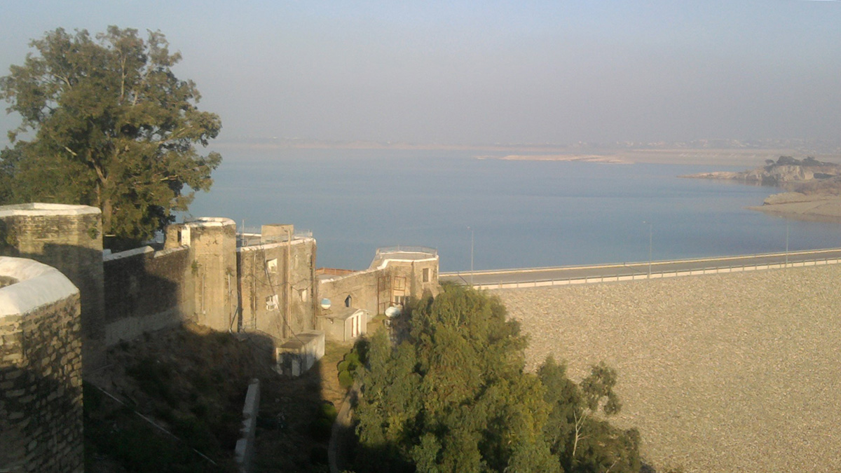

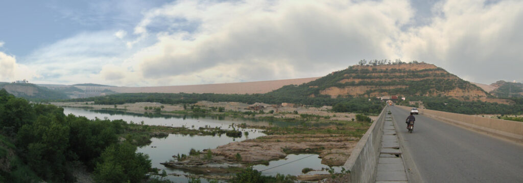
On the afternoon of 24 September 2019, seismic tremors tore through the western Himalayas after a shallow magnitude 5.7 earthquake struck just south of New Mirpur City in eastern Pakistan. The shaking extended as far as New Delhi, India, 600 kilometers southeast of the epicenter, leading to roughly 40 deaths and hundreds of people injured and collapsing or severely damaging bridges, roads, and buildings in the region. To many people’s relief, however, the Mangla Dam—which sits at the foot of the Himalayas about 10 kilometers from the earthquake’s epicenter and impounds the largest water reservoir in Pakistan—escaped intact.
Yet the dam, and the waters of the Jhelum River that it contains, might not have been just passive bystanders to the shaking. New research casts light on a possible connection between the Mangla Reservoir, rapidly filled by heavy summer rains, and the underground conditions that led to the New Mirpur earthquake.
The Weight of Water
The number and severity of rain events have been on the rise across much of South Asia. A study led by researchers at the Indian Institute of Tropical Meteorology, for example, reported that the frequency of widespread extreme rain events in central India tripled between 1950 and 2015. And the 2019 Indian monsoon season was the heaviest the country had seen in 25 years.
By the end of September, when the earthquake hit, the reservoir held 10 times more water than it had the preceding June.
Lei Xie, a Ph.D. student at Hong Kong Polytechnic University, and his colleagues have been studying how the heavy monsoon season in 2019 may have contributed to the strong, regional New Mirpur earthquake. In Pakistan, the rains that season raised levels in the Mangla Reservoir to the highest ever reached. By the end of September, when the earthquake hit, the reservoir held 10 times more water than it had the preceding June.
When water from precipitation, rivers, or other sources collects on Earth’s surface, the added mass puts more pressure on the underlying crust—and on any weak spots in it. Xie and his team compared the fluctuations in reservoir water levels from 1987 to the present against the record of seismic activity in the area over the same period. They found that between July and September 2019, the reservoir gained 4.5 cubic kilometers of water, a sudden and historically large change in volume. The earthquake then happened roughly 10 days after the water level peaked.
From seismic and radar data, the team also found that the earthquake occurred on the Main Himalayan Thrust (MHT) fault, and they determined the local geometry of the MHT at the site of the quake. The MHT stretches more than 2,000 kilometers along the length of the Himalayas and accommodates much of the energy from the ongoing tectonic collision of the Indian and Eurasian plates, hosting major earthquakes in the past. The researchers’ findings suggest that the rapid filling of the Mangla Reservoir significantly increased the stress locally on the fault, possibly even enough to trigger the earthquake.
Pressure can build up along fault planes, “and at some point, if the energy exceeds [the critical] threshold, there will be an earthquake,” said Xie, who will present the new research on 16 December at AGU’s Fall Meeting.
Earthquakes are common across the western Himalayas region, although the magnitude 5.7 event in 2019 was the largest to hit near New Mirpur City and the Mangla Dam in a while.
“In 2016, there was also large rainfall, but maybe the loading of the reservoir and the natural [tectonic stress loading] process did not yet exceed that threshold,” Xie said. But the 2019 monsoon may have coincided with prime tectonic conditions for seismic activity. The heavy summer rainfall over just 2 months might have accelerated the earthquake process, he said, “but we cannot yet be very, very certain.”
Earthquakes are common across the western Himalayas region, although the magnitude 5.7 event in 2019 was the largest to hit near New Mirpur City and the Mangla Dam in a while—in the past 5 decades, only four earthquakes in the area have had a magnitude greater than 4. Several earthquakes around the world have previously been associated with dammed water reservoirs, such as the damaging events that occurred in 2017 and 2018 near the Atatürk Dam in Turkey, but most have occurred when the reservoirs were either newly filled or emptied.
Neither of those scenarios applied to the Mangla Dam in 2019, however, which has operated safely since it was built starting in the early 1960s and then raised by 10 meters in 2009.
The Difficulty of Confirming Earthquake Causes
“You can certainly do appropriate calculations and say the loading of this reservoir [could have] promoted the occurrence of that earthquake or not.…But to say it directly caused [the earthquake] is a bit of a challenge.”
Despite the circumstantial and technical evidence presented in the new research, defining the catalysts for individual earthquakes, including this one, is difficult, said Paul Lundgren, a principal research scientist at NASA’s Jet Propulsion Laboratory. “You can certainly do appropriate calculations and say the loading of this reservoir [could have] promoted the occurrence of that earthquake or not,” he said. “But to say it directly caused [the earthquake] is a bit of a challenge.”
Lundgren said that Xie and his colleagues provide strong geophysical support for their argument but added that more research is needed to identify meaningful connections between rainfall and earthquakes, in this case and others. One of the main challenges of studying earthquakes, he said, is the long time it can take to gather enough evidence to draw clear conclusions. Because recurrence intervals for earthquakes at a given location or on a particular part of a fault can sometimes span hundreds or thousands of years, it is difficult to specify consistent trends.
In predicting the weather, meteorologists “can see a weather system coming through every week,” Lundgren said. “You can look at phenomena over and over again and make more accurate physics-based weather models and then test them.” You can’t do that as easily with earthquakes to identify their causes, he said.
Even if it is too early to identify a firm correlation between the 2019 monsoon rains and the New Mirpur earthquake, Xie and his colleagues suggest that officials overseeing the Mangla Reservoir keep a watchful eye on water levels there. This attention may help to reduce potential risks from future earthquakes or other hazards like landslides that might occur if the reservoir gets too full, especially as extreme weather becomes more common in South Asia.
“We need to pay attention, because if we have a lot of earthquakes that are small in magnitude, they may not harm the structure of the dam, but they can trigger landslides,” Xie said.
—Maria Rose (@mariaparazorose), Science Writer