Combining visual and sonic representations of data can make science more accessible and help reveal subtle details. The recent decade-long eruption of Hawaii’s Kīlauea Volcano offers a prime example.
earthquakes
Posted inEditors' Highlights
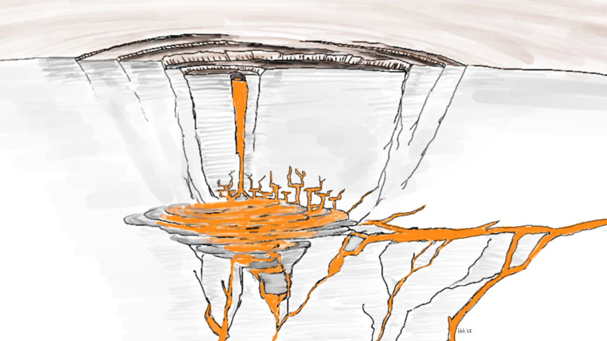
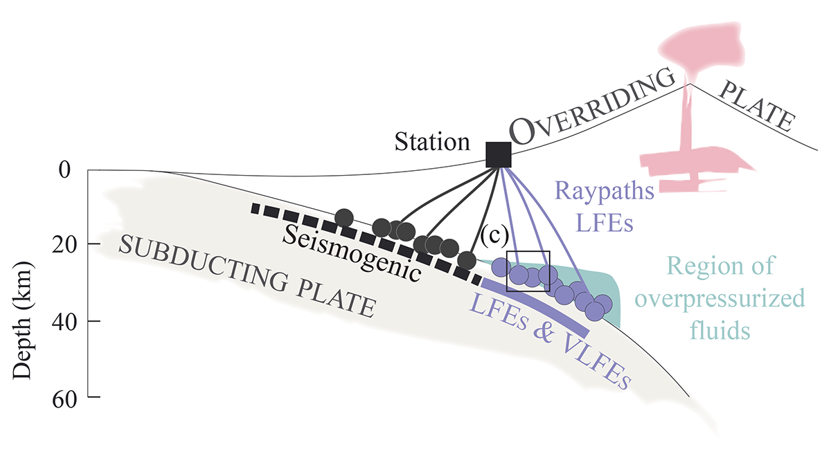
Are Low-Frequency Earthquakes Just Slow Slip?
Tests of seismic attenuation show fluid saturation and high pressure near a seismic source reduce high-frequency content, challenging the idea of slow slip as the cause of low-frequency earthquakes.

Posted inResearch Spotlights
Rougher Faults May Generate More Earthquake Aftershocks
Lab experiments on pieces of granite reflect natural aftershock dynamics and highlight the role of rock roughness along a fault.

Posted inNews
Dating the World’s Tallest Trees
Scientists analyzed more than 1.2 million trees to assemble chronologies of annually dated rings, which will inform fields ranging from climate science to seismology.

Posted inEditors' Highlights
Zooming in on the Nucleus of Earthquake Fault Slips
Controlled arrest and re-nucleation of laboratory earthquakes reveals nucleation processes unapproachable by traditional linear elastic fracture mechanics.

Posted inFeatures
A Common Language for Reporting Earthquake Intensities
Scientists are working together to establish a standardized international scale for measuring and reporting the intensities and impacts of earthquake shaking.
Posted inEditors' Highlights
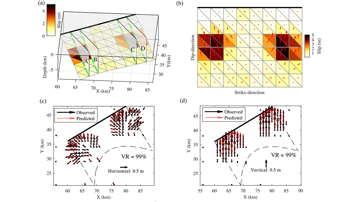
Bayesian Inversion Used to Recover Geometry of Ruptured Fault
A new Bayesian inversion framework is used to solve non-planar geometry of a ruptured fault from spatially variable slip and rake measured with geodesy.
Posted inNews
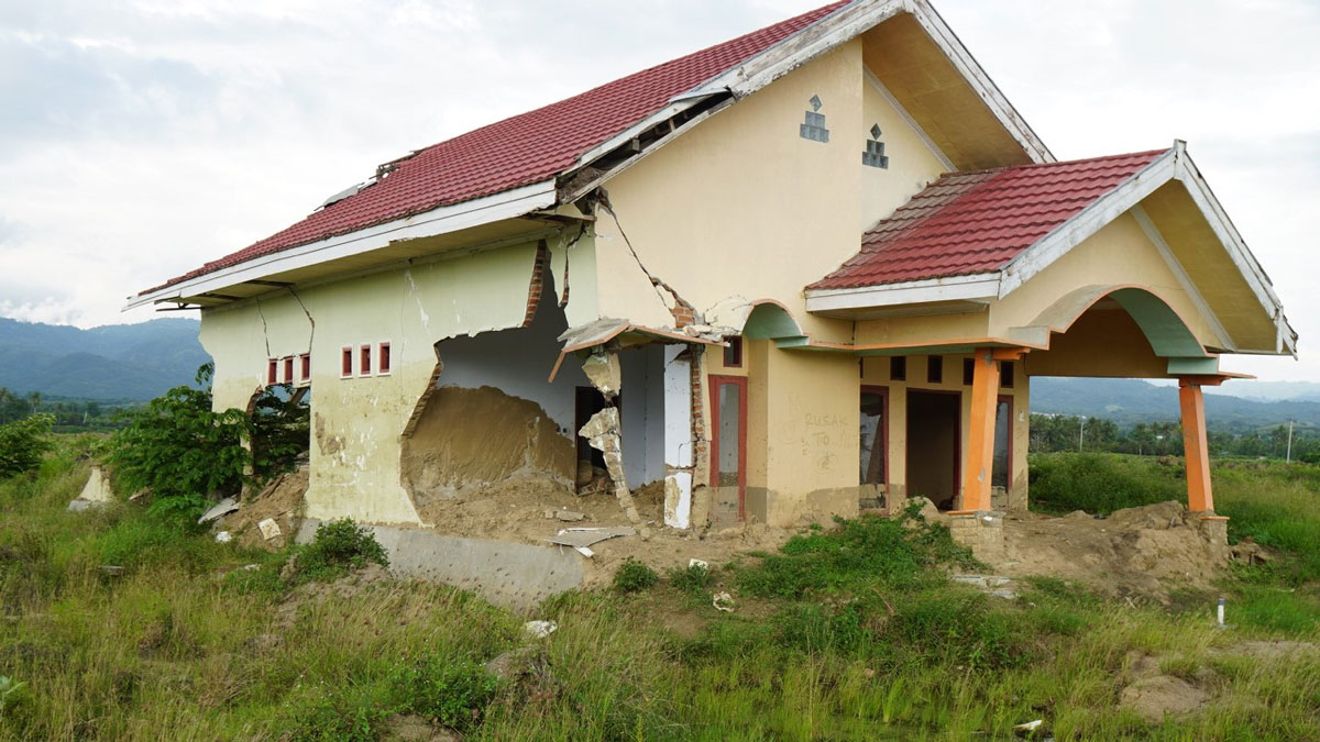
Felt Reports Could Shake Up Earthquake Response
Firsthand accounts of earthquake impacts could aid in identifying people who require help as well as increasing safety in some areas.
Posted inScience Updates
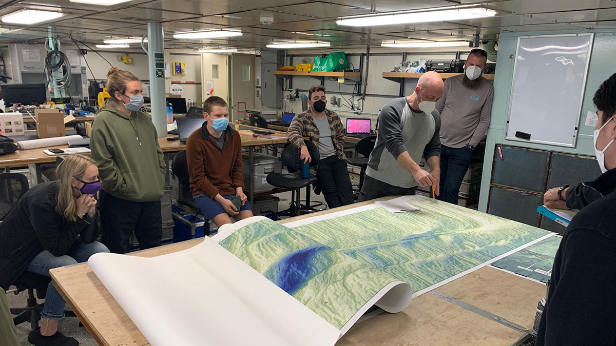
Observing a Seismic Cycle at Sea
Scientists organized a trio of expeditions to document the buildup of stress leading to a large earthquake on a seafloor fault, developing innovations for successful seagoing research in the process.

Posted inNews
Accounting for Offbeat Earthquakes Could Improve Forecasts
A new model considers the full history of earthquakes on a fault, improving forecasts of when the next will strike.