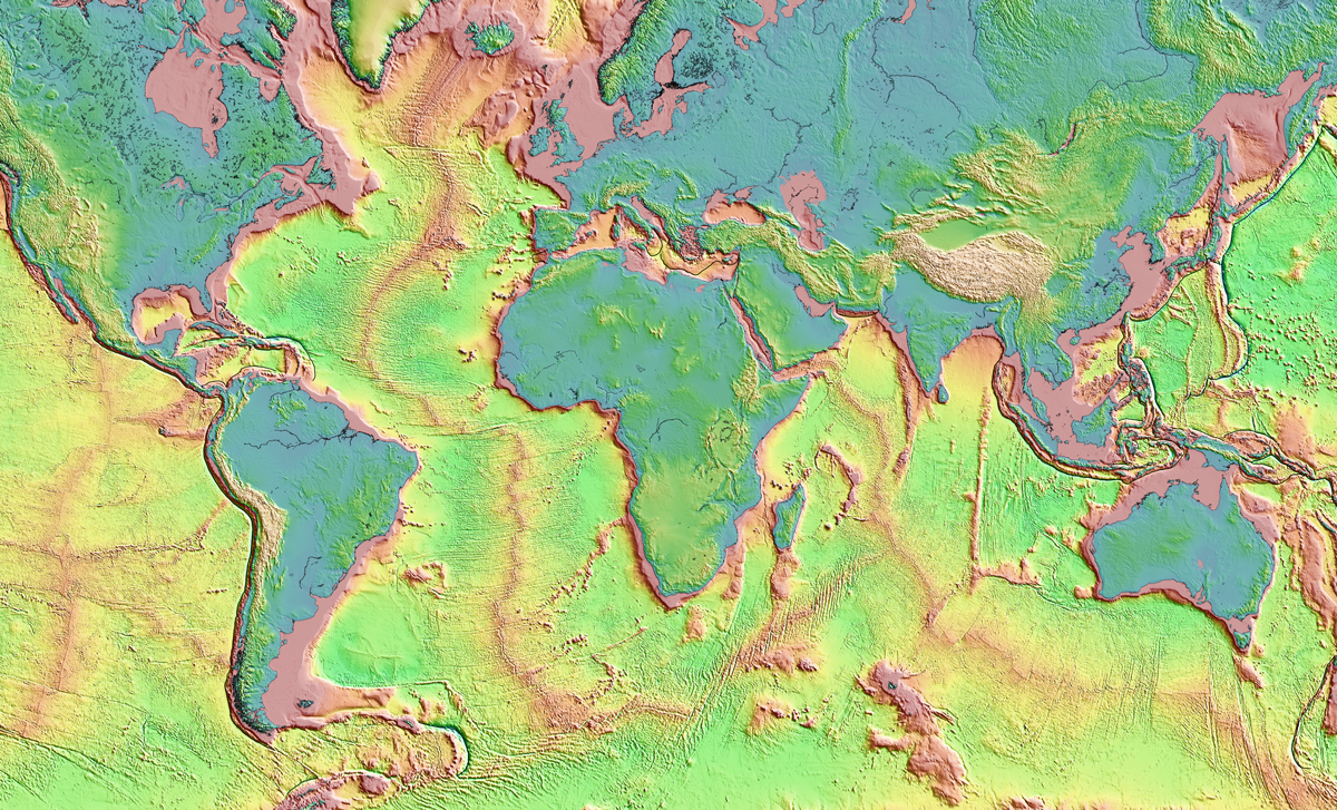
Submap merges graphic design with geodynamics, providing a fast, free, and user-friendly resource to map subduction zones.
earthquakes

Posted inFeatures
The 2023 Türkiye-Syria Earthquakes Shifted Stress in the Crust
In February, a devastating magnitude 7.8 earthquake struck the eastern Mediterranean, triggering a second major jolt and a cascade of aftershocks.

Posted inResearch Spotlights
Talc May Make Mexico’s Subduction Zone More Slippery
Production of the weak, water-bearing mineral at the interface between the Cocos and North American Plates could contribute to the occurrence of poorly understood episodic tremor and slow slip.

Posted inNews
Grâce à la science communautaire, un réseau sismologique en Haïti
De petits sismomètres peu coûteux peuvent communiquer des données de haute qualité et en temps réel. Pendant le tremblement de terre d’août 2021, ils ont été mis à l’épreuve.

Posted inThe Landslide Blog
The Temi landslide – an ancient, valley-blocking failure in Sichuan Province, China
Xie et al. 2023 describe the ancient, 35 million cubic metre, valley-blocking Temi landslide in China.
Posted inNews
Global Earthquake Analysis Seeks Elusive Foreshock Signal
Spotting foreshocks for what they are could help seismologists forecast large earthquakes.

Posted inNews
On-Again, Off-Again Lake Cahuilla Likely Enhanced Earthquakes in Southern California
The disappearance of the ephemeral lake has made earthquakes along the San Andreas Fault even more unpredictable.
Posted inNews
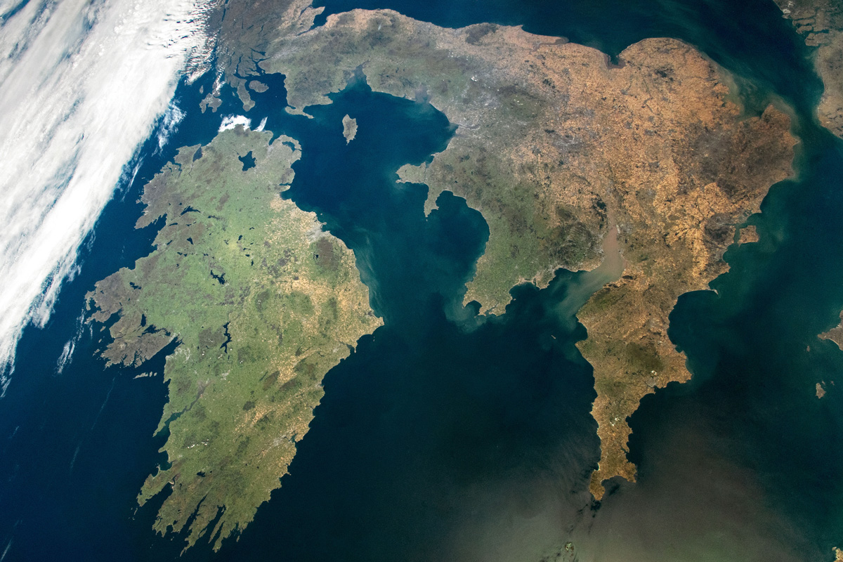
The Mysterious Case of Ireland’s Missing Earthquakes
The Emerald Isle has far fewer earthquakes than neighboring Britain. Now scientists think they know why.

Posted inEditors' Highlights
A New Workflow to Image the 3D Structure of Active Faults
A new approach to illuminate 3D fault structures using earthquake hypocenters may improve our understanding of earthquake propagation and arrest across step overs.

Posted inNews
Forecasting Earthquake-Induced Floods
Surface-rupturing earthquakes can abruptly reroute rivers when fault scarps function like dams. Researchers have now successfully modeled such an event that occurred in New Zealand.