The role the deep Earth plays in creating topography is hotly debated. A new study uses subtle elevation changes around the globe as evidence that the mantle plays a key role in building topography.
Earth’s crust

Posted inEditors' Vox
Old Igneous Rocks Hold the Key to Crustal Thickness Evolution
The chemical composition of orogenic igneous rocks and their zircons is sensitive to crustal thickness and can be used to quantify the evolution of Moho depths beneath continents back in time.

Posted inEditors' Highlights
Zircons and Plate Tectonics
New data on ancient zircons points to a transition from stagnant lid to subduction style tectonics at 3.6 Ga ago.

Posted inEditors' Vox
Understanding and Utilizing the Fractured Earth
The prediction of flow and transport in fractured rock is one of the great challenges in the Earth and energy sciences with far-reaching economic and environmental impacts.

Posted inNews
The Goldilocks Zone May Be Just Right for Migrating Metals
Researchers identified a gateway that allows metals critical for renewable energy technologies, like copper and gold, to make their way to the surface.
Posted inEditors' Highlights
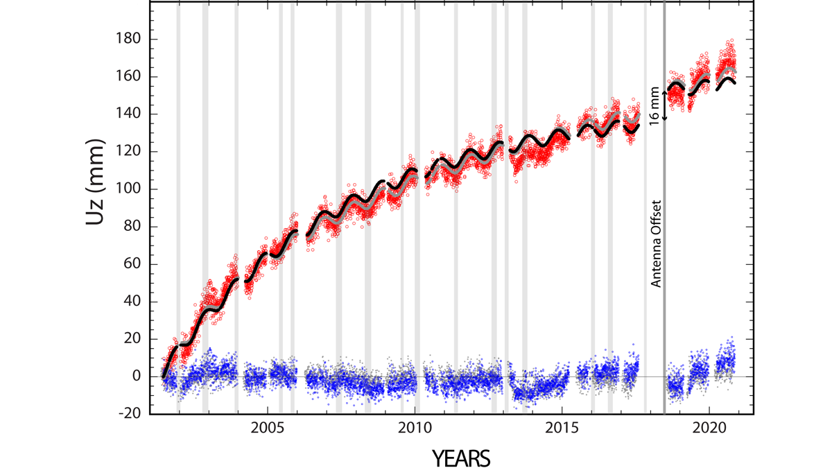
Continuity is the Father of Success
Geodetic measurements indicate that Three Sisters Volcano uplifted by almost 300 millimeters in the past 25 years without significant anomalies at the surface.
Posted inEditors' Highlights
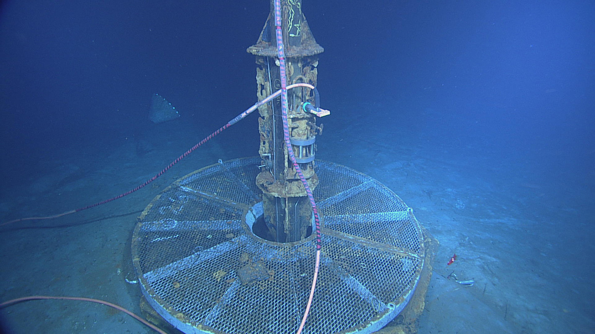
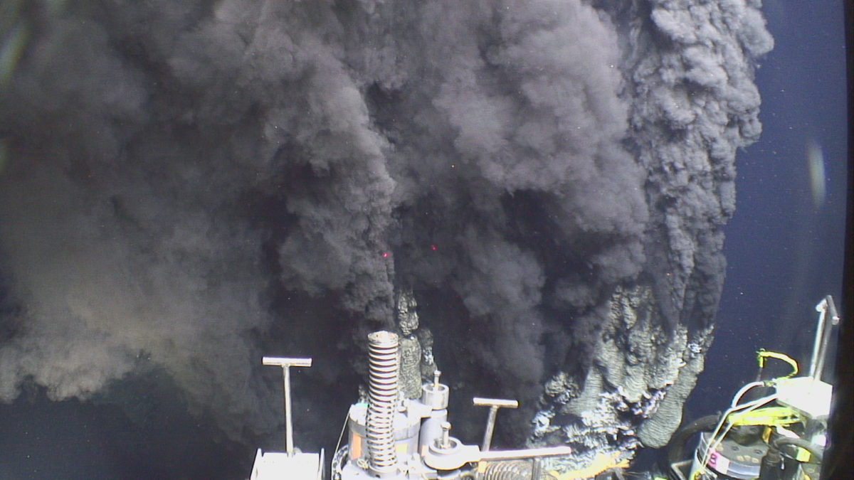
Bubble, Bubble, Toil and Trouble: Ocean Vents Spew Rubble
Hydrothermal vents in the ocean emit 6000-year-old carbon. The likely source? Ocean crust.

Posted inNews
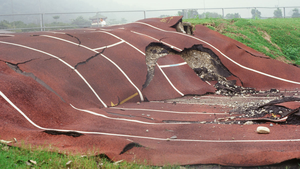
A Giant Impact Triggered Earthquakes for Thousands of Years
When an asteroid struck South Africa during the Precambrian, earthquakes rocked the region for millennia as Earth’s crust reequilibrated, new research reveals.