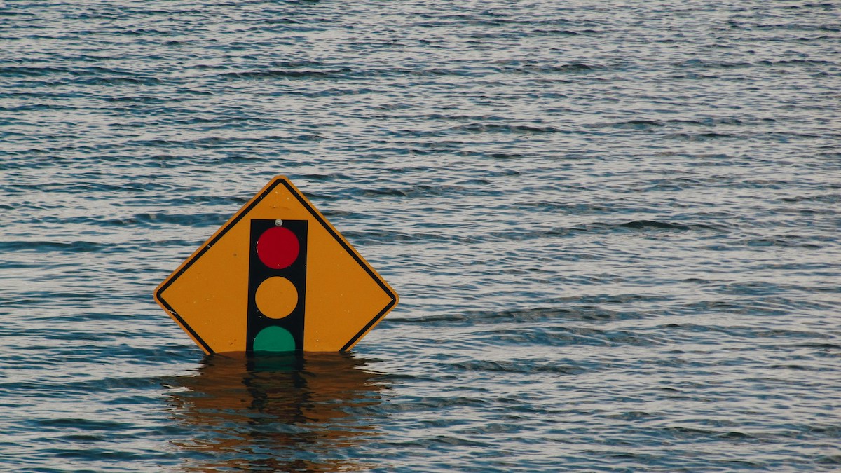
Rising sea levels have put thousands of facilities containing hazardous materials at risk of flooding this century, according to a new study published in Nature Communications.
floods
Posted inNews
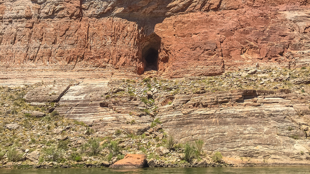
An Asteroid Impact May Have Led to Flooding near the Grand Canyon
There’s remarkable synchronicity between the timing of a paleolake in what is today Grand Canyon National Park and the formation of nearby Barringer Meteorite Crater.
Posted inThe Landslide Blog
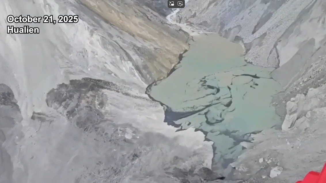
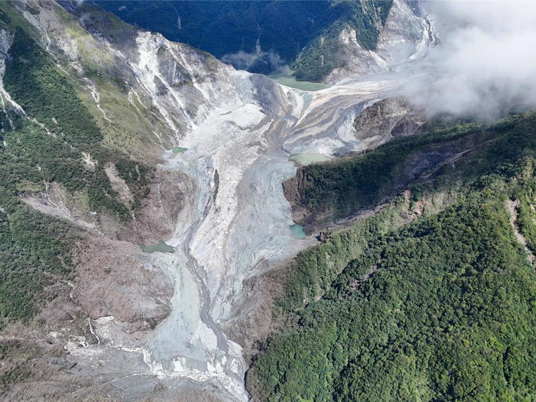
Another landslide dam flood at the site of the Matai’an rock avalanche in Taiwan
Failure of the landslide debris from the Matai’an rock avalanche allowed another barrier lake to form. This breached on 21 October 2025, generating another damaging debris flow. Newspapers in Taiwan are reporting that a new landslide barrier lake formed and then failed at the site of the giant Matai’an rock avalanche. The breach event apparently […]
Posted inResearch & Developments
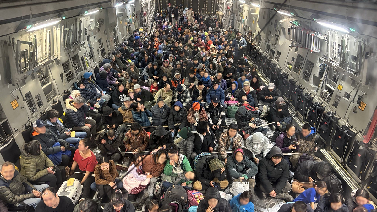
Alaska Awaits Response from FEMA in the Aftermath of Major Floods
Major floods in Alaska have caused the death of at least one person and displaced thousands more over the course of the last two weeks. Many of the displaced may not be able to return home for 18 months or longer, according to Alaska Gov. Mike Dunleavy.
Posted inThe Landslide Blog
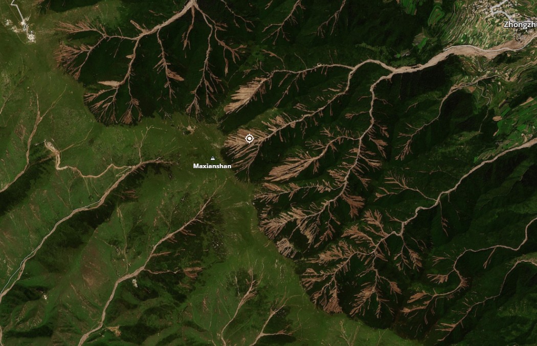
The aftermath of the Matai’an landslide and dam breach in Taiwan
Good digital data is now being published that presents the scale of landscape change that occurred as a result of the Matai’an landslide hazard cascade. There is also interesting information about the root causes of the vulnerability of the town of Guangfu, where the fatalities occurred. Some interesting information is now emerging about the Matai’an […]
Posted inNews
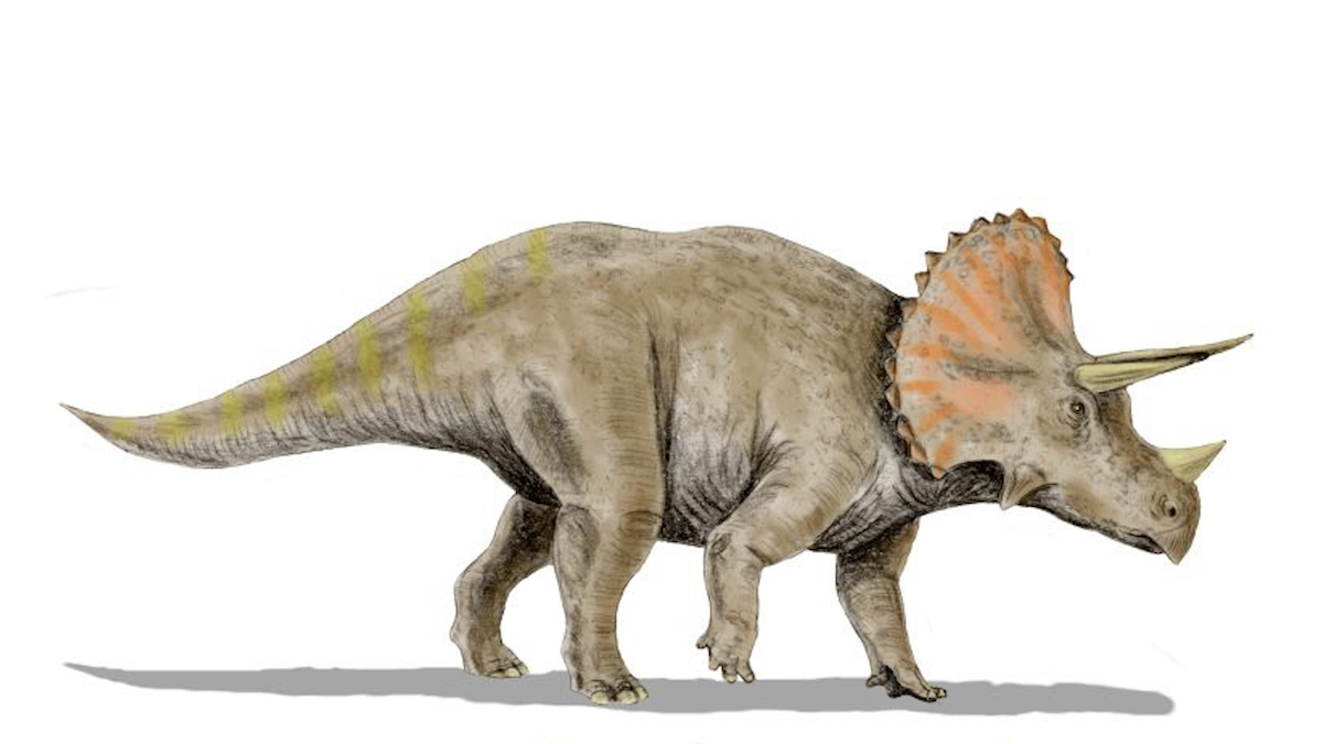
Move Over, Beavers. Dinosaurs Might Also Have Been Nature’s Engineers
Late Cretaceous dinosaurs may have cut back vegetation, creating large floodplains. When the asteroid hit, those floodplains became forests, a new study argues.
Posted inNews
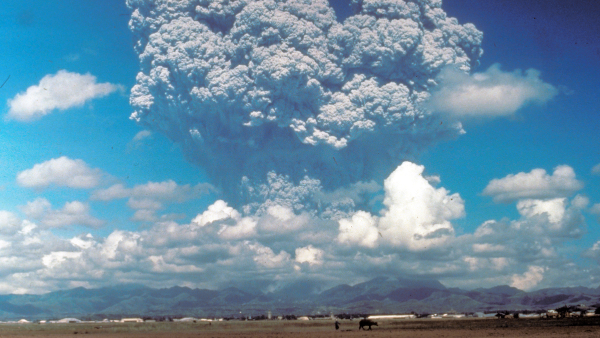
Volcanic Eruptions in One Hemisphere Linked to Floods in the Opposite One
Asymmetric volcanic plumes may shift equatorial weather patterns and increase tropical stream flow, according to new simulations.
Posted inNews
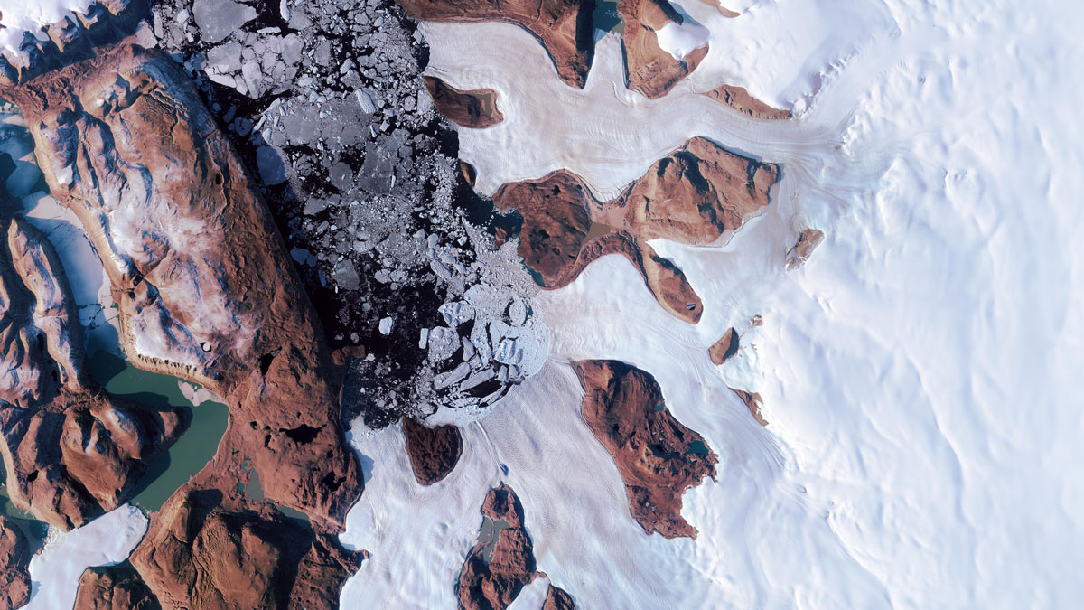
A Burst of Subglacial Water Cracked the Greenland Ice Sheet
When a lake beneath the Greenland Ice Sheet drained, its water burst through the ice sheet’s surface. This surprising event may have affected the movement of a nearby glacier.
Posted inThe Landslide Blog
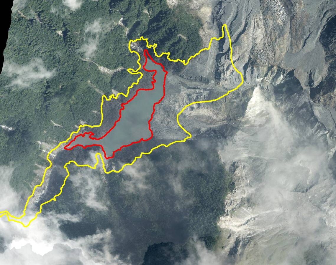
An update on the 21 July 2025 rock avalanche in the Matia’an valley, in Wanrong township in eastern Taiwan.
Following the passage Typhoon Podul, the lake created by this massive landslide has now grown considerably. Overtopping is expected in October, although could occur sooner if further heavy rainfall occurs. The landslide-dammed lake behind the the enormous 21 July 2025 rock avalanche in the Matia’an valley, in Wanrong township in eastern Taiwan continues to fill. […]
Posted inThe Landslide Blog
The 7 August 2025 landslides and debris flows in Yuzhong County, Gansu Province
At least 43 people were killed in devastating landslides and debris flows in northern China. Planet Labs images provide an insight into this disaster. It is extremely challenging to keep up with the landslides occurring around the world at the moment. There has been a lot of attention paid to the remarkable rock slope failure […]