
The replacement of native vegetation by crops has raised groundwater levels in the Pampas, a new study suggests.
floods

Posted inResearch Spotlights
Specious Timescales from Sedimentary Layers
Changing environments can dramatically change how quickly layers form in sedimentary rocks, leading to incorrect time estimates.
Posted inEditors' Vox
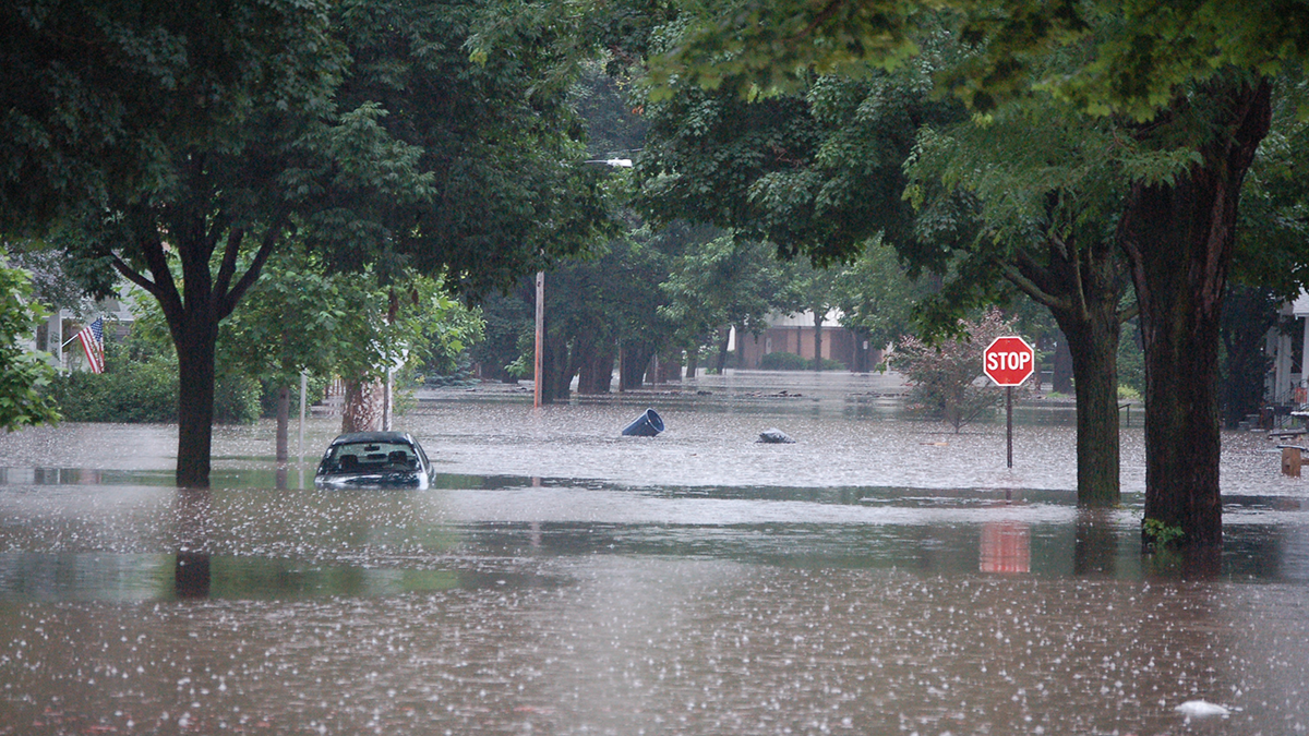
Unlocking the Secrets of Floods: Breakthroughs in Riverine and Coastal Modeling
To enhance flood modeling, it is imperative to gain a comprehensive understanding of the causative mechanisms and cutting-edge models and tools, while also acknowledging their uncertainties.

Posted inNews
Forecasting Earthquake-Induced Floods
Surface-rupturing earthquakes can abruptly reroute rivers when fault scarps function like dams. Researchers have now successfully modeled such an event that occurred in New Zealand.
Posted inEditors' Highlights
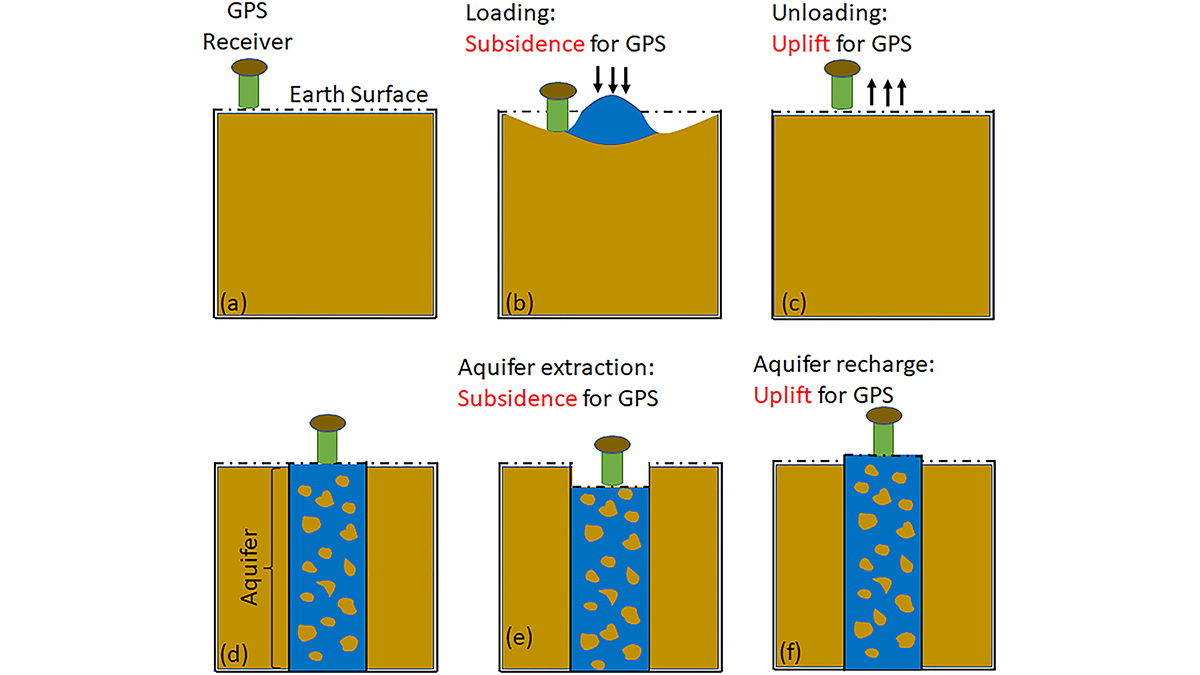
GPS Observations Sense Groundwater Change in Australia
By exploiting the fact that changes in groundwater cause deformations of the Earth’s surface, GPS receivers are used to detect groundwater changes related to extreme events and to seasonal oscillations.
Posted inEditors' Highlights
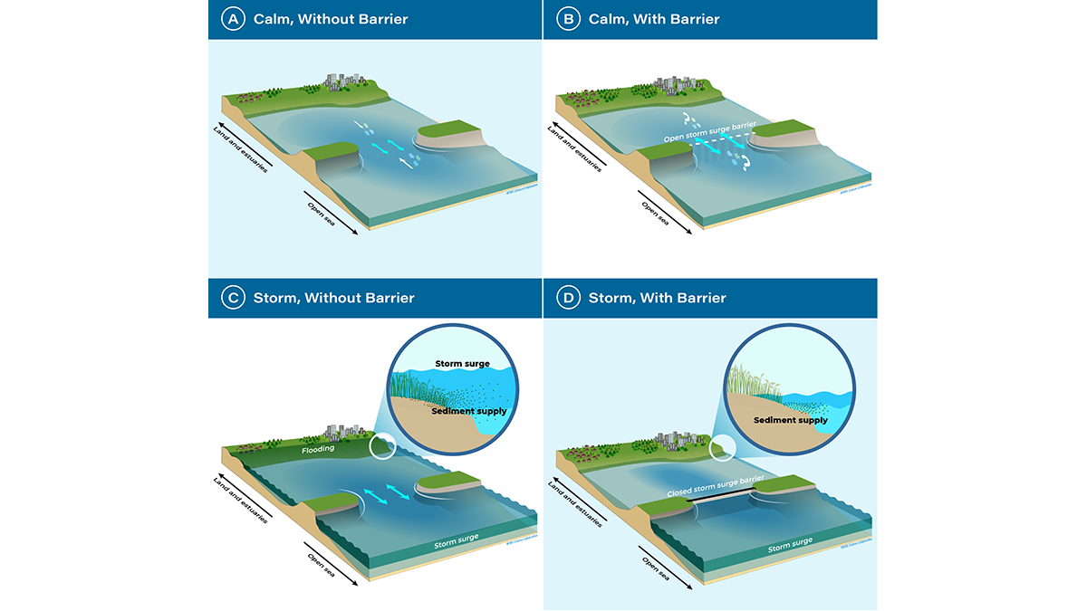
A Turning Point for Estuaries Worldwide
As estuarine barriers are built in response to sea level rise, flooding, and salinization, more research is needed to better understand their implications for human activities and ecosystems.

Posted inNews
Back-to-Back Hurricanes Could Become Common by 2100
New research shows back-to-back hurricanes could strike the United States every few years by 2100.

Posted inENGAGE, News
Como as mudanças climáticas estão afetando as mulheres na Amazônia
Secas e enchentes alteraram radicalmente a agricultura familiar, mas lideranças femininas estão encontrando soluções para si e suas comunidades.

Posted inNews
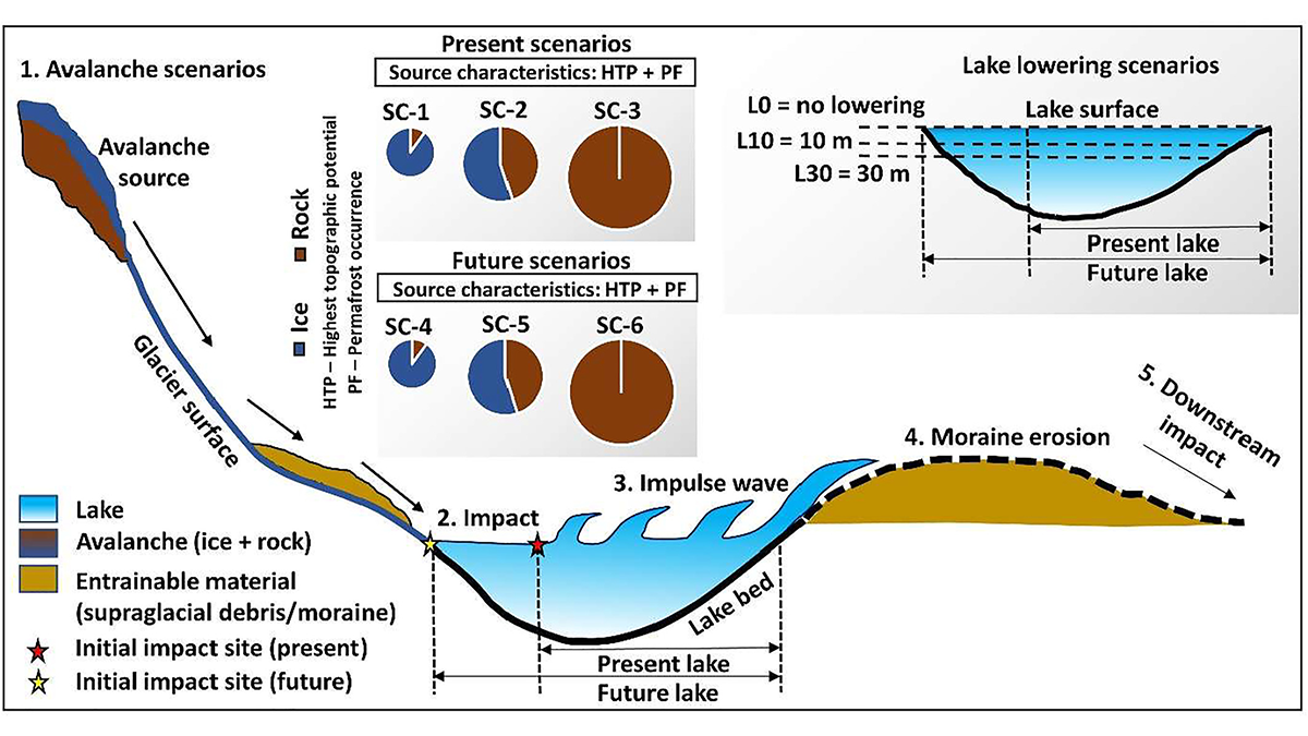
Glacial Lakes Can Unleash Deadly Deluges. How Risky Are They?
Breaches in glacial lake dams threaten millions around the world, and scientists are investigating how climate change might affect that risk.
Posted inEditors' Highlights
Artificial Lake-Level Lowering Alleviates Floods in the Himalayas
A new model combining future permafrost degradation and related avalanches demonstrates that artificial lake-lowering could significantly reduce the risk of glacial lake outburst floods.