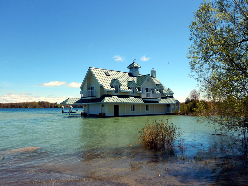
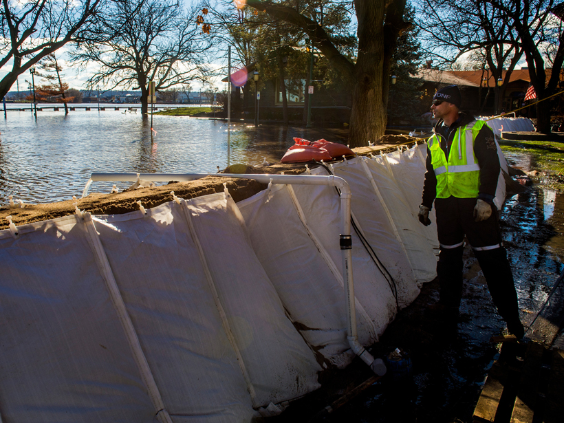
• About
  • Special Reports
  • Topics
    • Climate
    • Earth Science
    • Oceans
    • Space & Planets
    • Health & Ecosystems
    • Culture & Policy
    • Education & Careers
    • Opinions
  • Projects
    • Postcards From the Field
    • ENGAGE
    • Editors’ Highlights
    • Editors’ Vox
    • Eos en Español
    • Eos 简体中文版
    • Print Archive: 2015–2025
  • Policy Tracker
  • Blogs
    • Research & Developments
    • The Landslide Blog
  • Newsletter
  • Submit to Eos
  • AGU.org
  • Career Center
  • Join AGU
  • Give to AGU
  • About
  • Special Reports
  • Topics
    • Climate
    • Earth Science
    • Oceans
    • Space & Planets
    • Health & Ecosystems
    • Culture & Policy
    • Education & Careers
    • Opinions
  • Projects
    • Postcards From the Field
    • ENGAGE
    • Editors’ Highlights
    • Editors’ Vox
    • Eos en Español
    • Eos 简体中文版
    • Print Archive: 2015–2025
  • Policy Tracker
  • Blogs
    • Research & Developments
    • The Landslide Blog
  • Newsletter
  • Submit to Eos
Skip to content
  • AGU.org
  • Career Center
  • Join AGU
  • Give to AGU
Eos

Eos

Science News by AGU

Support Eos
Sign Up for Newsletter
  • About
  • Special Reports
  • Topics
    • Climate
    • Earth Science
    • Oceans
    • Space & Planets
    • Health & Ecosystems
    • Culture & Policy
    • Education & Careers
    • Opinions
  • Projects
    • Postcards From the Field
    • ENGAGE
    • Editors’ Highlights
    • Editors’ Vox
    • Eos en Español
    • Eos 简体中文版
    • Print Archive: 2015–2025
  • Policy Tracker
  • Blogs
    • Research & Developments
    • The Landslide Blog
  • Newsletter
  • Submit to Eos

floods

In September 2009, Typhoon Ketsana dropped 455 millimeters of rain on Manila in 24 hours, flooding the city.
Posted inNews

Mapping Dengue Fever Hazard with Machine Learning

Tim Hornyak, Science Writer by Tim Hornyak 14 June 201715 March 2023

Researchers develop a predictive software system to identify city-specific, dengue fever risk areas amid a global increase in cases.

Researchers assess whether methods of studying alluvial rivers are helpful to understanding behavior of rivers without loose sediment.
Posted inResearch Spotlights

How Do Rivers Flow over Bedrock?

by Terri Cook 8 May 201713 October 2022

A study questions whether the hydraulics of rivers that lack loose sediments along their bottoms can be accurately depicted by standard equations for flow over sediment.

A glacial outburst flood from Lhotse Glacier on 12 June 2016 threatens a stone wall adjacent to a village in Nepal.
Posted inNews

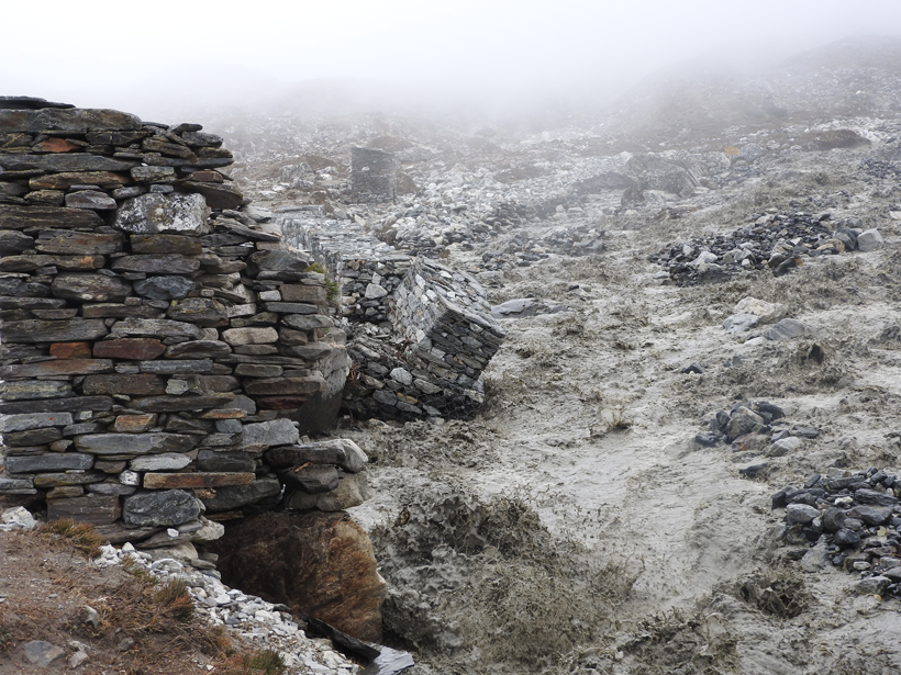
Glacial Outburst Flood near Mount Everest Caught on Video

Katherine Kornei, Science Writer by Katherine Kornei 14 March 20179 March 2023

More than 2 million cubic meters of water, hidden deep within Lhotse Glacier, spilled down toward the village of Chukhung, Nepal, in 2016.

A city employee checks on the pumps as a sandbag wall keeps flood waters from the Illinois River at bay in January 2016.
Posted inNews

Key House Member Makes a Conservative's Case for Water Projects

by Randy Showstack 13 March 201723 March 2023

The White House and Democrats want to see an infrastructure package move through Congress. One House subcommittee chairman intends to make sure that water resource projects are part of the plan.

Floodwaters in the Elbe River reached an all-time high in August 2002, inundating this street in Dresden.
Posted inScience Updates

Using Archives of Past Floods to Estimate Future Flood Hazards

by T. Swierczynski, M. Ionita and D. Pino 13 January 201723 January 2023

Cross Community Workshop on Past Flood Variability; Grenoble, France, 27–30 June 2016

Researchers look at how flood risk will impact different regions in a warming world.
Posted inResearch Spotlights

Tracking Trends in U.S. Flood Risk

by S. Witman 21 December 201615 February 2023

As floods become more frequent around the globe, scientists work to pinpoint what puts certain regions at risk.

Japan’s Self-Defense Forces personnel examine a still-inundated area following the Kinu River’s 10 September flood.
Posted inNews

Can Data Extracted from Twitter Help Map Flood Hazards?

by T. L. Carey 16 December 201630 August 2022

Tweets, if scrutinized closely, may allow scientists to map hazards in real time, helping to guide emergency response.

Disaster response team rescues flood victims
Posted inScience Updates

Flood Response Using Earth Observation Data and Products

by G. J.-P. Schumann 12 October 20163 June 2022

NASA Flood Response Workshop; Greenbelt, Maryland, 14–16 June 2016

Flooding in Vienna after an ice dam failed on the Danube River in March 1830, captured here in a watercolor painting by Eduard Gurk
Posted inResearch Spotlights

How Vague Historical Writings Help Scientists Predict Floods

Leah Crane by L. Crane 13 September 20169 March 2023

By including imprecise historical written records in their calculations, researchers were able to decrease uncertainty in estimations of future flood frequency.

Residents in Louisiana survey a flooded road.
Posted inNews

New Flood Model Offers National Streamflow Coverage

JoAnna Wendel, freelance science writer and illustrator by JoAnna Wendel 19 August 201610 March 2023

The model, released by the National Weather Service, will provide neighborhood-level flood forecasting.

Posts pagination

Newer posts 1 … 18 19 20 21 22 Older posts
Over a dark blue-green square appear the words Special Report: The State of the Science 1 Year On.

Features from AGU Publications

Research Spotlights

What Makes Mars’s Magnetotail Flap?

20 April 202620 April 2026
Editors' Highlights

Weather Radar Data Reveal the Dynamics of Rapidly Spreading Wildfires

21 April 202616 April 2026
Editors' Vox

Can Any Single Satellite Keep Up with the World’s Floods?

20 April 202620 April 2026
Eos logo at left; AGU logo at right

About Eos
ENGAGE
Awards
Contact

Advertise
Submit
Career Center
Sitemap

© 2026 American Geophysical Union. All rights reserved Powered by Newspack