• About
  • Special Reports
  • Topics
    • Climate
    • Earth Science
    • Oceans
    • Space & Planets
    • Health & Ecosystems
    • Culture & Policy
    • Education & Careers
    • Opinions
  • Projects
    • Postcards From the Field
    • ENGAGE
    • Editors’ Highlights
    • Editors’ Vox
    • Eos en Español
    • Eos 简体中文版
    • Print Archive: 2015–2025
  • Policy Tracker
  • Blogs
    • Research & Developments
    • The Landslide Blog
  • Newsletter
  • Submit to Eos
  • AGU.org
  • Career Center
  • Join AGU
  • Give to AGU
  • About
  • Special Reports
  • Topics
    • Climate
    • Earth Science
    • Oceans
    • Space & Planets
    • Health & Ecosystems
    • Culture & Policy
    • Education & Careers
    • Opinions
  • Projects
    • Postcards From the Field
    • ENGAGE
    • Editors’ Highlights
    • Editors’ Vox
    • Eos en Español
    • Eos 简体中文版
    • Print Archive: 2015–2025
  • Policy Tracker
  • Blogs
    • Research & Developments
    • The Landslide Blog
  • Newsletter
  • Submit to Eos
Skip to content
  • AGU.org
  • Career Center
  • Join AGU
  • Give to AGU
Eos

Eos

Science News by AGU

Support Eos
Sign Up for Newsletter
  • About
  • Special Reports
  • Topics
    • Climate
    • Earth Science
    • Oceans
    • Space & Planets
    • Health & Ecosystems
    • Culture & Policy
    • Education & Careers
    • Opinions
  • Projects
    • Postcards From the Field
    • ENGAGE
    • Editors’ Highlights
    • Editors’ Vox
    • Eos en Español
    • Eos 简体中文版
    • Print Archive: 2015–2025
  • Policy Tracker
  • Blogs
    • Research & Developments
    • The Landslide Blog
  • Newsletter
  • Submit to Eos

floods

Flooding during June 2011 on the Missouri River floodplain near Arrow Rock, Mo.
Posted inResearch Spotlights

Missouri River Floodplain Expansion, Services, and Resiliency

Aaron Sidder, freelance science writer by Aaron Sidder 28 July 202221 September 2022

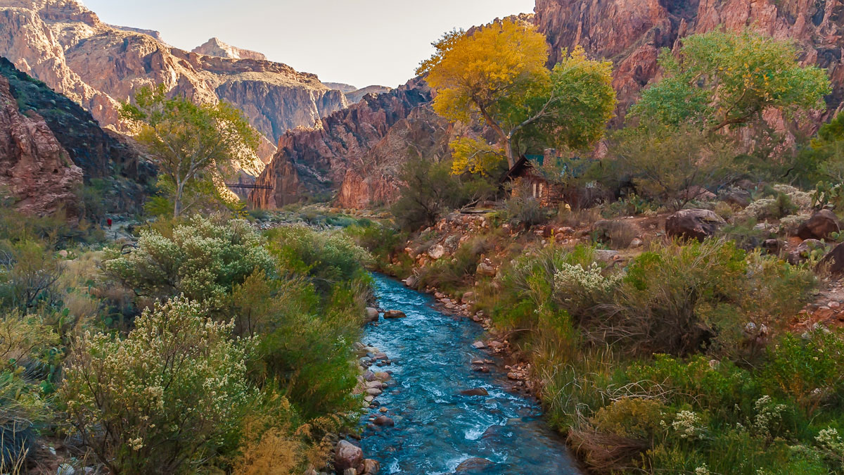
Benefits might accrue for both wildlife and climate resiliency if more floodplains along the lower Missouri River were allowed to flood.

The Colorado River with canyons in the background
Posted inResearch Spotlights

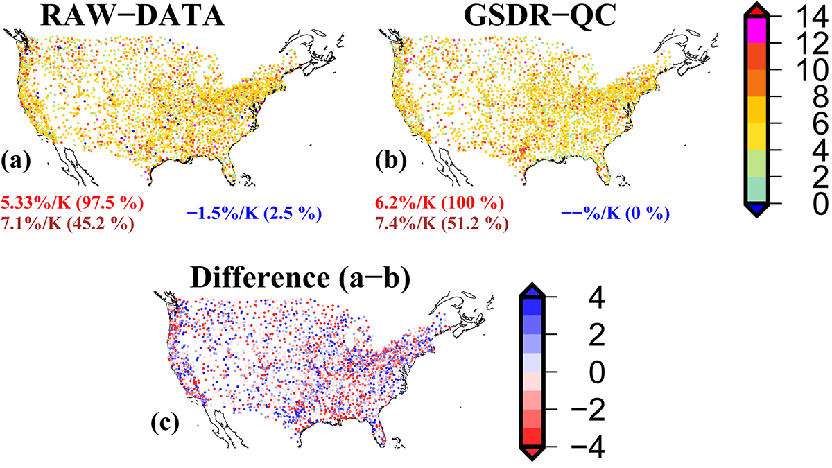
Impact of Climate on River Chemistry Across the United States

Sarah Derouin, Science Writer by Sarah Derouin 26 July 202227 July 2022

Findings of a new study have implications for water quality, aquatic ecosystem health, and water treatment and management as the world warms.

Senior citizens in a rural setting take part in a mapping workshop in Uganda’s Kigezi Highlands.
Posted inENGAGE, News

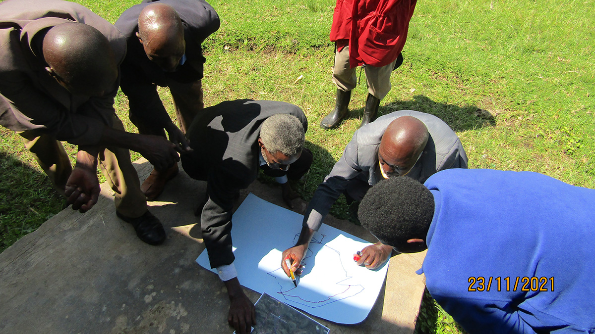
Community Science Project Helps Track Geohazard Risks in Uganda

by James Dacey 22 July 202227 March 2023

A community project in the Kigezi Highlands is helping to identify landslide and flooding hot spots and how the hazards are evolving.

Three maps of the United States with different colored data points.
Posted inEditors' Highlights

Explaining Uncertainty in Estimates of Rain Response to Warming

by Alessandra Giannini 13 July 202225 July 2022

Humidity increases with warming. Theory and observations about how increased humidity translates into more extreme rainfall can be reconciled if attention is paid to data and methods.

San Pablo Bay marsh
Posted inResearch Spotlights

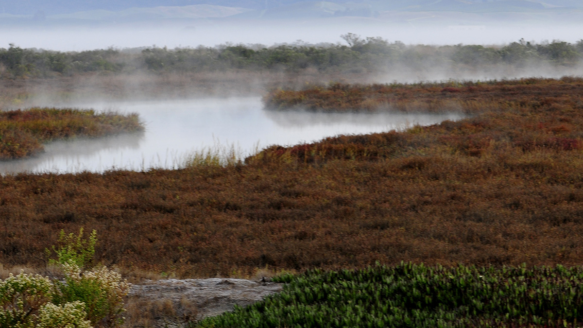
Atmospheric Rivers Help Coastal Wetlands Build Up Sediment

by Alexandra K. Scammell 13 July 202230 January 2024

Accounting for these storms and flooding can help experts predict and respond to rising sea levels.

Aerial view of the Pemali delta in Indonesia
Posted inNews

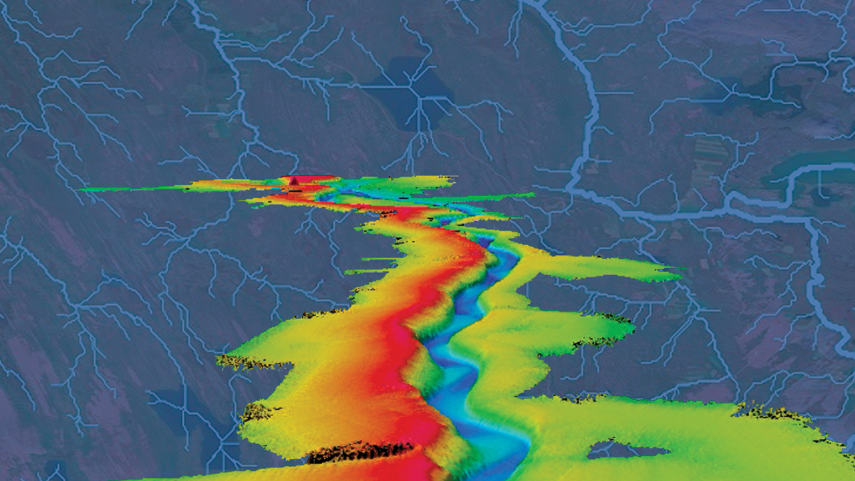
Why Do Rivers Jump Off the Beaten Path?

by Carolyn Wilke 21 June 2022

Researchers sifted through 50 years of satellite imagery and came up with new clues to where and why rivers avulse, suddenly changing their course.

River flow paths in Iceland derived from HydroSHEDS.
Posted inAGU News

Charting Paths to New Knowledge

Heather Goss, AGU Publisher by Heather Goss 20 May 20221 June 2022

In our June issue of Eos, we home in on the unique ways researchers are using maps to better understand Earth and beyond.

An image of a partially submerged house, powerline pole, and foliage in a flooded neighborhood in Asunción, Paraguay
Posted inNews

More Frequent El Niño Events Predicted by 2040

Rachel Fritts, Science Writer by Rachel Fritts 20 April 20221 December 2022

Cutting-edge models predict that El Niño frequency will increase within 2 decades because of climate change, regardless of emissions mitigation efforts.

Figure 1 from the paper, showing the depiction of a multiple-reservoir system and the system that is used in the computation of the index.
Posted inEditors' Highlights

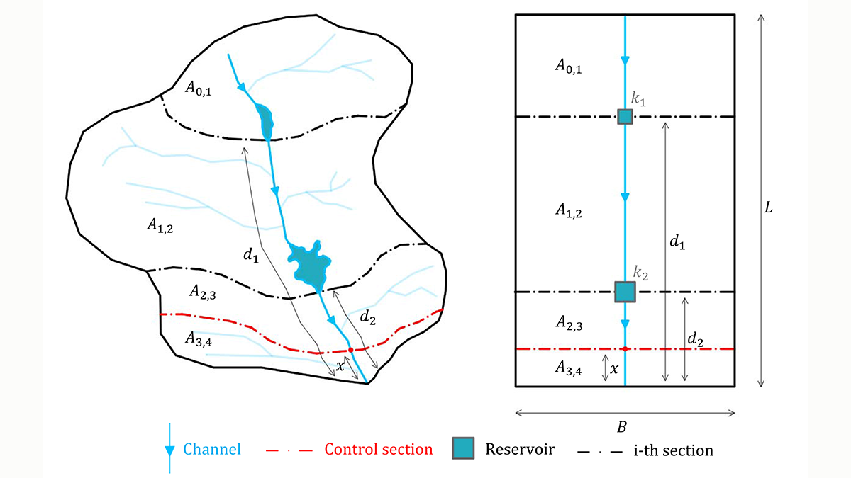
A New Index to Assess Multiple-Reservoir Effects on Peak Floods

by Georgia Destouni 11 April 202220 May 2022

A simple, yet quantitative, index is demonstrated to quantify reductions in the peak flood resulting from multiple reservoirs, arranged in series along the same river reach.

Imagen aérea de un vecindario en Texas inundado. Se observan sólo los techos de las casas y las copas de los árboles.
Posted inENGAGE, News

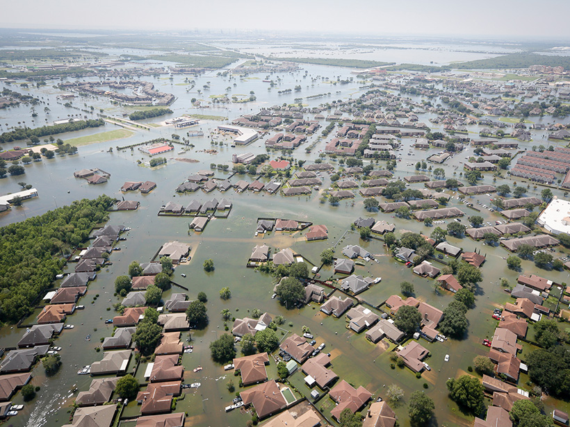
Cuando los ríos están contaminados, las inundaciones son solamente el primer problema

by J. Besl 24 March 202227 March 2023

A medida que las inundaciones aumentan en frecuencia e intensidad, los productos químicos enterrados en los sedimentos de los ríos se convierten en “bombas de tiempo” que esperan activarse.

Posts pagination

Newer posts 1 … 8 9 10 11 12 … 23 Older posts
Over a dark blue-green square appear the words Special Report: The State of the Science 1 Year On.

Features from AGU Publications

Research Spotlights

As Wildfires Increase in the West, So Does Suppression Spending

10 June 202610 June 2026
Editors' Highlights

Multi-Scale Fault Roughness Encapsulated in a Friction Law

11 June 202611 June 2026
Editors' Vox

Small-Scale Indian Ocean Dynamics Underpin Marine Ecology and Climate

4 June 20263 June 2026
Eos logo at left; AGU logo at right

About Eos
ENGAGE
Awards
Contact

Advertise
Submit
Career Center
Sitemap

© 2026 American Geophysical Union. All rights reserved Powered by Newspack