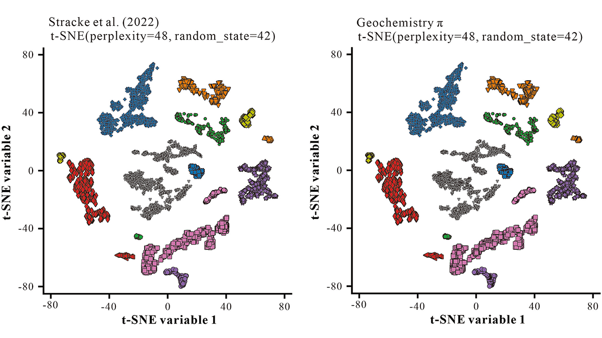
Geochemistry π is an easy-to-use step-by-step interface to carry out common machine learning tasks on geochemical data, including regression, clustering, classification, and dimension-reduction.
Geochemistry, Geophysics, Geosystems

Posted inResearch Spotlights
Some High-Threat Volcanoes Are Severely Understudied
Scientists have little understanding of where magma is stored along the Cascade Volcanic Arc or how its volcanoes could affect population centers.

Posted inEditors' Vox
Announcing New AGU Journal Editors-in-Chief Starting in 2024
AGU is excited to welcome new Editors-in-Chief for seven of our journals in 2024, including the founding Editor of JGR: Machine Learning and Computation.
Posted inEditors' Highlights
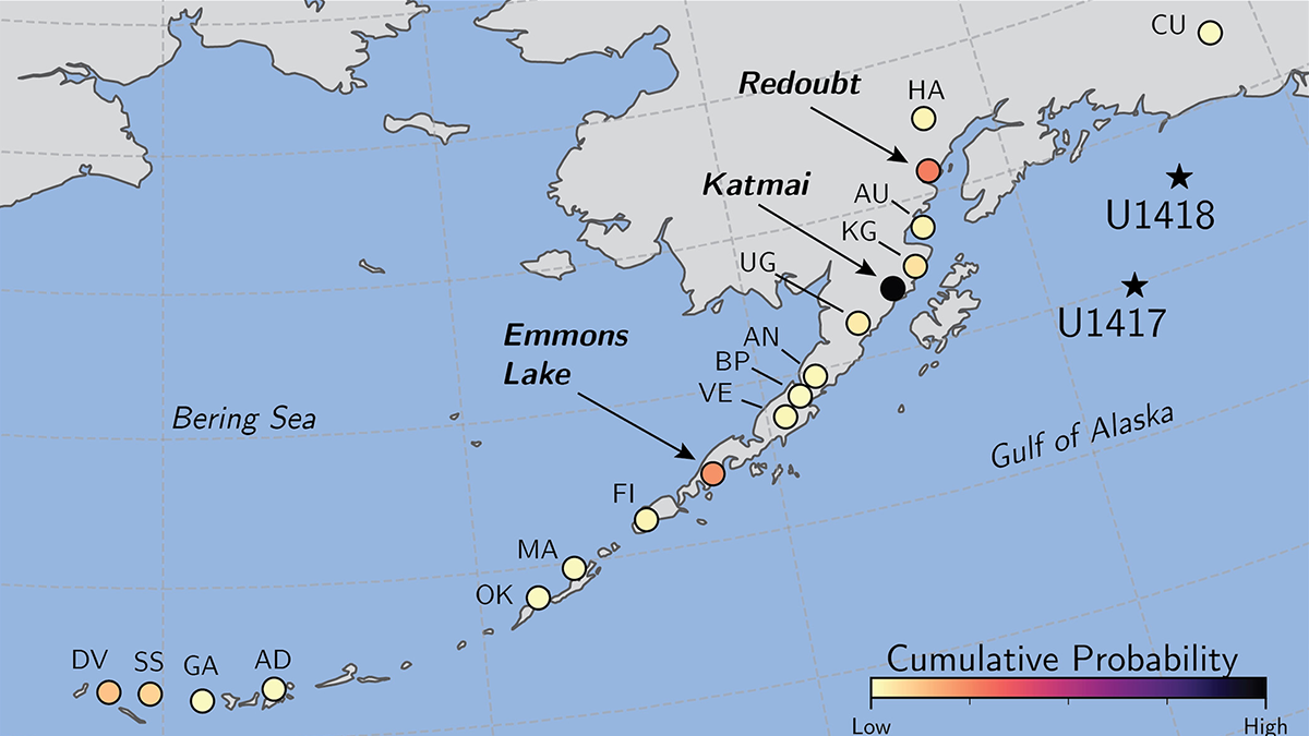
Machine Learning Identifies Source Volcanoes of Ash Deposits
Tracing ash layers from explosive eruptions back to their source volcanoes is needed to evaluate hazards to population and aviation, a problem addressed by a new machine learning classification method.
Posted inEditors' Highlights
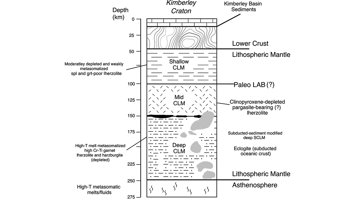
Piecing Together the Roots of the Ancient Australian Continent
Mineral compositions from numerous volcanic rocks that sample the mantle keel beneath Western Australia’s Kimberley Craton reveal the temperature and mineralogy that explain its long-lived stability.
Posted inEditors' Highlights
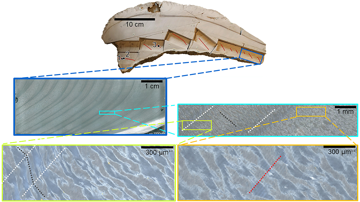
Ultra-High-Resolution Age Model in Clams Yields Daily Paleo-Data
Using geochemical techniques, scientists identify daily cycles in fossilized giant clams, which permits climate reconstructions at the weather timescale.

Posted inResearch Spotlights
Talc May Make Mexico’s Subduction Zone More Slippery
Production of the weak, water-bearing mineral at the interface between the Cocos and North American Plates could contribute to the occurrence of poorly understood episodic tremor and slow slip.
Posted inEditors' Highlights
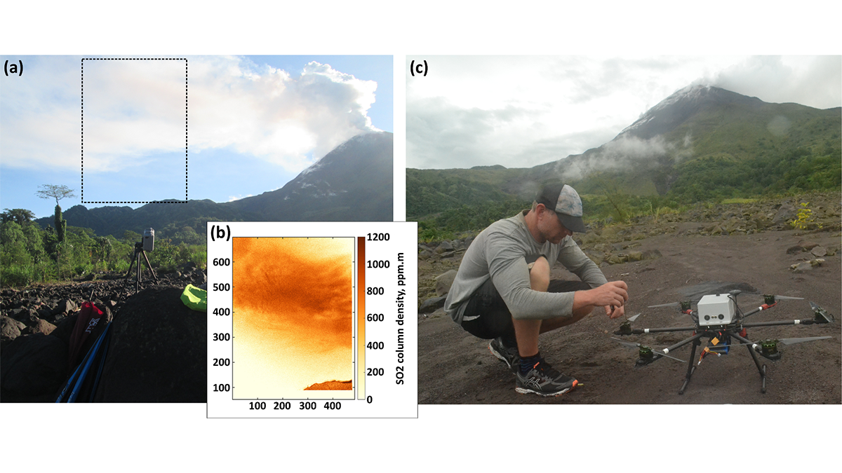
Send in the Drones: Safely Monitoring Volcanic Gas Emissions
New drone technology was combined with satellite and ground-based data to improve volcanic gas flux monitoring at the remote Bagana Volcano in Papua New Guinea.
Posted inEditors' Highlights
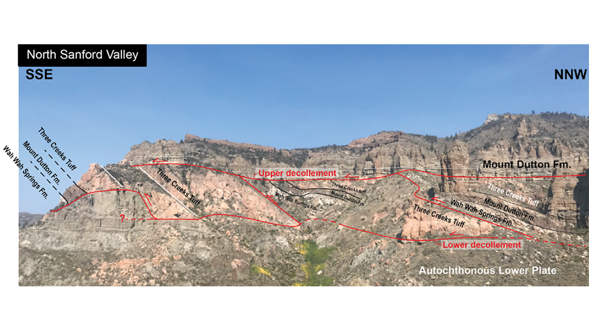
A Giant Rockslide on a Bed of Steam
Detailed observations of the giant Sevier gravity slide in Utah show that the exceedingly low basal friction required for its rapid emplacement was developed by trapped thermally pressurized fluids.
Posted inEditors' Highlights
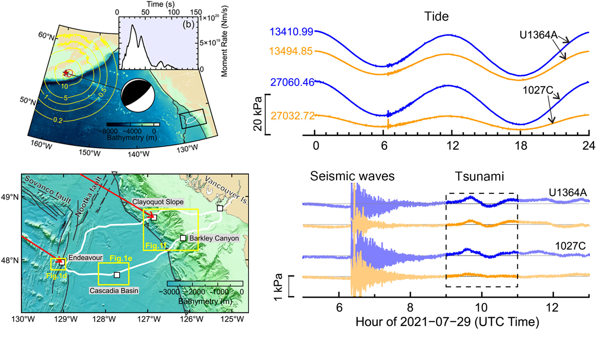
Under Pressure: Recording Earthquakes at and Below the Seafloor
Cabled ocean-floor observatories record ground shaking and pressure variations, which contribute to early warning systems and give us a unique view of the ocean–crust coupling.