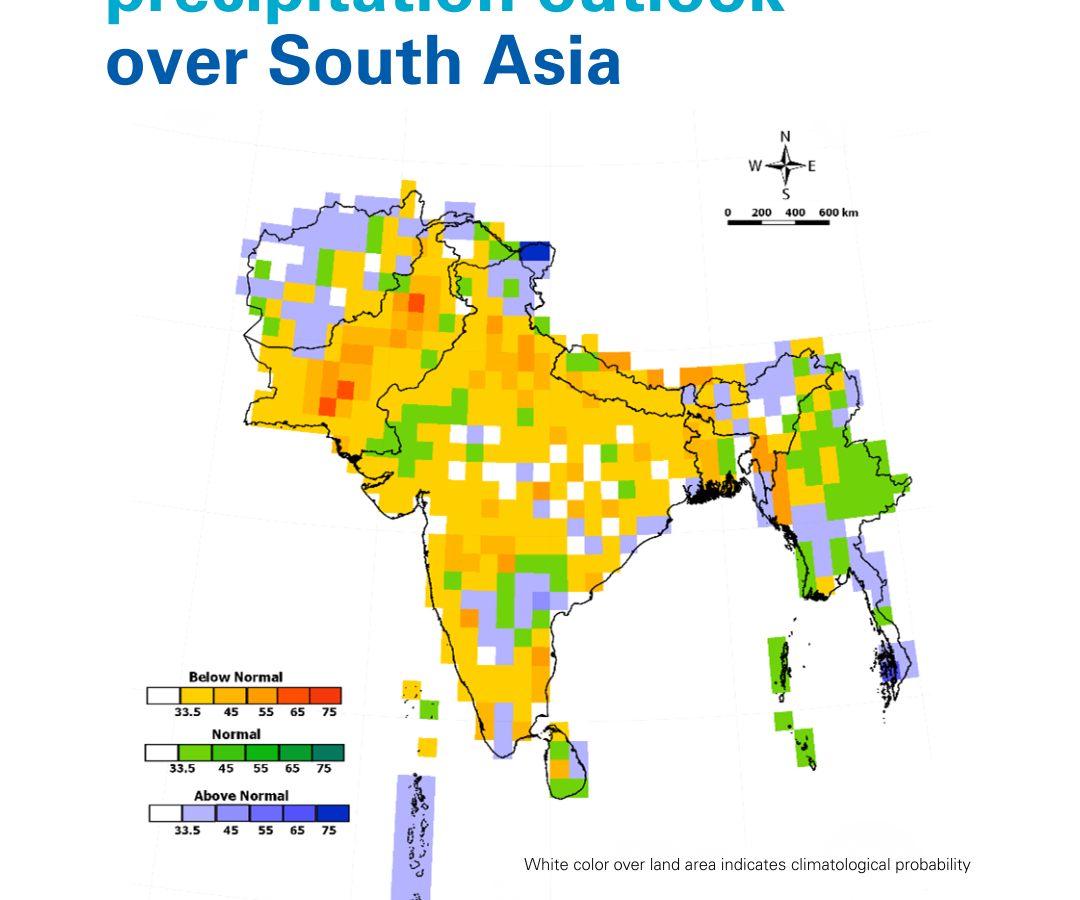
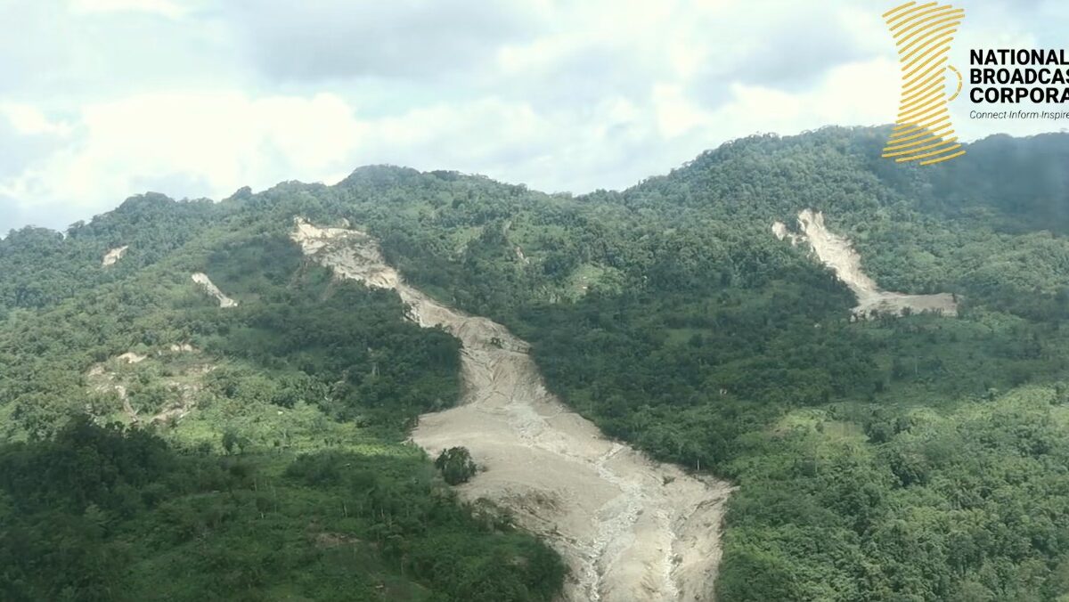
Forecasts for the 2026 South Asia monsoon are for below average rainfall, but some of the most landslide prone areas of India may receive totals that are above average. As usual, we are now starting to see the number of reported global fatal landslides increase as the northern hemisphere rainy season commences. In recent days, […]
Hazards & Disasters
Posted inThe Landslide Blog
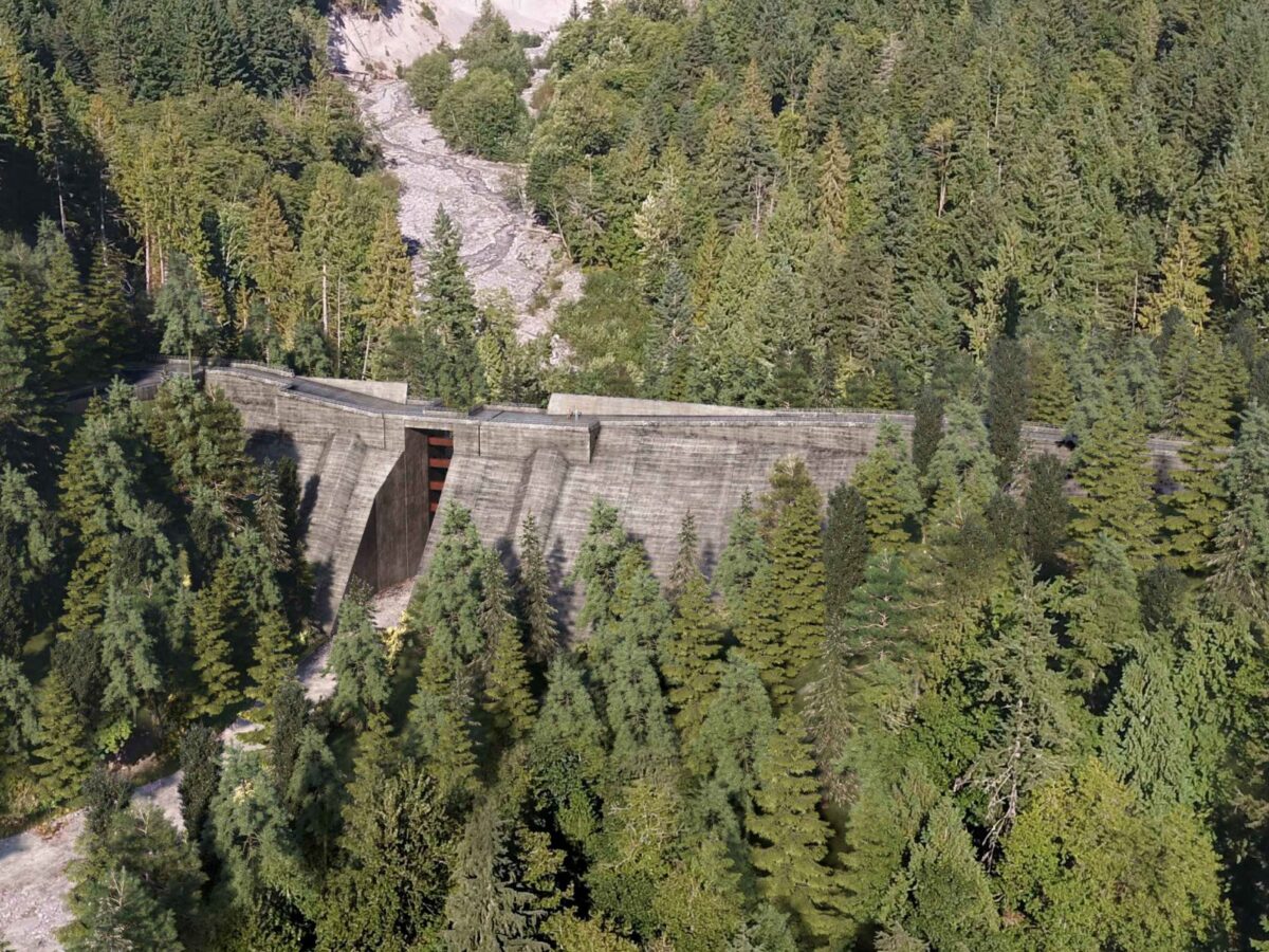
The Cheekeye Debris Barrier Project
In British Columbia a CAN$115 million project is almost complete to mitigate the risk posed by debris flows to the town of Squamish. Upstream of the town of Squamish in British Columbia, Canada, an extraordinary project is underway to mitigate the risk of debris flows. Known as the Cheekeye Debris Barrier Project, the scheme involves […]
Posted inNews
A New Approach Can Better Predict Debris Flow Hazards Years After Fires
USGS hazard maps don’t always reflect real landslide risk in the years after wildfires. Fine-tuning assessments of vegetation recovery could help.
Posted inThe Landslide Blog
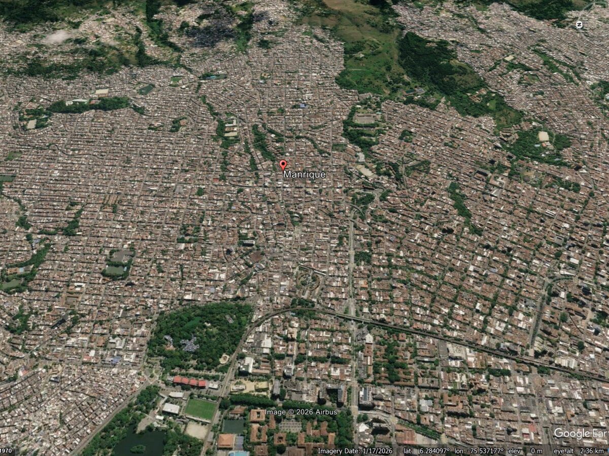
The landslide drivers of structural damage in Medellin, Colombia
A new study (Vega et al. 2026) shows that patterns of reported structural damage in Medellin are probably caused by deep-seated deformation driven by a series of ancient landslides under the city. Medellin is the second largest metropolitan area in Colombia, with a population of around 4 million people. It has grown rapidly, expanding into […]
Posted inThe Landslide Blog
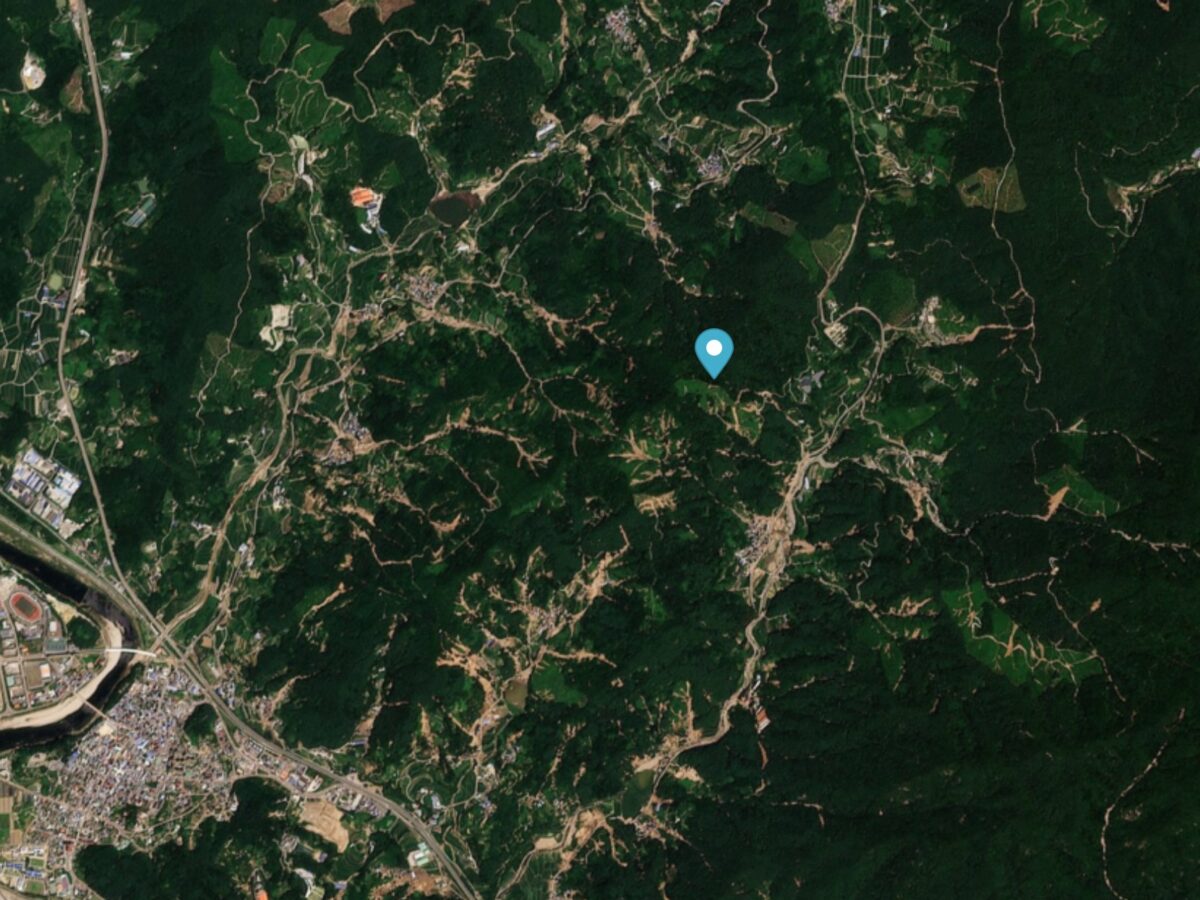
The 19 July 2025 multiple landslide event in Sancheong, South Korea
On 19 July 2025, intense, long duration rainfall triggered over 550 landslides in Sancheong, South Korea, killing at least 10 people. On 19 July 2025, extremely heavy rainfall triggered multiple landslides in Sancheong, South Korea. This event has been described by a new paper (Nguyen et al. 2026) just published in the journal Landslides. The […]
Posted inThe Landslide Blog
Landslides are New Zealand’s most expensive natural hazard, and the costs are rising quickly
New evidence from the Natural Hazards Commission – Toka Tū Ake (NHC) shows that landslides are now New Zealand’s most costly natural hazard. New Zealand is a country that is prone to a range of natural hazards. Located on a series of major fault systems, earthquakes cause high levels of loss. The country is also […]
Posted inResearch Spotlights
Seismic Attenuation Techniques Reveal What Lies Beneath Taiwan
A new imaging modality explores the complex subduction‐collision transition zone below southern Taiwan.
Posted inThe Landslide Blog
Fatal landslides in April 2026
In April 2026 I recorded 36 fatal landslides causing 90 fatalities, the lowest monthly total for 2026 to date. This is my regular update for the number of fatal global landslides, focusing on April 2026. As usual, this data has been collected in line with the methodology described in Froude and Petley (2018) and in Petley (2012). References […]
Posted inThe Landslide Blog
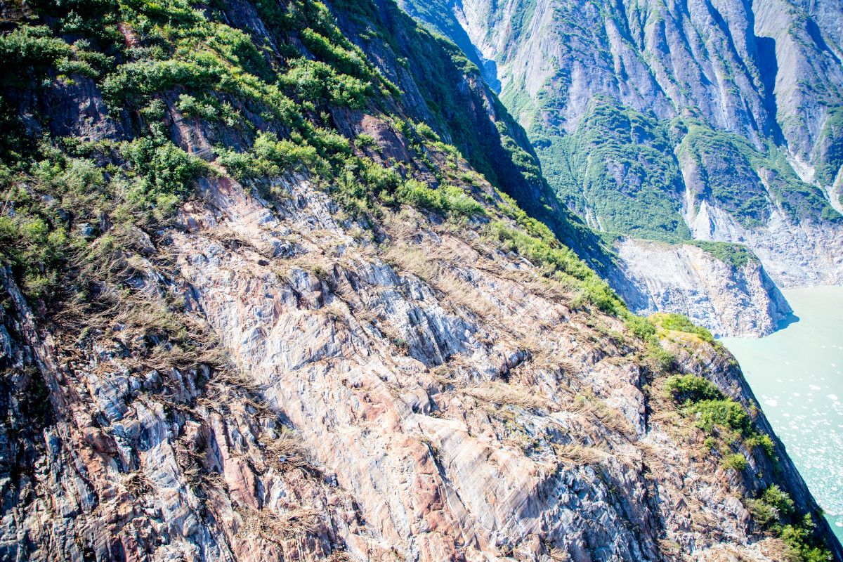
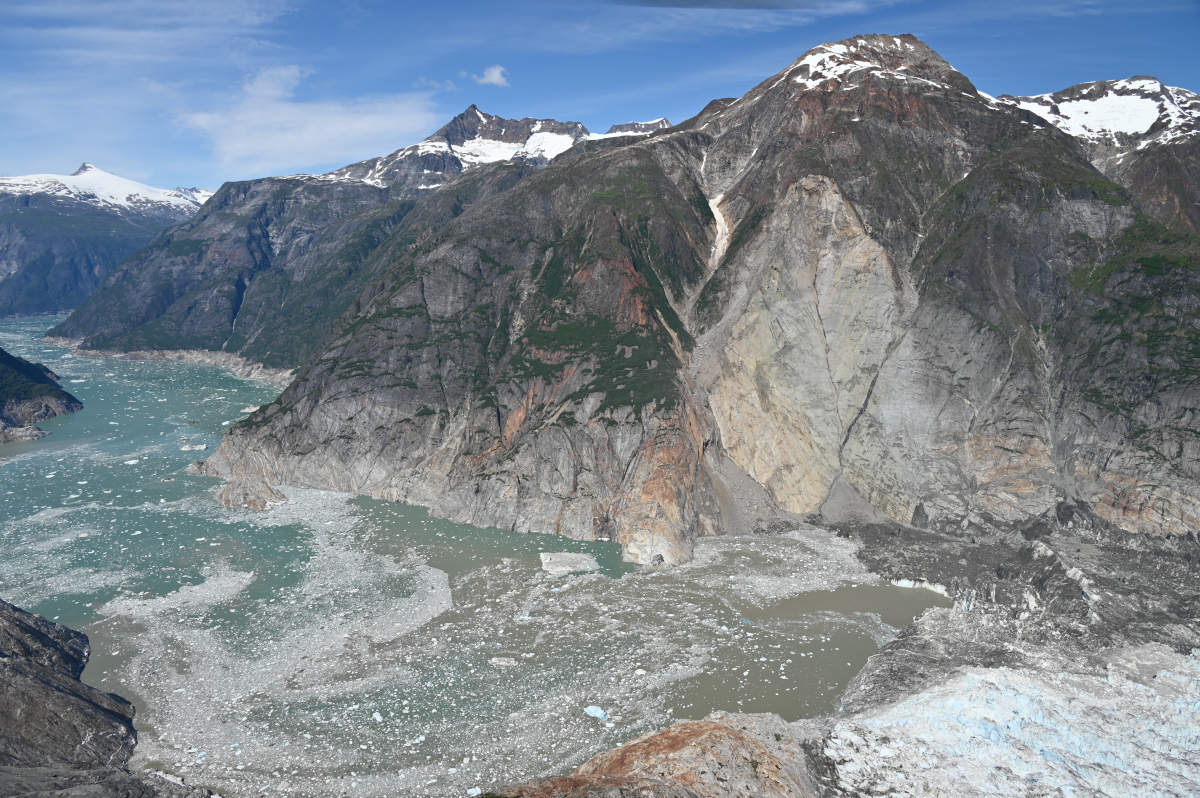
The 10 August 2025 landslide and tsunami at Tracy Arm fjord in Alaska
A wonderful new paper on the huge Tracy Arm landslide and tsunami will have profound but challenging implications for the management of risk in an age of increased tourism and rapid climate change. The journal Science has published an excellent new paper (Shugar et al. 2026) that examines the extraordinary 10 August 2025 landslide and […]
Posted inNews
The Forensics of a Skyscraper-Sized Tsunami
A landslide in Tracy Arm Fjord in Alaska created the second-largest tsunami on record. A new analysis links this abrupt event to the retreat of a glacier and, ultimately, to climate change.